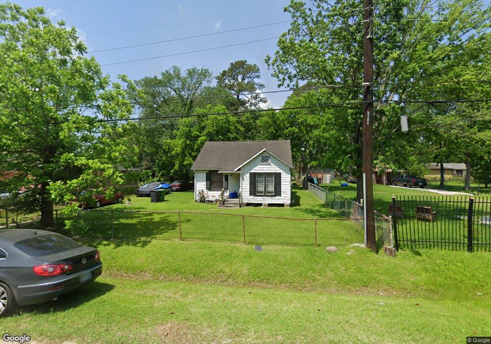
8825 Lanewood Dr Houston, TX 77016
Trinity-Houston Gardens NeighborhoodEstimated Value: $125,315 - $195,000
3
Beds
1
Bath
1,060
Sq Ft
$147/Sq Ft
Est. Value
About This Home
This home is located at 8825 Lanewood Dr, Houston, TX 77016 and is currently estimated at $155,579, approximately $146 per square foot. 8825 Lanewood Dr is a home located in Harris County with nearby schools including Felix Cook Jr. Elementary School, Key Middle, and Kashmere High School.
Ownership History
Date
Name
Owned For
Owner Type
Purchase Details
Closed on
Feb 2, 2007
Sold by
Callander Hugh S
Bought by
Raven Ora Nell
Current Estimated Value
Home Financials for this Owner
Home Financials are based on the most recent Mortgage that was taken out on this home.
Original Mortgage
$25,900
Outstanding Balance
$15,539
Interest Rate
6.19%
Mortgage Type
Seller Take Back
Estimated Equity
$140,040
Create a Home Valuation Report for This Property
The Home Valuation Report is an in-depth analysis detailing your home's value as well as a comparison with similar homes in the area
Home Values in the Area
Average Home Value in this Area
Purchase History
| Date | Buyer | Sale Price | Title Company |
|---|---|---|---|
| Raven Ora Nell | -- | None Available |
Source: Public Records
Mortgage History
| Date | Status | Borrower | Loan Amount |
|---|---|---|---|
| Open | Raven Ora Nell | $25,900 |
Source: Public Records
Tax History Compared to Growth
Tax History
| Year | Tax Paid | Tax Assessment Tax Assessment Total Assessment is a certain percentage of the fair market value that is determined by local assessors to be the total taxable value of land and additions on the property. | Land | Improvement |
|---|---|---|---|---|
| 2025 | $867 | $89,778 | $51,795 | $37,983 |
| 2024 | $867 | $89,778 | $51,795 | $37,983 |
| 2023 | $867 | $80,282 | $38,846 | $41,436 |
| 2022 | $861 | $57,725 | $25,898 | $31,827 |
| 2021 | $829 | $43,749 | $17,265 | $26,484 |
| 2020 | $783 | $39,756 | $17,265 | $22,491 |
| 2019 | $744 | $34,190 | $13,812 | $20,378 |
| 2018 | $0 | $28,546 | $13,812 | $14,734 |
| 2017 | $614 | $28,546 | $13,812 | $14,734 |
| 2016 | $558 | $22,997 | $10,791 | $12,206 |
| 2015 | -- | $20,075 | $9,927 | $10,148 |
| 2014 | -- | $20,075 | $9,927 | $10,148 |
Source: Public Records
Map
Nearby Homes
- 6415 Laura Koppe Rd
- 8914 Lanewood Dr
- 6513 Laura Koppe Rd
- 9009 Compton St
- 9205 & 9207 Spaulding St
- 6320 Laura Koppe Rd
- 8700 Lanewood Dr
- 8928 Homestead Rd
- 8514 Spaulding St
- 8504 Shady Dr
- 6213 Laura Koppe Rd
- 7129 Springdale St Unit A/B
- 9227 Homestead Rd
- 6012 Laura Koppe Rd
- 8420 Lanewood Dr
- 6005 Laura Koppe Rd
- 8716 Allwood St
- 8502 Shady Dr
- 9317 Homestead Rd
- 8636 Allwood St
- 8821 Lanewood Dr
- 8901 Lanewood Dr
- 8905 Lanewood Dr
- 8817 Lanewood Dr
- 8906 Compton St
- 8909 Lanewood Dr
- 8920 Compton St
- 8902 Compton St
- 8826 Lanewood Dr
- 8822 Lanewood Dr
- 8902 Lanewood Dr
- 8930 Compton St
- 8814 Compton St
- 8913 Lanewood Dr
- 8814 Lanewood Dr
- 8910 Lanewood Dr
- 9002 Compton St
- 8934 Compton St
- 8810 Lanewood Dr
- 8810 Lanewood Dr Unit B