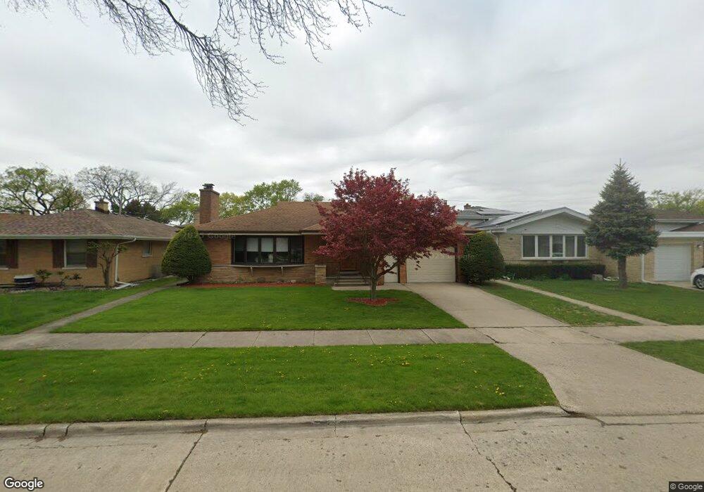
8832 Mango Ave Morton Grove, IL 60053
Estimated Value: $494,013 - $596,000
3
Beds
2
Baths
1,911
Sq Ft
$288/Sq Ft
Est. Value
About This Home
This home is located at 8832 Mango Ave, Morton Grove, IL 60053 and is currently estimated at $550,253, approximately $287 per square foot. 8832 Mango Ave is a home located in Cook County with nearby schools including Park View Elementary School, Niles West High School, and Arie Crown Hebrew Day School.
Ownership History
Date
Name
Owned For
Owner Type
Purchase Details
Closed on
Mar 30, 2009
Sold by
Rasinar Antoaneta Pop
Bought by
Gianaris Panagiotis N
Current Estimated Value
Purchase Details
Closed on
Apr 17, 2007
Sold by
Krueger Fred Ray and Krueger Evelyn
Bought by
Pop Antoaneta
Home Financials for this Owner
Home Financials are based on the most recent Mortgage that was taken out on this home.
Original Mortgage
$91,200
Interest Rate
6.2%
Mortgage Type
Stand Alone Second
Create a Home Valuation Report for This Property
The Home Valuation Report is an in-depth analysis detailing your home's value as well as a comparison with similar homes in the area
Home Values in the Area
Average Home Value in this Area
Purchase History
| Date | Buyer | Sale Price | Title Company |
|---|---|---|---|
| Gianaris Panagiotis N | $350,000 | None Available | |
| Pop Antoaneta | $456,000 | Pntn | |
| Pop Antoaneta | $456,000 | Pntn |
Source: Public Records
Mortgage History
| Date | Status | Borrower | Loan Amount |
|---|---|---|---|
| Previous Owner | Pop Antoaneta | $91,200 | |
| Previous Owner | Pop Antoaneta | $364,800 |
Source: Public Records
Tax History Compared to Growth
Tax History
| Year | Tax Paid | Tax Assessment Tax Assessment Total Assessment is a certain percentage of the fair market value that is determined by local assessors to be the total taxable value of land and additions on the property. | Land | Improvement |
|---|---|---|---|---|
| 2024 | $3,013 | $18,921 | $4,875 | $14,046 |
| 2023 | $3,056 | $18,921 | $4,875 | $14,046 |
| 2022 | $3,056 | $18,921 | $4,875 | $14,046 |
| 2021 | $4,430 | $13,810 | $3,000 | $10,810 |
| 2020 | $4,312 | $13,810 | $3,000 | $10,810 |
| 2019 | $4,345 | $15,517 | $3,000 | $12,517 |
| 2018 | $4,653 | $14,745 | $2,718 | $12,027 |
| 2017 | $5,206 | $16,375 | $2,718 | $13,657 |
| 2016 | $4,907 | $16,375 | $2,718 | $13,657 |
| 2015 | $4,827 | $14,978 | $2,343 | $12,635 |
| 2014 | $4,408 | $14,978 | $2,343 | $12,635 |
| 2013 | $4,298 | $14,978 | $2,343 | $12,635 |
Source: Public Records
Map
Nearby Homes
- 8841 Menard Ave
- 8836 Mansfield Ave
- 8918 Parkside Ave
- 8708 Central Ave
- 5536 Greenwood St
- 8849 Mcvicker Ave
- 5459 Suffield Ct
- 8655 Harms Rd
- 5352 Greenwood St
- 9224 Menard Ave
- 8541 Lotus Ave Unit 914
- 5510 Lincoln Ave Unit B301
- 5510 Lincoln Ave Unit B101
- 5506 Lincoln Ave Unit A117
- 5506 Lincoln Ave Unit A211
- 5506 Lincoln Ave Unit A216
- 5449 Arcadia St
- 6020 Lincoln Ave Unit 407
- 5346 Suffield Terrace
- 9234 Central Ave
- 8832 Mango Ave
- 8826 Mango Ave
- 8836 Mango Ave
- 8822 Mango Ave
- 8840 Mango Ave
- 8831 Menard Ave
- 8831 Menard Ave
- 8825 Menard Ave
- 8825 Menard Ave
- 8837 Menard Ave
- 8818 Mango Ave
- 8841 Menard Ave
- 8831 Mango Ave
- 8827 Mango Ave
- 8827 Mango Ave
- 8835 Mango Ave
- 8814 Mango Ave
- 8845 Menard Ave
- 8845 Menard Ave
- 8821 Menard Ave