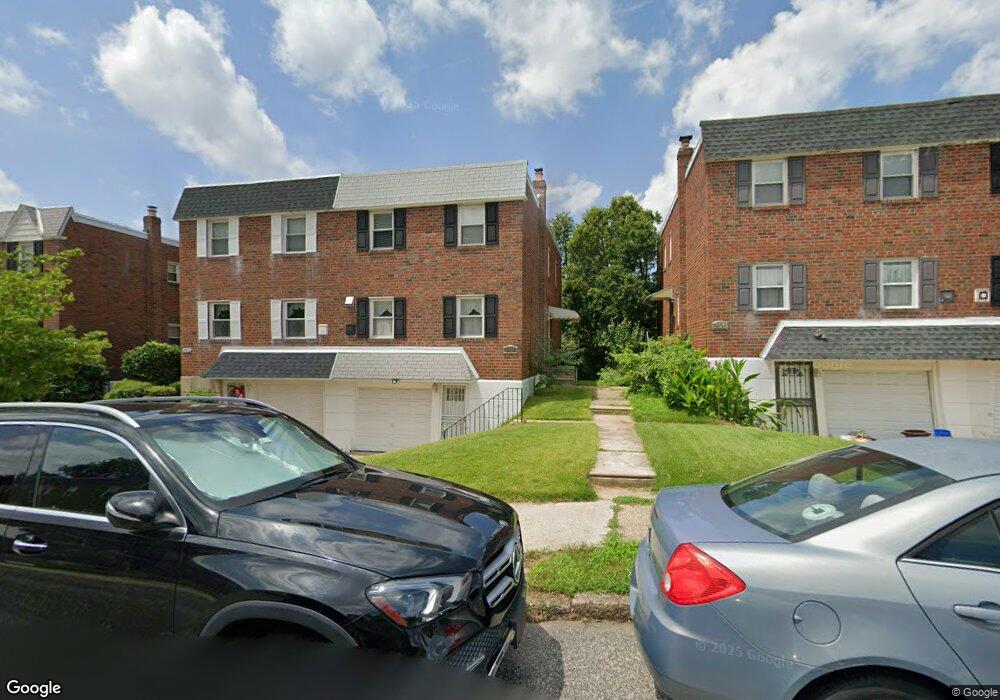
8836 Hargrave St Philadelphia, PA 19152
Pennypack NeighborhoodEstimated Value: $362,000 - $388,000
4
Beds
1
Bath
1,666
Sq Ft
$222/Sq Ft
Est. Value
About This Home
This home is located at 8836 Hargrave St, Philadelphia, PA 19152 and is currently estimated at $370,564, approximately $222 per square foot. 8836 Hargrave St is a home with nearby schools including Lincoln High School, Robert B. Pollock School, and Meehan Austin Middle School.
Ownership History
Date
Name
Owned For
Owner Type
Purchase Details
Closed on
Jun 29, 2001
Sold by
Fischer Kettyle Diane L
Bought by
Guld Joseph
Current Estimated Value
Home Financials for this Owner
Home Financials are based on the most recent Mortgage that was taken out on this home.
Original Mortgage
$102,000
Outstanding Balance
$39,422
Interest Rate
7.18%
Mortgage Type
Stand Alone First
Estimated Equity
$331,142
Purchase Details
Closed on
Nov 16, 1999
Sold by
Fischer Kettyle James Charles and Fischer Kettyle Diane L
Bought by
Kettyle Diane L Fischer
Create a Home Valuation Report for This Property
The Home Valuation Report is an in-depth analysis detailing your home's value as well as a comparison with similar homes in the area
Home Values in the Area
Average Home Value in this Area
Purchase History
| Date | Buyer | Sale Price | Title Company |
|---|---|---|---|
| Guld Joseph | $102,000 | Stewart Title Guaranty Compa | |
| Kettyle Diane L Fischer | -- | -- |
Source: Public Records
Mortgage History
| Date | Status | Borrower | Loan Amount |
|---|---|---|---|
| Open | Guld Joseph | $102,000 | |
| Closed | Guld Joseph | $15,300 |
Source: Public Records
Tax History Compared to Growth
Tax History
| Year | Tax Paid | Tax Assessment Tax Assessment Total Assessment is a certain percentage of the fair market value that is determined by local assessors to be the total taxable value of land and additions on the property. | Land | Improvement |
|---|---|---|---|---|
| 2025 | $3,736 | $337,600 | $67,520 | $270,080 |
| 2024 | $3,736 | $337,600 | $67,520 | $270,080 |
| 2023 | $3,736 | $266,900 | $53,380 | $213,520 |
| 2022 | $2,405 | $221,900 | $53,380 | $168,520 |
| 2021 | $3,035 | $0 | $0 | $0 |
| 2020 | $3,035 | $0 | $0 | $0 |
| 2019 | $2,857 | $0 | $0 | $0 |
| 2018 | $2,263 | $0 | $0 | $0 |
| 2017 | $2,683 | $0 | $0 | $0 |
| 2016 | $2,263 | $0 | $0 | $0 |
| 2015 | $2,167 | $0 | $0 | $0 |
| 2014 | -- | $191,700 | $59,824 | $131,876 |
| 2012 | -- | $25,152 | $3,310 | $21,842 |
Source: Public Records
Map
Nearby Homes
- 2648 Maxwell St
- 8860 Manchester St
- 2742 Welsh Rd
- 2633 Maxwell St
- 8817 R Danbury St
- 2777 Welsh Rd
- 2831 Chase Rd
- 2630 Taunton St
- 8920 Maxwell Place
- 9109 Revere St
- 8718 Hargrave St
- 9044 Brous Ave
- 2713 Clayton St
- 2831 Sebring Rd
- 9028 Brous Ave
- 2738 Maxwell St
- 8945 Haven Place
- 2876 Walnut Hill St
- 2759 Axe Factory Rd
- 2710 Riverhouse Rd
- 8834 Hargrave St
- 8838 Hargrave St
- 8832 Hargrave St
- 8840 Hargrave St
- 8830 Hargrave St
- 8842 Hargrave St
- 8828 Hargrave St
- 8835 Manchester St
- 8837 Manchester St
- 8833 Manchester Ave
- 8831 Manchester Ave
- 8844 Hargrave St
- 8841 Manchester St
- 8839 Manchester St
- 8829 Manchester St
- 8826 Hargrave St
- 8839 Hargrave St
- 8846 Hargrave St
- 8835 Hargrave St
- 8843 Manchester St