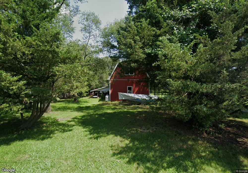
8837 Howeth Rd Wittman, MD 21676
Estimated Value: $425,690 - $757,000
Studio
2
Baths
3,232
Sq Ft
$178/Sq Ft
Est. Value
About This Home
This home is located at 8837 Howeth Rd, Wittman, MD 21676 and is currently estimated at $575,423, approximately $178 per square foot. 8837 Howeth Rd is a home located in Talbot County with nearby schools including Tilghman Elementary School, St. Michaels Middle/High School, and Easton High School.
Ownership History
Date
Name
Owned For
Owner Type
Purchase Details
Closed on
Apr 18, 2022
Sold by
Keene Michael J
Bought by
Keene Michael J
Current Estimated Value
Purchase Details
Closed on
Jul 10, 1989
Sold by
Utkewicz June M
Bought by
Keene Michael J and Crawford Carita T H
Purchase Details
Closed on
Jun 8, 1987
Sold by
Utkewicz June M and Utkewicz Karen A
Bought by
Utkewicz June M
Purchase Details
Closed on
Oct 17, 1980
Sold by
Fishpaw William T and Fishpaw Ruth I
Bought by
Utkewicz June M and Utkewicz Karen A
Home Financials for this Owner
Home Financials are based on the most recent Mortgage that was taken out on this home.
Original Mortgage
$30,000
Interest Rate
13.78%
Create a Home Valuation Report for This Property
The Home Valuation Report is an in-depth analysis detailing your home's value as well as a comparison with similar homes in the area
Purchase History
| Date | Buyer | Sale Price | Title Company |
|---|---|---|---|
| Keene Michael J | -- | None Listed On Document | |
| Keene Michael J | $67,000 | -- | |
| Utkewicz June M | $100 | -- | |
| Utkewicz June M | $40,000 | -- |
Source: Public Records
Mortgage History
| Date | Status | Borrower | Loan Amount |
|---|---|---|---|
| Previous Owner | Utkewicz June M | $30,000 |
Source: Public Records
Tax History
| Year | Tax Paid | Tax Assessment Tax Assessment Total Assessment is a certain percentage of the fair market value that is determined by local assessors to be the total taxable value of land and additions on the property. | Land | Improvement |
|---|---|---|---|---|
| 2025 | $1,558 | $321,200 | $86,500 | $234,700 |
| 2024 | $1,524 | $306,000 | $0 | $0 |
| 2023 | $1,440 | $290,800 | $0 | $0 |
| 2022 | $1,336 | $275,600 | $86,500 | $189,100 |
| 2021 | $1,271 | $275,233 | $0 | $0 |
| 2020 | $1,271 | $274,867 | $0 | $0 |
| 2019 | $1,271 | $274,500 | $86,500 | $188,000 |
| 2018 | $1,229 | $269,067 | $0 | $0 |
| 2017 | $1,173 | $263,633 | $0 | $0 |
| 2016 | $1,109 | $258,200 | $0 | $0 |
| 2015 | $1,004 | $258,200 | $0 | $0 |
| 2014 | $1,004 | $258,200 | $0 | $0 |
Source: Public Records
Map
Nearby Homes
- 22582 Pot Pie Rd
- 8805 Cummings Rd
- 8915 Palmer Ln
- 22707 Marshall Ln
- 22314 Pot Pie Rd
- 22349 Cooper Ln
- 8781 Tilghman Island Rd
- 9262 Macks Ln
- 8620 Bozman Neavitt Rd
- 9681 Macks Ln
- 8034 Bozman Neavitt Rd
- 21869 Albie Rd
- 7651 Main St
- 23869 Mount Misery Rd
- 7508 Cooper Point Rd
- 23961 Lynnewood Dr
- 0 Cooper Point Rd Unit MDTA2013120
- 23857 Ebb Point Rd
- 9180 Saint Michaels Rd
- 24354 Widgeon Place Unit 20
- 22597 Pot Pie Rd
- 8847 Howeth Rd
- 8830 Cummings Rd
- 22595 Pot Pie Rd
- 22585 Pot Pie Rd
- 0 Sewell Pt Rd Unit TA7806550
- 22601 Pot Pie Rd
- 8814 Cummings Rd
- 8844 Howeth Rd
- 22580 Pot Pie Rd
- 8848 Howeth Rd
- 8850 Howeth Rd
- 8808 Cummings Rd
- 8800 Cummings Rd
- 8829 Cummings Rd
- 22611 Pot Pie Rd
- 22619 Pot Pie Rd
- 22623 Pot Pie Rd
- 22600 Pot Pie Rd
- 22590 Pot Pie Rd
Your Personal Tour Guide
Ask me questions while you tour the home.