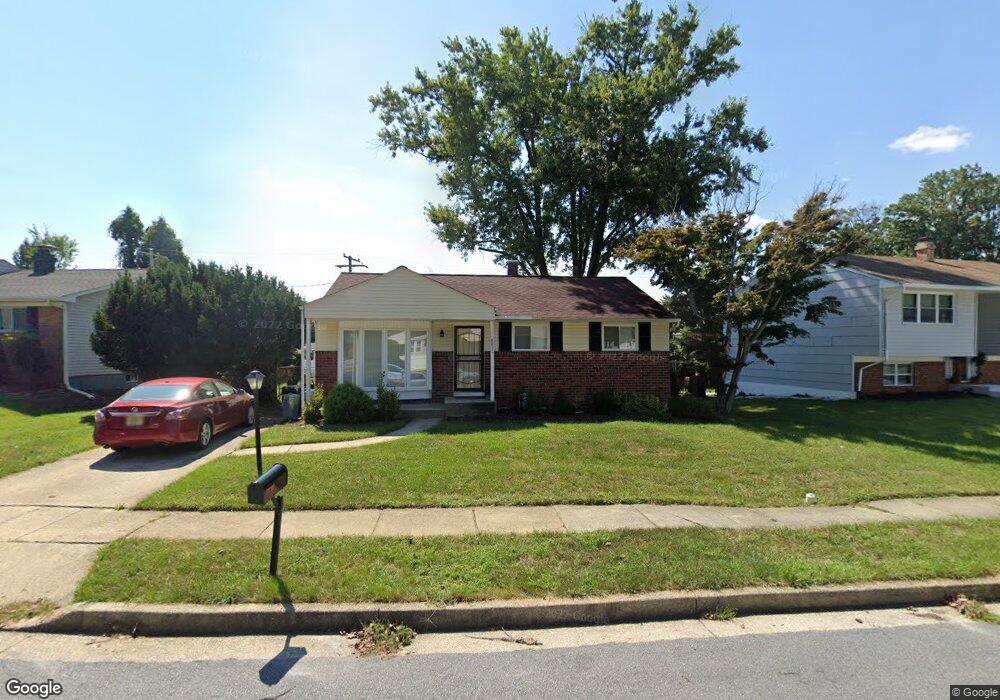
8837 Sigrid Rd Randallstown, MD 21133
Estimated Value: $253,000 - $348,000
Studio
1
Bath
1,044
Sq Ft
$291/Sq Ft
Est. Value
About This Home
This home is located at 8837 Sigrid Rd, Randallstown, MD 21133 and is currently estimated at $303,530, approximately $290 per square foot. 8837 Sigrid Rd is a home located in Baltimore County with nearby schools including Church Lane Elementary Technology School, Northwest Academy of Health Sciences, and Randallstown High School.
Ownership History
Date
Name
Owned For
Owner Type
Purchase Details
Closed on
Nov 5, 1992
Sold by
Spear Michael J
Bought by
Barnette Larry A
Current Estimated Value
Purchase Details
Closed on
Dec 11, 1980
Sold by
Majewski Joseph P
Bought by
Spear Michael J
Create a Home Valuation Report for This Property
The Home Valuation Report is an in-depth analysis detailing your home's value as well as a comparison with similar homes in the area
Home Values in the Area
Average Home Value in this Area
Purchase History
| Date | Buyer | Sale Price | Title Company |
|---|---|---|---|
| Barnette Larry A | $98,000 | -- | |
| Spear Michael J | $54,000 | -- |
Source: Public Records
Tax History
| Year | Tax Paid | Tax Assessment Tax Assessment Total Assessment is a certain percentage of the fair market value that is determined by local assessors to be the total taxable value of land and additions on the property. | Land | Improvement |
|---|---|---|---|---|
| 2025 | $2,909 | $233,567 | -- | -- |
| 2024 | $2,909 | $217,600 | $72,600 | $145,000 |
| 2023 | $1,442 | $201,467 | $0 | $0 |
| 2022 | $2,999 | $185,333 | $0 | $0 |
| 2021 | $2,746 | $169,200 | $54,600 | $114,600 |
| 2020 | $2,746 | $162,400 | $0 | $0 |
| 2019 | $2,630 | $155,600 | $0 | $0 |
| 2018 | $2,419 | $148,800 | $54,600 | $94,200 |
| 2017 | $2,284 | $141,467 | $0 | $0 |
| 2016 | $2,003 | $134,133 | $0 | $0 |
| 2015 | $2,003 | $126,800 | $0 | $0 |
| 2014 | $2,003 | $126,800 | $0 | $0 |
Source: Public Records
Map
Nearby Homes
- 4048 Carthage Rd
- 8541 Lucerne Rd
- 9012 Allenswood Rd
- 9063 Meadow Heights Rd
- 8604 Woodbrook Ct
- 5 Windy Meadow Ct
- 4226 Huntshire Rd
- 3729 Offutt Rd
- 1205/99 Winands Rd
- 8513 Charlton Rd
- 9110 Meadow Heights Rd
- 9112 Meadow Heights Rd
- 4816 Valley Forge Rd
- 4818 Oakland Park Rd
- 4812 Valley Forge Rd
- 3506 Bayer Ave
- 4814 Oakland Park Rd
- 9202 Samoset Rd
- 4104 Brad Jacob Ct
- 4228 Brookside Oaks