Estimated Value: $174,000 - $187,776
3
Beds
1
Bath
1,126
Sq Ft
$160/Sq Ft
Est. Value
About This Home
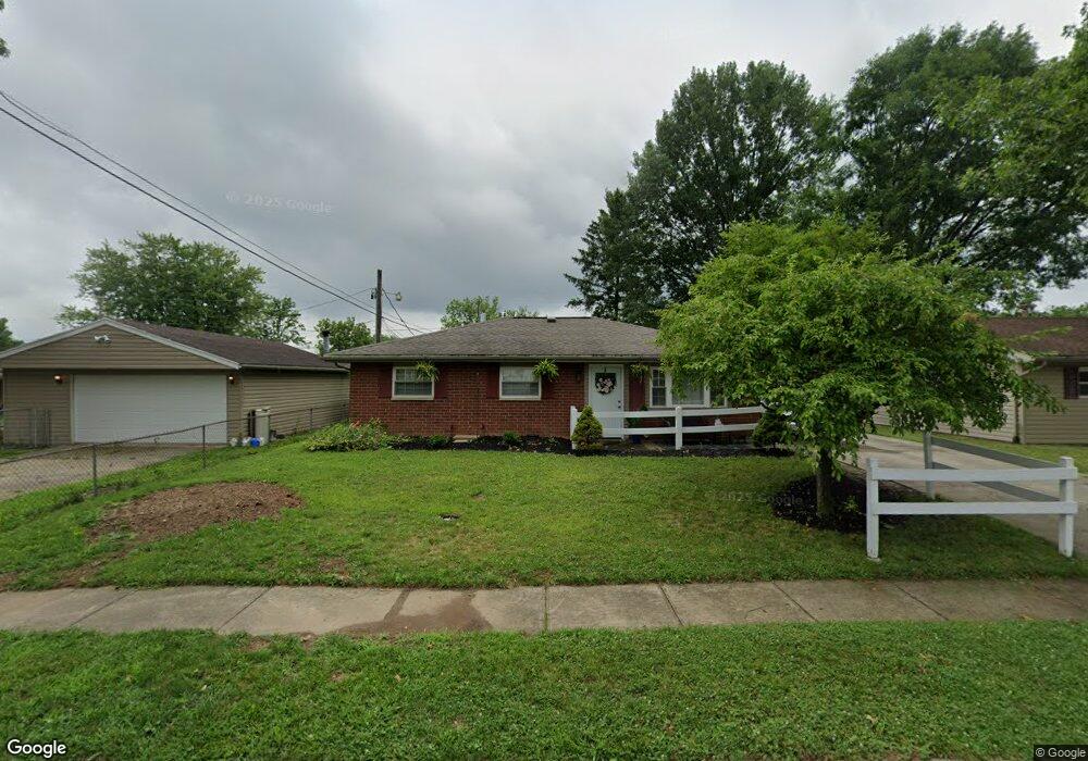
This home is located at 884 Buckskin Trail, Xenia, OH 45385 and is currently estimated at $179,694, approximately $159 per square foot. 884 Buckskin Trail is a home located in Greene County with nearby schools including Xenia High School, Summit Academy Community School for Alternative Learners - Xenia, and Legacy Christian Academy.
Ownership History
Date
Name
Owned For
Owner Type
Purchase Details
Closed on
Nov 14, 2014
Sold by
Wallman Gary and Wallman Cheryl L
Bought by
Cre 2 Llc
Current Estimated Value
Purchase Details
Closed on
Nov 10, 2014
Sold by
Secretary Of Hud
Bought by
Walman Gary
Purchase Details
Closed on
Sep 3, 2014
Sold by
The Huntington National Bank
Bought by
The Secretary Of Hud
Purchase Details
Closed on
Oct 29, 2013
Sold by
Sparkman Winford and Sparkman Gwen R
Bought by
The Huntington National Bank
Purchase Details
Closed on
Mar 3, 1993
Bought by
Sparkman Winford and Sparkman Sparkman
Create a Home Valuation Report for This Property
The Home Valuation Report is an in-depth analysis detailing your home's value as well as a comparison with similar homes in the area
Home Values in the Area
Average Home Value in this Area
Purchase History
| Date | Buyer | Sale Price | Title Company |
|---|---|---|---|
| Cre 2 Llc | -- | None Available | |
| Walman Gary | -- | None Available | |
| The Secretary Of Hud | -- | None Available | |
| The Huntington National Bank | $56,000 | None Available | |
| Sparkman Winford | $65,000 | -- |
Source: Public Records
Tax History Compared to Growth
Tax History
| Year | Tax Paid | Tax Assessment Tax Assessment Total Assessment is a certain percentage of the fair market value that is determined by local assessors to be the total taxable value of land and additions on the property. | Land | Improvement |
|---|---|---|---|---|
| 2024 | $1,972 | $46,080 | $11,420 | $34,660 |
| 2023 | $1,972 | $46,080 | $11,420 | $34,660 |
| 2022 | $1,649 | $32,860 | $6,720 | $26,140 |
| 2021 | $1,671 | $32,860 | $6,720 | $26,140 |
| 2020 | $1,601 | $32,860 | $6,720 | $26,140 |
| 2019 | $1,382 | $26,710 | $6,320 | $20,390 |
| 2018 | $1,388 | $26,710 | $6,320 | $20,390 |
| 2017 | $1,277 | $26,710 | $6,320 | $20,390 |
| 2016 | $1,278 | $24,140 | $6,320 | $17,820 |
| 2015 | $1,281 | $24,140 | $6,320 | $17,820 |
| 2014 | $502 | $24,140 | $6,320 | $17,820 |
Source: Public Records
Map
Nearby Homes
- 1208 Bellbrook Ave
- 1272 Bellbrook Ave
- 1144 Rockwell Dr
- 1778 Arapaho Dr
- 1618 Navajo Dr
- 1342 Kylemore Dr
- 1568 Cheyenne Dr
- 1653 Seneca Dr
- 1223 June Dr
- 1233 June Dr
- 1283 June Dr
- 1403 Texas Dr
- 1391 June Dr
- 1769 Gayhart Dr
- 1866 Roxbury Dr
- 305-325 Bellbrook Ave
- 1829 Gayhart Dr
- 523 Newport Rd
- 453 Walnut St
- 1908 Whitt St
- 874 Buckskin Trail
- 1454 Arrowhead Trail
- 1462 Arrowhead Trail
- 860 Buckskin Trail
- 1478 Arrowhead Trail
- 891 Moccasin Trail
- 879 Moccasin Trail
- 1415 Peacepipe Trail
- 1490 Arrowhead Trail
- 1428 Arrowhead Trail
- 865 Moccasin Trail
- 846 Buckskin Trail
- 1401 Peacepipe Trail
- 851 Moccasin Trail
- 1416 Peacepipe Trail
- 1414 Arrowhead Trail
- 1463 Arrowhead Trail
- 1453 Arrowhead Trail
- 834 Buckskin Trail
- 1479 Arrowhead Trail