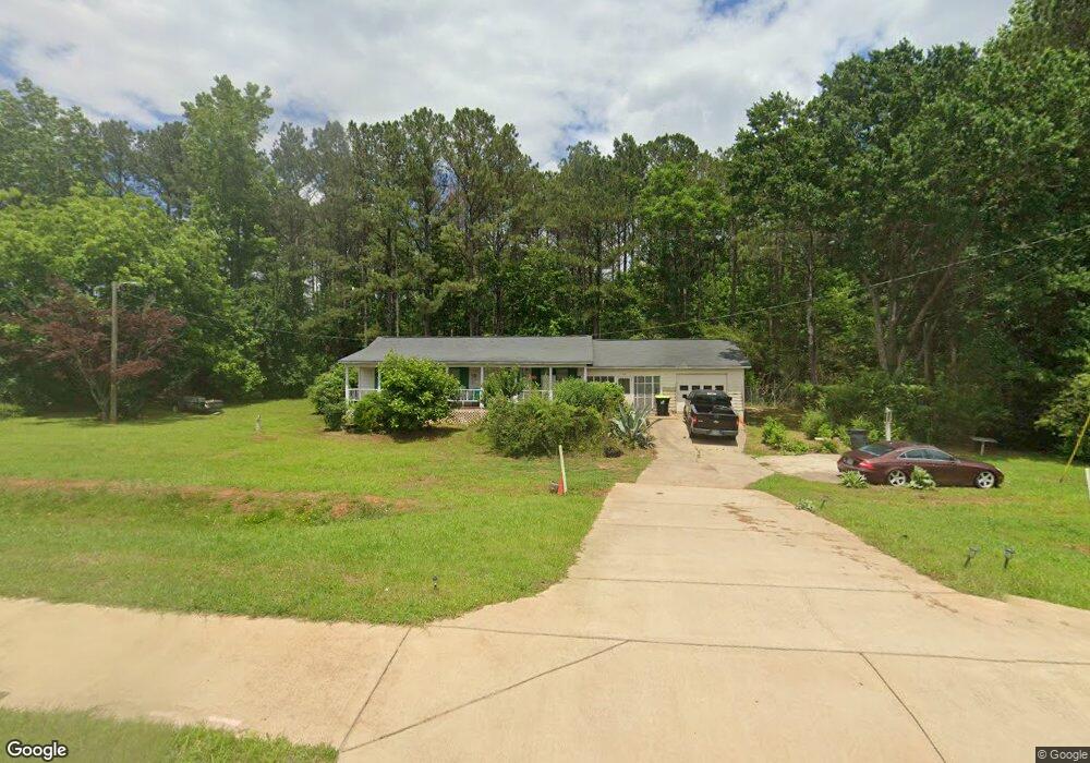
884 Poplar Rd Newnan, GA 30265
Estimated Value: $193,416 - $238,000
3
Beds
2
Baths
1,085
Sq Ft
$196/Sq Ft
Est. Value
About This Home
This home is located at 884 Poplar Rd, Newnan, GA 30265 and is currently estimated at $212,854, approximately $196 per square foot. 884 Poplar Rd is a home located in Coweta County with nearby schools including Welch Elementary School, East Coweta Middle School, and East Coweta High School.
Ownership History
Date
Name
Owned For
Owner Type
Purchase Details
Closed on
Jul 26, 2002
Sold by
Pittman Kristy Y
Bought by
Matthews Annie M
Current Estimated Value
Purchase Details
Closed on
Aug 2, 2001
Sold by
Matthews Annie Maude
Bought by
Pitman Kristy
Purchase Details
Closed on
Jul 27, 2001
Sold by
Pitman Kristy Yvonne
Bought by
Matthews Annie Maude
Purchase Details
Closed on
Dec 7, 1987
Sold by
Pitman George H Estate
Bought by
Pitman Kristy Yvonne
Purchase Details
Closed on
Nov 30, 1987
Sold by
Pitman Carolyn F Estate
Bought by
Pitman George H and Kristy Yvonne
Create a Home Valuation Report for This Property
The Home Valuation Report is an in-depth analysis detailing your home's value as well as a comparison with similar homes in the area
Home Values in the Area
Average Home Value in this Area
Purchase History
| Date | Buyer | Sale Price | Title Company |
|---|---|---|---|
| Matthews Annie M | -- | -- | |
| Pitman Kristy | $60,000 | -- | |
| Matthews Annie Maude | -- | -- | |
| Pitman Kristy Yvonne | -- | -- | |
| Pitman George H | -- | -- |
Source: Public Records
Tax History Compared to Growth
Tax History
| Year | Tax Paid | Tax Assessment Tax Assessment Total Assessment is a certain percentage of the fair market value that is determined by local assessors to be the total taxable value of land and additions on the property. | Land | Improvement |
|---|---|---|---|---|
| 2024 | $280 | $45,607 | $10,309 | $35,298 |
| 2023 | $280 | $51,982 | $14,318 | $37,664 |
| 2022 | $255 | $39,195 | $9,545 | $29,650 |
| 2021 | $239 | $35,746 | $9,090 | $26,656 |
| 2020 | $238 | $35,746 | $9,090 | $26,656 |
| 2019 | $326 | $40,227 | $5,594 | $34,633 |
| 2018 | $329 | $40,227 | $5,594 | $34,633 |
| 2017 | $328 | $40,227 | $5,594 | $34,633 |
| 2016 | $318 | $40,227 | $5,594 | $34,633 |
| 2015 | $328 | $42,909 | $8,276 | $34,633 |
| 2014 | -- | $42,909 | $8,276 | $34,633 |
Source: Public Records
Map
Nearby Homes
- 869 Poplar Rd
- 869 Poplar Rd Unit 2
- 918 Poplar Rd
- 925 Poplar Rd
- 856 Poplar Rd Unit 11
- 856 Poplar Rd
- 908 Poplar Rd
- 930 Poplar Rd
- 48 Burke Rd
- 54 Burke Rd
- 952 Poplar Rd
- 27 Thompson Dr
- 0 Thompson Dr Unit 8413268
- 0 Thompson Dr Unit 7377252
- 35 Thompson Dr
- 41 Thompson Dr
- 64 Hays Rd
- 978 Poplar Rd
- 50 Sunnyland Dr
- 76 Hays Rd