Estimated Value: $285,000 - $308,000
3
Beds
1
Bath
1,624
Sq Ft
$182/Sq Ft
Est. Value
About This Home
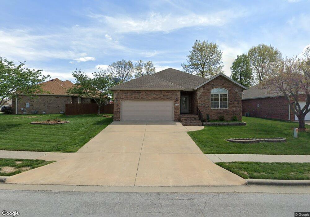
This home is located at 884 W Chestnut Bend Cir, Nixa, MO 65714 and is currently estimated at $296,157, approximately $182 per square foot. 884 W Chestnut Bend Cir is a home located in Christian County with nearby schools including P.S. 40 Samuel Huntington, Espy Elementary School, and Queens Gateway to Health Sciences Secondary School.
Ownership History
Date
Name
Owned For
Owner Type
Purchase Details
Closed on
Apr 15, 2010
Sold by
Harrington Robert B and Harrington Joyce A
Bought by
Metcalf Donna
Current Estimated Value
Purchase Details
Closed on
Sep 15, 2009
Sold by
Dean Alberta K
Bought by
Harrington Robert B and Harrington Joyce A
Create a Home Valuation Report for This Property
The Home Valuation Report is an in-depth analysis detailing your home's value as well as a comparison with similar homes in the area
Home Values in the Area
Average Home Value in this Area
Purchase History
| Date | Buyer | Sale Price | Title Company |
|---|---|---|---|
| Metcalf Donna | -- | None Available | |
| Harrington Robert B | -- | None Available |
Source: Public Records
Tax History Compared to Growth
Tax History
| Year | Tax Paid | Tax Assessment Tax Assessment Total Assessment is a certain percentage of the fair market value that is determined by local assessors to be the total taxable value of land and additions on the property. | Land | Improvement |
|---|---|---|---|---|
| 2024 | $1,814 | $29,110 | -- | -- |
| 2023 | $1,814 | $29,110 | $0 | $0 |
| 2022 | $1,698 | $27,210 | $0 | $0 |
| 2021 | $1,699 | $27,210 | $0 | $0 |
| 2020 | $1,523 | $23,280 | $0 | $0 |
| 2019 | $1,523 | $23,280 | $0 | $0 |
| 2018 | $1,418 | $23,280 | $0 | $0 |
| 2017 | $1,418 | $23,280 | $0 | $0 |
| 2016 | $1,397 | $23,280 | $0 | $0 |
| 2015 | $1,399 | $23,280 | $23,280 | $0 |
| 2014 | $1,366 | $23,310 | $0 | $0 |
| 2013 | $2 | $23,310 | $0 | $0 |
| 2011 | $2 | $46,620 | $0 | $0 |
Source: Public Records
Map
Nearby Homes
- 403 S Bryant St
- 412 S Bryant St
- 848 S Somerset Dr
- 601 S Gregg Rd
- 1334 W Mount Vernon St
- 000 West St
- Sw Corner Highway 160 & St S
- Tract 3c S Gregg Rd
- 1216 W Verna Ln
- 502 Osage Dr
- 985 W Pembrook Ave
- 886 W Paddington Dr
- 305 Meadow St
- 404 S Patricia Ave
- 304 N Bonda Way
- 931 W Butterfield Dr
- 000 (Tbd) Highway 160 (14 8 Acres) St
- 204 Gate Ln
- 106 S Delaware St
- 701 S Cedarwood Ct
- 886 W Chestnut Bend Cir
- 0 W Chestnut Bend Cir
- 878 W Chestnut Bend Cir
- 883 Dustin Ln
- 885 Dustin Ln
- 876 W Chestnut Bend Cir
- 883 W Chestnut Bend Cir
- 885 W Chestnut Bend Cir
- 887 Dustin Ln
- 881 W Chestnut Bend Cir
- 887 W Chestnut Bend Cir
- 879 W Chestnut Bend Cir
- 877 W Chestnut Bend Cir
- 891 Dustin Ln
- 884 Dustin Ln
- 882 Dustin Ln
- 886 Dustin Ln
- 880 W Dustin Ln
- 880 Dustin Ln
- 875 W Chestnut Bend Cir