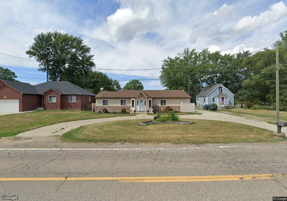
8841 16 1 2 Mile Rd Sterling Heights, MI 48312
Estimated Value: $361,011 - $396,000
3
Beds
2
Baths
1,363
Sq Ft
$280/Sq Ft
Est. Value
About This Home
This home is located at 8841 16 1 2 Mile Rd, Sterling Heights, MI 48312 and is currently estimated at $382,003, approximately $280 per square foot. 8841 16 1 2 Mile Rd is a home located in Macomb County with nearby schools including Plumbrook Elementary School, Heritage Junior High School, and Davis Junior High School.
Ownership History
Date
Name
Owned For
Owner Type
Purchase Details
Closed on
Sep 28, 2018
Sold by
Simpson Eric P
Bought by
Simpson Eric P and Simpson Lisa M
Current Estimated Value
Home Financials for this Owner
Home Financials are based on the most recent Mortgage that was taken out on this home.
Original Mortgage
$170,000
Outstanding Balance
$148,250
Interest Rate
4.5%
Mortgage Type
New Conventional
Estimated Equity
$233,753
Purchase Details
Closed on
Oct 31, 2013
Sold by
Simpson Bradley P and Simpson Cynthia J
Bought by
Simpson Eric P
Home Financials for this Owner
Home Financials are based on the most recent Mortgage that was taken out on this home.
Original Mortgage
$151,210
Interest Rate
4.42%
Mortgage Type
FHA
Purchase Details
Closed on
Oct 2, 2009
Sold by
Wells Fargo Bank Na
Bought by
Federal National Mortgage Association
Create a Home Valuation Report for This Property
The Home Valuation Report is an in-depth analysis detailing your home's value as well as a comparison with similar homes in the area
Home Values in the Area
Average Home Value in this Area
Purchase History
| Date | Buyer | Sale Price | Title Company |
|---|---|---|---|
| Simpson Eric P | -- | Sterling Title Agency | |
| Simpson Eric P | $154,000 | None Available | |
| Federal National Mortgage Association | -- | None Available | |
| Wells Fargo Bank Na | $144,862 | None Available |
Source: Public Records
Mortgage History
| Date | Status | Borrower | Loan Amount |
|---|---|---|---|
| Open | Simpson Eric P | $170,000 | |
| Previous Owner | Simpson Eric P | $151,210 |
Source: Public Records
Tax History Compared to Growth
Tax History
| Year | Tax Paid | Tax Assessment Tax Assessment Total Assessment is a certain percentage of the fair market value that is determined by local assessors to be the total taxable value of land and additions on the property. | Land | Improvement |
|---|---|---|---|---|
| 2025 | $4,600 | $190,700 | $0 | $0 |
| 2024 | $4,206 | $180,100 | $0 | $0 |
| 2023 | $3,971 | $171,600 | $0 | $0 |
| 2022 | $4,140 | $137,600 | $0 | $0 |
| 2021 | $4,054 | $133,100 | $0 | $0 |
| 2020 | $3,616 | $127,700 | $0 | $0 |
| 2019 | $3,705 | $125,200 | $0 | $0 |
| 2018 | $3,746 | $110,600 | $0 | $0 |
| 2017 | $3,579 | $107,600 | $22,800 | $84,800 |
| 2016 | $3,458 | $107,600 | $0 | $0 |
| 2015 | -- | $76,100 | $0 | $0 |
| 2014 | -- | $66,400 | $0 | $0 |
Source: Public Records
Map
Nearby Homes
- 11025 16 1 2 Mile Rd
- 37608 Andrew Dr
- 8453 Smethwick Rd
- 8716 Calvert Dr
- 38567 Trafalgar Way
- 38614 Arcola Dr
- 8125 Willesdon Square
- 8759 Calvert Dr
- 8268 Doncaster Dr
- 11401 Anna Lisa Dr
- 11425 Plumbrook Rd
- 39517 Balboa Dr
- 36719 Gregory Dr
- 11820 Creekview Dr Unit 54
- 36738 Vine Dr
- 11859 Fairview Dr
- 11118 Plumridge Blvd
- 39044 Dodge Park Rd
- 39123 Boston Dr
- 13193 Metro Pkwy
- 8841 16 1/2 Mile Rd
- 8753 16 1 2 Mile Rd
- 8753 16 1/2 Mile Rd
- 8841 Sixteen 1 2
- 8855 16 1/2 Mile Rd
- 38080 Arcola Dr
- 8739 16 1/2 Mile Rd
- 8872 Sixteen 1 2 Mile Rd
- 38098 Arcola Dr
- 38136 Thames Ct
- 8820 16 1/2 Mile Rd
- 8820 Sixteen 1 2 Mile Rd
- 38130 Thames Ct
- 38142 Thames Ct
- 8872 16 1 2 Mile Rd
- 8872 16 1/2 Mile Rd
- 37843 Brookwood Dr
- 38075 Arcola Dr
- 38124 Thames Ct
- 8677 16 1/2 Mile Rd