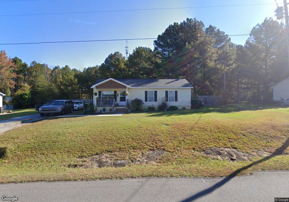
885 Black Rd Somerville, AL 35670
Estimated Value: $138,684 - $214,000
Studio
--
Bath
1,125
Sq Ft
$161/Sq Ft
Est. Value
About This Home
This home is located at 885 Black Rd, Somerville, AL 35670 and is currently estimated at $180,671, approximately $160 per square foot. 885 Black Rd is a home with nearby schools including Priceville Elementary School, Priceville Junior High School, and Priceville High School.
Ownership History
Date
Name
Owned For
Owner Type
Purchase Details
Closed on
Jan 16, 2013
Sold by
Habitat For Humanity
Bought by
James Megan Mashell
Current Estimated Value
Create a Home Valuation Report for This Property
The Home Valuation Report is an in-depth analysis detailing your home's value as well as a comparison with similar homes in the area
Purchase History
| Date | Buyer | Sale Price | Title Company |
|---|---|---|---|
| James Megan Mashell | $88,000 | None Available |
Source: Public Records
Tax History Compared to Growth
Tax History
| Year | Tax Paid | Tax Assessment Tax Assessment Total Assessment is a certain percentage of the fair market value that is determined by local assessors to be the total taxable value of land and additions on the property. | Land | Improvement |
|---|---|---|---|---|
| 2024 | $243 | $8,110 | $630 | $7,480 |
| 2023 | $250 | $8,190 | $630 | $7,560 |
| 2022 | $257 | $8,280 | $630 | $7,650 |
| 2021 | $225 | $7,210 | $750 | $6,460 |
| 2020 | $225 | $13,950 | $750 | $13,200 |
| 2019 | $225 | $7,440 | $0 | $0 |
| 2015 | $191 | $6,540 | $0 | $0 |
| 2014 | $191 | $6,540 | $0 | $0 |
Source: Public Records
Map
Nearby Homes
- 1 ACRE Highway 67 S
- 60 Acres Cain Rd
- 16.5 Route 67
- 32 Madison St
- 554 Cain Rd
- 437 Old Six Mile Rd
- 370 Center Springs Rd
- 171 Brookwood Dr
- 1094 Perkins Wood Rd
- 571 Berry Rd
- 659 Church Rd
- 337 Perry Ave
- 80 Shirley Hill Rd
- 288 Union Rd
- 249 Union Rd
- 53 Slaten Dr
- 150 Kaylee Loop
- 45 Union Rd
- 10 Jack Thomas Ct
- 40 Kaylee Loop