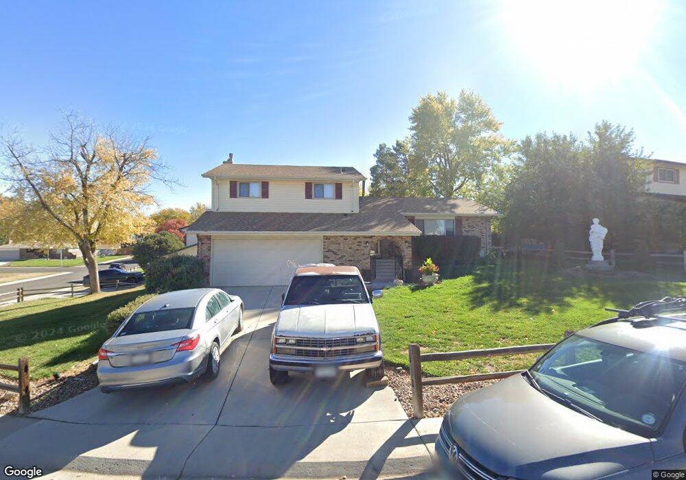
885 Mercury Cir Lone Tree, CO 80124
Estimated Value: $541,227 - $573,000
3
Beds
3
Baths
2,288
Sq Ft
$243/Sq Ft
Est. Value
About This Home
This home is located at 885 Mercury Cir, Lone Tree, CO 80124 and is currently estimated at $557,114, approximately $243 per square foot. 885 Mercury Cir is a home located in Douglas County with nearby schools including Acres Green Elementary School, Cresthill Middle School, and Highlands Ranch High School.
Ownership History
Date
Name
Owned For
Owner Type
Purchase Details
Closed on
Aug 9, 2018
Sold by
Black James R and Black Hazel
Bought by
L A B Services Llc
Current Estimated Value
Purchase Details
Closed on
Aug 19, 1994
Sold by
Leforce Terri Sue
Bought by
Black James R and Black Hazel
Home Financials for this Owner
Home Financials are based on the most recent Mortgage that was taken out on this home.
Original Mortgage
$36,000
Interest Rate
8.66%
Purchase Details
Closed on
Jul 13, 1990
Sold by
Karras George S and Karras Lambrene Ann
Bought by
Le Force Terri Sue
Purchase Details
Closed on
Nov 25, 1987
Sold by
Roth William E and Roth Cindy S
Bought by
Ann Karras George S and Ann Lambrene
Purchase Details
Closed on
May 23, 1979
Sold by
Unavailable
Bought by
Unavailable
Create a Home Valuation Report for This Property
The Home Valuation Report is an in-depth analysis detailing your home's value as well as a comparison with similar homes in the area
Home Values in the Area
Average Home Value in this Area
Purchase History
We collect this data history from publicly available records. To have your information removed, we recommend requesting removal directly through your county’s website.
| Date | Buyer | Sale Price | Title Company |
|---|---|---|---|
| L A B Services Llc | $400,000 | Guardian Title | |
| Black James R | $126,000 | First American Heritage Titl | |
| Le Force Terri Sue | $102,700 | -- | |
| Ann Karras George S | $100,000 | -- | |
| Unavailable | $66,200 | -- |
Source: Public Records
Mortgage History
We collect this data history from publicly available records. To have your information removed, we recommend requesting removal directly through your county’s website.
| Date | Status | Borrower | Loan Amount |
|---|---|---|---|
| Previous Owner | Black James R | $36,000 |
Source: Public Records
Tax History
| Year | Tax Paid | Tax Assessment Tax Assessment Total Assessment is a certain percentage of the fair market value that is determined by local assessors to be the total taxable value of land and additions on the property. | Land | Improvement |
|---|---|---|---|---|
| 2025 | $3,301 | $38,010 | $7,370 | $30,640 |
| 2024 | $3,301 | $39,660 | $7,910 | $31,750 |
| 2023 | $3,335 | $39,660 | $7,910 | $31,750 |
| 2022 | $2,490 | $27,960 | $6,710 | $21,250 |
| 2021 | $2,591 | $27,960 | $6,710 | $21,250 |
| 2020 | $2,726 | $26,700 | $6,400 | $20,300 |
| 2019 | $2,764 | $26,700 | $6,400 | $20,300 |
| 2018 | $1,276 | $22,280 | $5,580 | $16,700 |
| 2017 | $1,297 | $22,280 | $5,580 | $16,700 |
| 2016 | $986 | $19,180 | $3,950 | $15,230 |
| 2015 | $1,008 | $19,180 | $3,950 | $15,230 |
| 2014 | $777 | $16,060 | $3,980 | $12,080 |
Source: Public Records
Map
Nearby Homes
- 8872 Chestnut Hill Ln
- 13285 Rigel Dr
- 7057 Chestnut Hill St
- 13487 Antares Dr
- 9033 Edgewood St
- 6945 Mountain Brush Cir
- 8994 Bermuda Run Cir
- 9223 Wolfdale Dr
- 404 Neptune Ct
- 13255 Saturn Dr
- 424 Neptune Ct
- 9314 Wiltshire Dr
- 7191 Palisade Dr
- 13198 Mercury Dr
- 6472 Silver Mesa Dr Unit D
- 8159 Lodgepole Trail
- 8558 Gold Peak Ln Unit B
- 8546 Gold Peak Ln Unit F
- 8540 Gold Peak Ln Unit C
- 8626 Gold Peak Dr Unit B
- 889 Mercury Cir
- 879 Mercury Cir
- 888 Mercury Cir
- 884 Mercury Cir
- 13295 Peacock Dr
- 895 Mercury Cir
- 875 Mercury Cir
- 13285 Peacock Dr
- 878 Mercury Cir
- 869 Mercury Cir
- 899 Mercury Cir
- 13275 Peacock Dr
- 868 Mercury Cir
- 13256 Canopus Dr
- 13286 Peacock Dr
- 13358 Peacock Dr
- 866 Mercury Cir
- 905 Mercury Cir
- 13246 Canopus Dr
- 13378 Peacock Dr
Your Personal Tour Guide
Ask me questions while you tour the home.