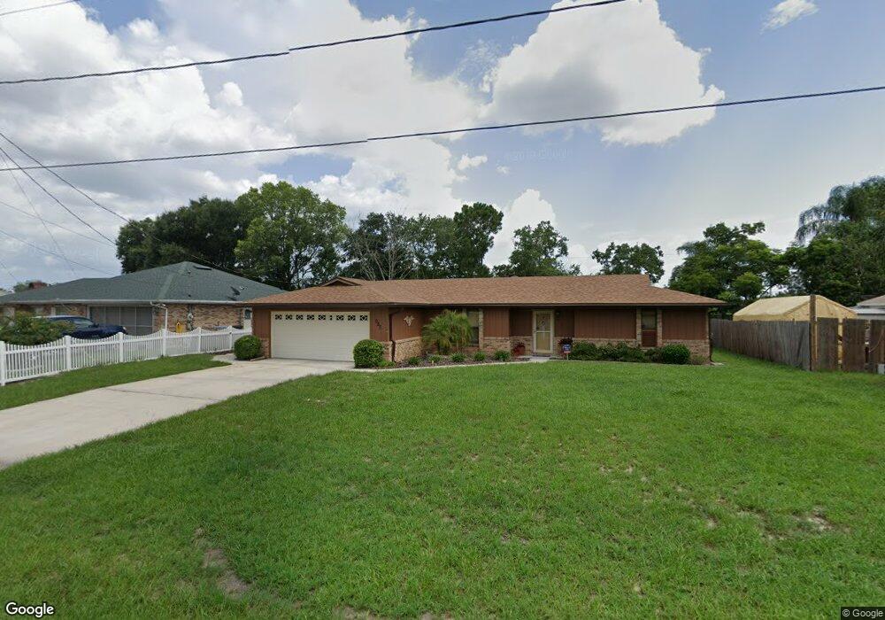
885 S Atmore Cir Deltona, FL 32725
Estimated Value: $306,000 - $359,000
3
Beds
2
Baths
2,329
Sq Ft
$140/Sq Ft
Est. Value
About This Home
This home is located at 885 S Atmore Cir, Deltona, FL 32725 and is currently estimated at $325,060, approximately $139 per square foot. 885 S Atmore Cir is a home located in Volusia County with nearby schools including Spirit Elementary School, Deltona Middle School, and Deltona High School.
Ownership History
Date
Name
Owned For
Owner Type
Purchase Details
Closed on
Sep 12, 2013
Sold by
Wagner Judith A
Bought by
Wagner Judith A and Judith Wagner Revocable Living Trust
Current Estimated Value
Purchase Details
Closed on
Dec 15, 1994
Sold by
Wagner Judith A and Wagner Paul R
Bought by
Wagner Judith A and Wagner Paul R
Purchase Details
Closed on
Sep 15, 1989
Bought by
Wagner Judith A
Purchase Details
Closed on
Dec 15, 1988
Bought by
Wagner Judith A
Purchase Details
Closed on
Jul 15, 1982
Bought by
Wagner Judith A
Purchase Details
Closed on
Mar 15, 1973
Bought by
Wagner Judith A
Create a Home Valuation Report for This Property
The Home Valuation Report is an in-depth analysis detailing your home's value as well as a comparison with similar homes in the area
Home Values in the Area
Average Home Value in this Area
Purchase History
| Date | Buyer | Sale Price | Title Company |
|---|---|---|---|
| Wagner Judith A | -- | None Available | |
| Wagner Judith A | -- | -- | |
| Wagner Judith A | $72,200 | -- | |
| Wagner Judith A | $100 | -- | |
| Wagner Judith A | $5,700 | -- | |
| Wagner Judith A | $1,800 | -- |
Source: Public Records
Tax History Compared to Growth
Tax History
| Year | Tax Paid | Tax Assessment Tax Assessment Total Assessment is a certain percentage of the fair market value that is determined by local assessors to be the total taxable value of land and additions on the property. | Land | Improvement |
|---|---|---|---|---|
| 2025 | $375 | $102,187 | -- | -- |
| 2024 | $375 | $99,308 | -- | -- |
| 2023 | $375 | $96,416 | $0 | $0 |
| 2022 | $363 | $93,608 | $0 | $0 |
| 2021 | $362 | $90,882 | $0 | $0 |
| 2020 | $362 | $89,627 | $0 | $0 |
| 2019 | $362 | $87,612 | $0 | $0 |
| 2018 | $344 | $85,978 | $0 | $0 |
| 2017 | $314 | $84,210 | $0 | $0 |
| 2016 | $312 | $82,478 | $0 | $0 |
| 2015 | $313 | $81,905 | $0 | $0 |
| 2014 | $280 | $81,255 | $0 | $0 |
Source: Public Records
Map
Nearby Homes
- 1991 Tilburg Ave
- 1940 Viking Ave
- 2091 Oldham Ave
- 1019 Sullivan St
- 1025 Sullivan St
- 1022 Blue Horizon Dr
- 918 N Atmore Cir
- 1030 Blue Horizon Dr
- 889 Swallow St
- 917 Swallow St
- 908 Vercelli St
- 1834 Tripoli Ave
- 2018 N Normandy Blvd
- 810 Sylvia Dr
- 805 Sylvia Dr
- 1854 N Normandy Blvd
- 0 Elkcam Blvd Unit MFRV4942623
- 2033 E Gloria Dr
- 1108 Sherbrook Dr
- 683 Gainsboro St
- 877 S Atmore Cir
- 891 S Atmore Cir
- 896 Sullivan St
- 902 Sullivan St
- 886 Sullivan St
- 871 S Atmore Cir
- 899 S Atmore Cir
- 878 S Atmore Cir
- 876 Sullivan St
- 904 Sullivan St
- 2025 Kelso Ave
- 870 S Atmore Cir
- 861 S Atmore Cir
- 903 S Atmore Cir
- 848 S Atmore Cir
- 840 S Atmore Cir
- 866 Sullivan St
- 914 Sullivan St
- 2037 Kelso Ave
- 2024 Kingswood Ave