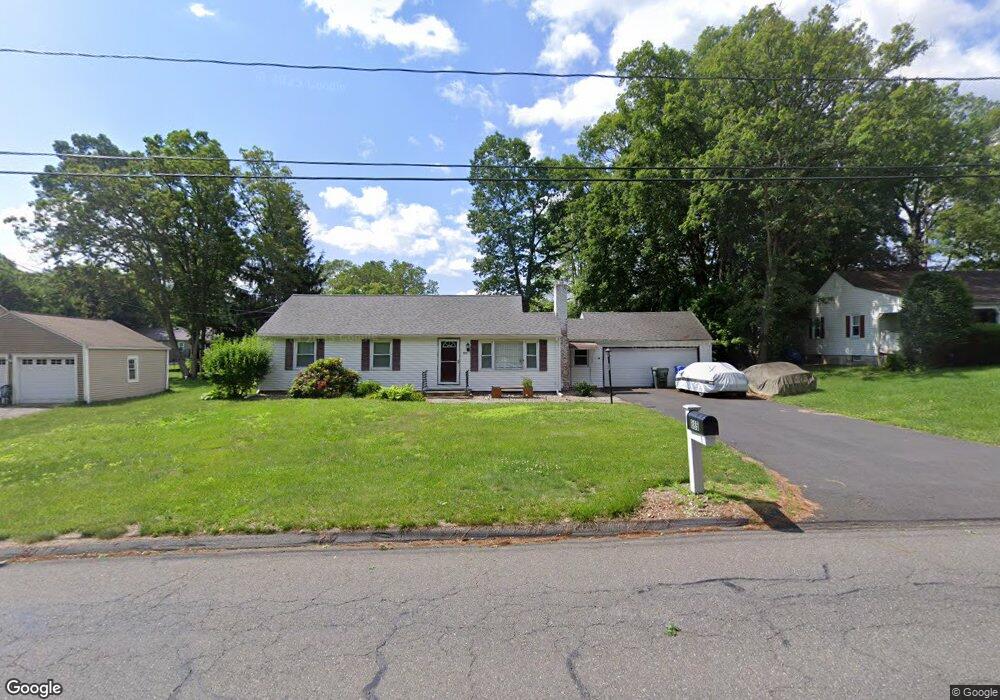
885 S Branch Pkwy Springfield, MA 01118
Sixteen Acres NeighborhoodEstimated Value: $349,000 - $374,000
3
Beds
2
Baths
1,297
Sq Ft
$274/Sq Ft
Est. Value
About This Home
This home is located at 885 S Branch Pkwy, Springfield, MA 01118 and is currently estimated at $355,750, approximately $274 per square foot. 885 S Branch Pkwy is a home located in Hampden County with nearby schools including Glickman Elementary, M Marcus Kiley Middle, and Springfield High School of Science and Technology.
Ownership History
Date
Name
Owned For
Owner Type
Purchase Details
Closed on
Jul 25, 2007
Sold by
Damato Donald J
Bought by
Barron Jeremy E
Current Estimated Value
Home Financials for this Owner
Home Financials are based on the most recent Mortgage that was taken out on this home.
Original Mortgage
$144,000
Outstanding Balance
$91,313
Interest Rate
6.78%
Mortgage Type
Purchase Money Mortgage
Estimated Equity
$264,437
Purchase Details
Closed on
Jul 10, 2000
Sold by
Broadhead Lea M
Bought by
Damato Donald J
Home Financials for this Owner
Home Financials are based on the most recent Mortgage that was taken out on this home.
Original Mortgage
$94,800
Interest Rate
8.55%
Mortgage Type
Purchase Money Mortgage
Create a Home Valuation Report for This Property
The Home Valuation Report is an in-depth analysis detailing your home's value as well as a comparison with similar homes in the area
Home Values in the Area
Average Home Value in this Area
Purchase History
| Date | Buyer | Sale Price | Title Company |
|---|---|---|---|
| Barron Jeremy E | $180,000 | -- | |
| Damato Donald J | $118,500 | -- |
Source: Public Records
Mortgage History
| Date | Status | Borrower | Loan Amount |
|---|---|---|---|
| Open | Barron Jeremy E | $144,000 | |
| Previous Owner | Damato Donald J | $121,500 | |
| Previous Owner | Damato Donald J | $94,800 | |
| Previous Owner | Damato Donald J | $70,000 | |
| Previous Owner | Damato Donald J | $108,000 |
Source: Public Records
Tax History Compared to Growth
Tax History
| Year | Tax Paid | Tax Assessment Tax Assessment Total Assessment is a certain percentage of the fair market value that is determined by local assessors to be the total taxable value of land and additions on the property. | Land | Improvement |
|---|---|---|---|---|
| 2025 | $4,801 | $306,200 | $61,700 | $244,500 |
| 2024 | $4,575 | $284,900 | $61,700 | $223,200 |
| 2023 | $4,576 | $268,400 | $58,700 | $209,700 |
| 2022 | $4,078 | $216,700 | $61,900 | $154,800 |
| 2021 | $3,848 | $203,600 | $56,300 | $147,300 |
| 2020 | $3,705 | $189,700 | $56,300 | $133,400 |
| 2019 | $3,641 | $185,000 | $56,300 | $128,700 |
| 2018 | $3,696 | $187,800 | $56,300 | $131,500 |
| 2017 | $3,553 | $180,700 | $56,300 | $124,400 |
| 2016 | $3,460 | $176,000 | $56,300 | $119,700 |
| 2015 | $3,326 | $169,100 | $56,300 | $112,800 |
Source: Public Records
Map
Nearby Homes
- 99 W Crystal Brook Dr
- 767 S Branch Pkwy
- 86 Talmadge Dr
- 41 Hillside Dr
- 41 Kerry Dr
- 82 Louis Rd
- 1680 Parker St
- 31 Acrebrook Rd
- 290 Newton Rd
- 54 Shady Brook Ln
- 111 Malibu Dr
- 17 Pebble Mill Rd
- 27 Regal St
- 55 Allen St
- 101 Regal St
- 196 Sawmill Rd
- 65 Fair Oak Rd
- 1815 Parker St
- 10 Woodcrest Rd
- 43 Sunridge Dr
- 875 S Branch Pkwy
- 895 S Branch Pkwy
- 26 Lynebrook Rd
- 16 Lynebrook Rd
- 36 Lynebrook Rd
- 865 S Branch Pkwy
- 905 S Branch Pkwy
- 23 Wildwood Ave
- 46 Lynebrook Rd
- 915 S Branch Pkwy
- 25 Lynebrook Rd
- 15 Lynebrook Rd
- 37 Lynebrook Rd
- 56 Lynebrook Rd
- 5 Lynebrook Rd
- 855 S Branch Pkwy
- 18 Wildwood Ave
- 47 Lynebrook Rd
- 28 Wildwood Ave
- 60 Harrow Rd