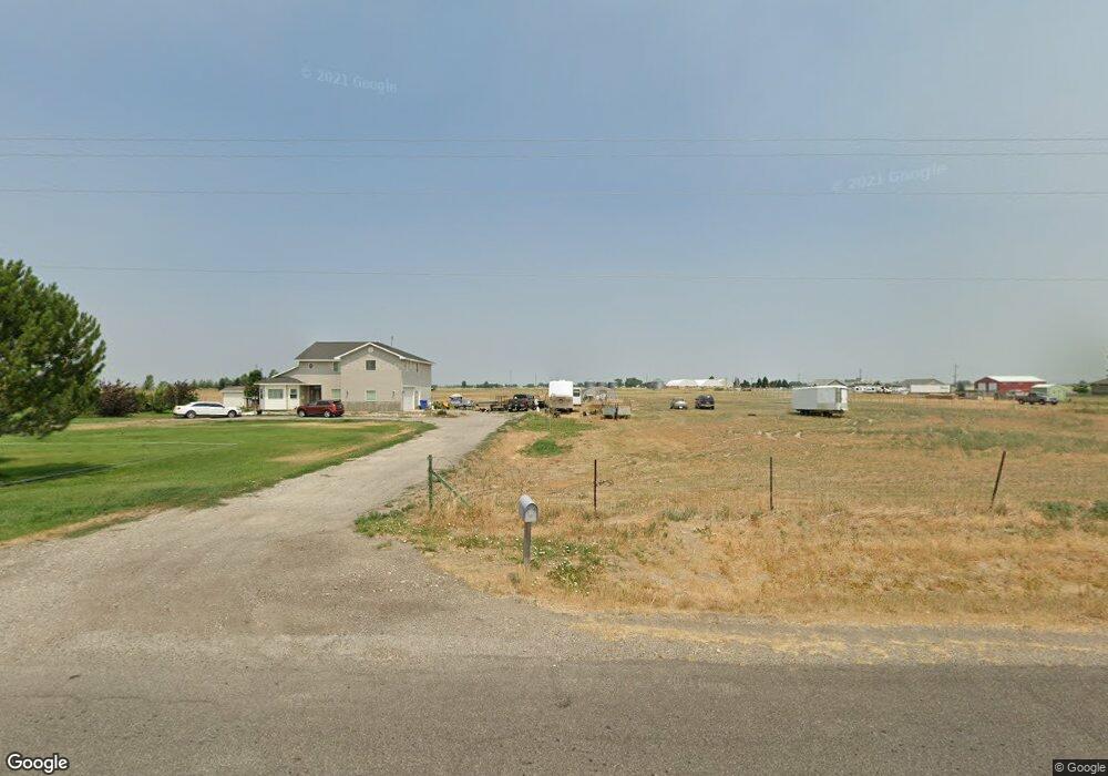
886 E 1000 N Shelley, ID 83274
Estimated Value: $610,078 - $716,000
--
Bed
--
Bath
2,515
Sq Ft
$266/Sq Ft
Est. Value
About This Home
This home is located at 886 E 1000 N, Shelley, ID 83274 and is currently estimated at $669,520, approximately $266 per square foot. 886 E 1000 N is a home with nearby schools including A.W. Johnson Elementary School, Firth Middle School, and Firth High School.
Ownership History
Date
Name
Owned For
Owner Type
Purchase Details
Closed on
Aug 4, 2008
Sold by
Malony Michael J and Malony Carol L
Bought by
Malony Carol L
Current Estimated Value
Home Financials for this Owner
Home Financials are based on the most recent Mortgage that was taken out on this home.
Original Mortgage
$212,000
Outstanding Balance
$138,731
Interest Rate
6.27%
Mortgage Type
Commercial
Estimated Equity
$530,789
Purchase Details
Closed on
Apr 1, 2005
Sold by
Cox Byard A and Cox Shirley A
Bought by
Malony Michael J and Malony Carol L
Purchase Details
Closed on
Mar 31, 2005
Sold by
Nulph Forrest H and Nulph Bonnie J
Bought by
Cox Byard A and Cox Shirley A
Create a Home Valuation Report for This Property
The Home Valuation Report is an in-depth analysis detailing your home's value as well as a comparison with similar homes in the area
Home Values in the Area
Average Home Value in this Area
Purchase History
| Date | Buyer | Sale Price | Title Company |
|---|---|---|---|
| Malony Carol L | -- | -- | |
| Malony Michael J | -- | Ameritite | |
| Cox Byard A | -- | None Available |
Source: Public Records
Mortgage History
| Date | Status | Borrower | Loan Amount |
|---|---|---|---|
| Open | Malony Carol L | $212,000 |
Source: Public Records
Tax History Compared to Growth
Tax History
| Year | Tax Paid | Tax Assessment Tax Assessment Total Assessment is a certain percentage of the fair market value that is determined by local assessors to be the total taxable value of land and additions on the property. | Land | Improvement |
|---|---|---|---|---|
| 2025 | $1,528 | $488,584 | $105,001 | $383,583 |
| 2024 | $1,528 | $488,584 | $105,001 | $383,583 |
| 2023 | $1,728 | $488,584 | $105,001 | $383,583 |
| 2022 | $3,568 | $488,584 | $105,001 | $383,583 |
| 2021 | $1,824 | $326,651 | $95,001 | $231,650 |
| 2020 | $1,698 | $287,651 | $0 | $0 |
| 2019 | $1,892 | $287,651 | $0 | $0 |
| 2018 | $1,557 | $242,001 | $45,001 | $197,000 |
| 2017 | $1,456 | $242,001 | $45,001 | $197,000 |
| 2016 | $1,464 | $242,001 | $0 | $0 |
| 2015 | $1,597 | $242,001 | $0 | $0 |
| 2014 | $1,597 | $242,001 | $45,001 | $197,000 |
Source: Public Records
Map
Nearby Homes
- TBD Sugar Factory Rd
- 956 E 1100 N
- 967 E 900 N
- TBD N 1000 E
- 1172 N 1000 E
- 757 E 1200 N
- 285 Moonlight Dr
- 862 E 1200 N
- 864 E 1200 N
- TBD E 1200 N
- Xavier Plan at Sunset Vista
- Ravenstone Plan at Sunset Vista
- Edgeworth Plan at Sunset Vista
- Northfield Plan at Sunset Vista
- Kensington Plan at Sunset Vista
- Denford Plan at Sunset Vista
- Clearpoint Plan at Sunset Vista
- Brantwood Plan at Sunset Vista
- Canyon Plan at Sunset Vista
- Ashland Plan at Sunset Vista