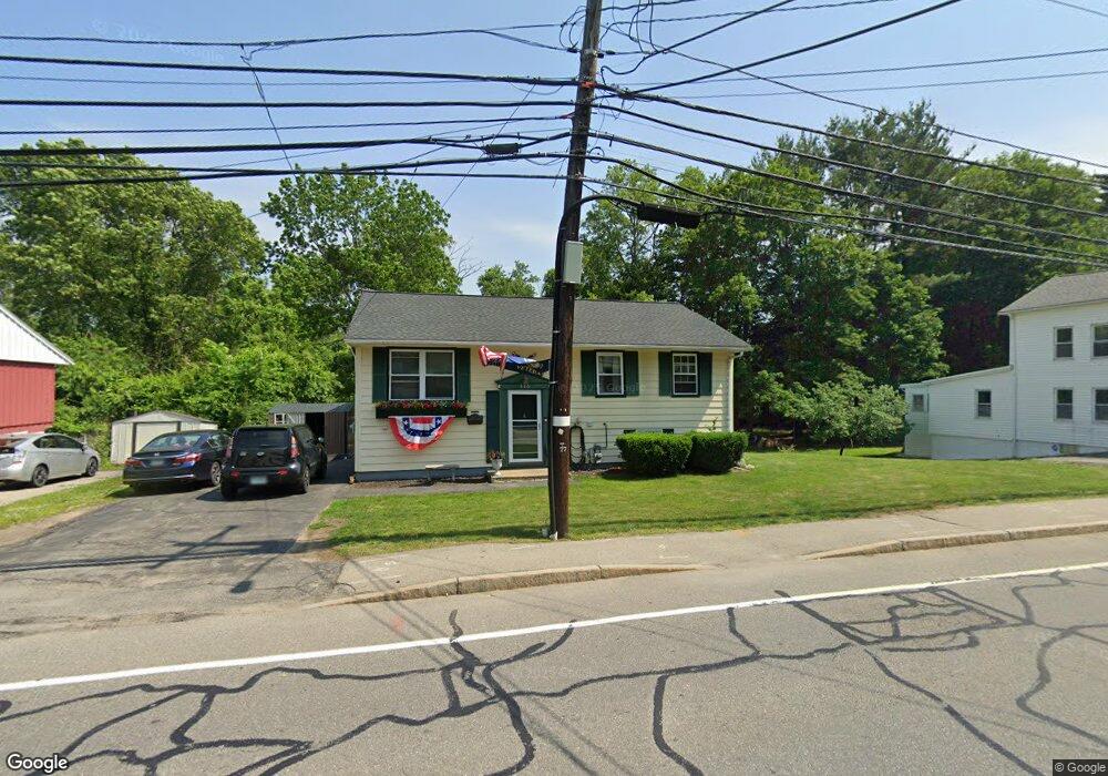
886 Varnum Ave Lowell, MA 01854
Pawtucketville NeighborhoodEstimated Value: $475,000 - $569,601
3
Beds
2
Baths
1,235
Sq Ft
$428/Sq Ft
Est. Value
About This Home
This home is located at 886 Varnum Ave, Lowell, MA 01854 and is currently estimated at $528,900, approximately $428 per square foot. 886 Varnum Ave is a home located in Middlesex County with nearby schools including Joseph McAvinnue Elementary School, Charlotte M. Murkland Elementary School, and Charles W. Morey Elementary School.
Ownership History
Date
Name
Owned For
Owner Type
Purchase Details
Closed on
Apr 15, 2011
Sold by
Farrell Doris M
Bought by
Langland Richard
Current Estimated Value
Home Financials for this Owner
Home Financials are based on the most recent Mortgage that was taken out on this home.
Original Mortgage
$200,100
Outstanding Balance
$138,630
Interest Rate
4.89%
Mortgage Type
Purchase Money Mortgage
Estimated Equity
$390,270
Create a Home Valuation Report for This Property
The Home Valuation Report is an in-depth analysis detailing your home's value as well as a comparison with similar homes in the area
Home Values in the Area
Average Home Value in this Area
Purchase History
| Date | Buyer | Sale Price | Title Company |
|---|---|---|---|
| Langland Richard | $200,100 | -- | |
| Langland Richard | $200,100 | -- |
Source: Public Records
Mortgage History
| Date | Status | Borrower | Loan Amount |
|---|---|---|---|
| Open | Langland Richard | $200,100 | |
| Closed | Langland Richard | $200,100 |
Source: Public Records
Tax History Compared to Growth
Tax History
| Year | Tax Paid | Tax Assessment Tax Assessment Total Assessment is a certain percentage of the fair market value that is determined by local assessors to be the total taxable value of land and additions on the property. | Land | Improvement |
|---|---|---|---|---|
| 2025 | $5,284 | $460,300 | $193,700 | $266,600 |
| 2024 | $5,277 | $443,100 | $181,100 | $262,000 |
| 2023 | $5,074 | $408,500 | $157,500 | $251,000 |
| 2022 | $4,600 | $362,500 | $143,300 | $219,200 |
| 2021 | $4,264 | $316,800 | $124,700 | $192,100 |
| 2020 | $4,045 | $302,800 | $127,200 | $175,600 |
| 2019 | $3,982 | $283,600 | $112,000 | $171,600 |
| 2018 | $3,741 | $260,000 | $106,800 | $153,200 |
| 2017 | $3,655 | $245,000 | $97,000 | $148,000 |
| 2016 | $3,590 | $236,800 | $90,500 | $146,300 |
| 2015 | $3,042 | $196,500 | $88,600 | $107,900 |
| 2013 | $3,049 | $203,100 | $111,500 | $91,600 |
Source: Public Records
Map
Nearby Homes
- 6 Louis Farm Rd Unit 6
- 3 Louis Farm Rd Unit 3
- 101 Laurie Ln
- 54 Shirley Ave
- 20 Sandy Ln
- 69 Coburn Dr
- 49 Coburn Dr
- 527 Pawtucket Blvd Unit 304
- 1975 Middlesex St Unit 51
- 1975 Middlesex St Unit 10
- 24 Brouilette St Unit A
- 240 Trotting Park Rd
- 1370 Varnum Ave
- 770 Princeton Blvd
- 1401 Pawtucket Blvd Unit 10
- 307 Pawtucket Blvd Unit 13
- 4 Tamarack St
- 295 Pawtucket Blvd Unit 7
- 1461 Pawtucket Blvd Unit 12
- 15 Dowling Dr
- 878A Varnum
- 878 Varnum Ave
- 878 Varnum Ave
- 887 Varnum Ave Unit 1
- 887 Varnum Ave Unit 10
- 868 Varnum Ave
- 915 Varnum Ave
- 900 Varnum Ave
- 860 Varnum Ave
- 902 Varnum Ave
- 24 Hunnewell Cir
- 26 Klianthi Dr
- 919 Varnum Ave
- 17 Klianthi Dr
- 40 Old Ferry Rd
- 16 Old Ferry Rd
- 863 Varnum Ave
- 1 Totman Rd
- 23 Hunnewell Cir
- 933 Varnum Ave Unit 6