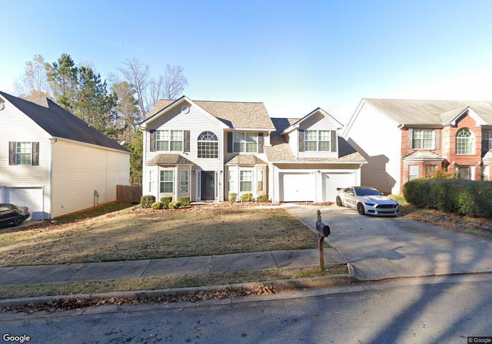
887 Carter Rd Jonesboro, GA 30238
Estimated Value: $317,769 - $370,000
5
Beds
3
Baths
2,678
Sq Ft
$128/Sq Ft
Est. Value
About This Home
This home is located at 887 Carter Rd, Jonesboro, GA 30238 and is currently estimated at $342,442, approximately $127 per square foot. 887 Carter Rd is a home located in Clayton County with nearby schools including Kemp Primary School, Kemp Elementary School, and Mundys Mill Middle School.
Ownership History
Date
Name
Owned For
Owner Type
Purchase Details
Closed on
Oct 26, 2006
Sold by
Franklin Builders Inc
Bought by
Jones Tracy
Current Estimated Value
Home Financials for this Owner
Home Financials are based on the most recent Mortgage that was taken out on this home.
Original Mortgage
$150,100
Outstanding Balance
$89,084
Interest Rate
6.27%
Mortgage Type
New Conventional
Estimated Equity
$253,358
Create a Home Valuation Report for This Property
The Home Valuation Report is an in-depth analysis detailing your home's value as well as a comparison with similar homes in the area
Home Values in the Area
Average Home Value in this Area
Purchase History
| Date | Buyer | Sale Price | Title Company |
|---|---|---|---|
| Jones Tracy | $187,700 | -- |
Source: Public Records
Mortgage History
| Date | Status | Borrower | Loan Amount |
|---|---|---|---|
| Open | Jones Tracy | $150,100 |
Source: Public Records
Tax History Compared to Growth
Tax History
| Year | Tax Paid | Tax Assessment Tax Assessment Total Assessment is a certain percentage of the fair market value that is determined by local assessors to be the total taxable value of land and additions on the property. | Land | Improvement |
|---|---|---|---|---|
| 2024 | $4,532 | $125,200 | $11,200 | $114,000 |
| 2023 | $4,237 | $117,360 | $11,200 | $106,160 |
| 2022 | $4,164 | $115,120 | $11,200 | $103,920 |
| 2021 | $2,588 | $74,560 | $11,200 | $63,360 |
| 2020 | $2,494 | $71,400 | $11,200 | $60,200 |
| 2019 | $2,298 | $65,668 | $12,800 | $52,868 |
| 2018 | $2,211 | $63,537 | $12,800 | $50,737 |
| 2017 | $2,216 | $63,532 | $12,800 | $50,732 |
| 2016 | $2,216 | $63,532 | $12,800 | $50,732 |
| 2015 | $2,201 | $0 | $0 | $0 |
| 2014 | $1,664 | $50,858 | $12,800 | $38,058 |
Source: Public Records
Map
Nearby Homes
- 895 Corinth Dr
- 9181 Welch Ct
- 810 River Valley Dr Unit 3
- 853 Capital Ct
- 608 Woodknoll Ct
- 9319 Forest Knoll Dr
- 655 Raven Ct
- 9409 Forest Knoll Dr
- 9138 Sunset Dr Unit 3
- 8971 Habersham Dr Unit 2
- 9383 Woodknoll Way Unit 4
- 9425 Forest Knoll Dr
- 9043 Raven Dr
- 9413 Woodloop Ct
- 405 Oak Hill Dr
- 8882 Habersham Dr
- 8919 Saddlewood Dr
- 8883 Peppertree Dr
- 8949 Raven Dr Unit I
- 815 Darlington Dr
- 881 Carter Rd
- 893 Carter Rd
- 856 Chapman St
- 901 Carter Rd Unit 1
- 901 Carter Rd
- 875 Carter Rd
- 844 Chapman St
- 850 Chapman St
- 860 Carter Rd
- 902 Carter Rd
- 838 Chapman St
- 832 Chapman St
- 855 Chapman St
- 0 Carter Rd Unit 7235073
- 0 Carter Rd Unit 3194975
- 0 Carter Rd Unit 3144994
- 0 Carter Rd Unit 8106909
- 0 Carter Rd Unit 8024640
- 0 Carter Rd Unit 7553194
- 0 Carter Rd Unit 3267028