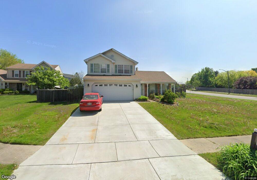
887 Winchester Ct Carol Stream, IL 60188
Estimated Value: $412,437 - $455,000
3
Beds
3
Baths
1,628
Sq Ft
$265/Sq Ft
Est. Value
About This Home
This home is located at 887 Winchester Ct, Carol Stream, IL 60188 and is currently estimated at $431,359, approximately $264 per square foot. 887 Winchester Ct is a home located in DuPage County with nearby schools including Evergreen Elementary School, Benjamin Middle School, and West Chicago Community High School.
Ownership History
Date
Name
Owned For
Owner Type
Purchase Details
Closed on
Apr 28, 2000
Sold by
Bell Steven and Bell Tracie
Bought by
Natale David P and Natale Kim L
Current Estimated Value
Home Financials for this Owner
Home Financials are based on the most recent Mortgage that was taken out on this home.
Original Mortgage
$182,414
Outstanding Balance
$63,473
Interest Rate
8.24%
Mortgage Type
FHA
Estimated Equity
$367,886
Create a Home Valuation Report for This Property
The Home Valuation Report is an in-depth analysis detailing your home's value as well as a comparison with similar homes in the area
Home Values in the Area
Average Home Value in this Area
Purchase History
| Date | Buyer | Sale Price | Title Company |
|---|---|---|---|
| Natale David P | $184,000 | Fox Title Company |
Source: Public Records
Mortgage History
| Date | Status | Borrower | Loan Amount |
|---|---|---|---|
| Open | Natale David P | $182,414 |
Source: Public Records
Tax History Compared to Growth
Tax History
| Year | Tax Paid | Tax Assessment Tax Assessment Total Assessment is a certain percentage of the fair market value that is determined by local assessors to be the total taxable value of land and additions on the property. | Land | Improvement |
|---|---|---|---|---|
| 2024 | $8,933 | $111,862 | $35,469 | $76,393 |
| 2023 | $8,563 | $101,490 | $32,180 | $69,310 |
| 2022 | $8,156 | $94,320 | $29,910 | $64,410 |
| 2021 | $7,799 | $89,530 | $28,390 | $61,140 |
| 2020 | $7,600 | $86,850 | $27,540 | $59,310 |
| 2019 | $7,411 | $83,750 | $26,560 | $57,190 |
| 2018 | $7,007 | $80,150 | $25,420 | $54,730 |
| 2017 | $7,256 | $80,910 | $24,410 | $56,500 |
| 2016 | $7,111 | $77,290 | $23,320 | $53,970 |
| 2015 | $7,035 | $73,160 | $22,070 | $51,090 |
| 2014 | $7,003 | $71,300 | $21,510 | $49,790 |
| 2013 | $6,866 | $73,000 | $22,020 | $50,980 |
Source: Public Records
Map
Nearby Homes
- 848 Birchbark Trail
- 716 Shining Water Dr
- 716 Sand Creek Dr
- 1304 Yorkshire Ln
- 911 Hampton Dr
- 1065 Brighton Dr
- 1297 Woodlake Dr Unit 1
- 808 Trinity Ct
- 654 Tacoma Dr
- 1329 Gloucester Cir
- 1080 Ridgefield Cir
- 1340 Nantucket Ct
- 1333 Petersburg Ct
- 526 Alton Ct
- 515 Dakota Ct
- 1410 Georgetown Dr
- 27W270 Jefferson St
- 1318 Antigo Trail
- 641 Kingsbridge Dr
- 607 Kingsbridge Dr
- 890 High Ridge Pass
- 891 Winchester Ct
- 1093 Gunsmoke Ct
- 886 Winchester Ct
- 895 Winchester Ct
- 894 High Ridge Pass
- 890 Winchester Ct
- 1095 Gunsmoke Ct
- 894 Winchester Ct
- 898 Winchester Ct
- 898 High Ridge Pass
- 919 Rocky Valley Way
- 897 High Ridge Pass
- 1092 Gunsmoke Ct
- 818 Burning Trail
- 1097 Gunsmoke Ct
- 917 Rocky Valley Way
- 901 High Ridge Pass
- 1177 Westward Trail
- 1181 Westward Trail