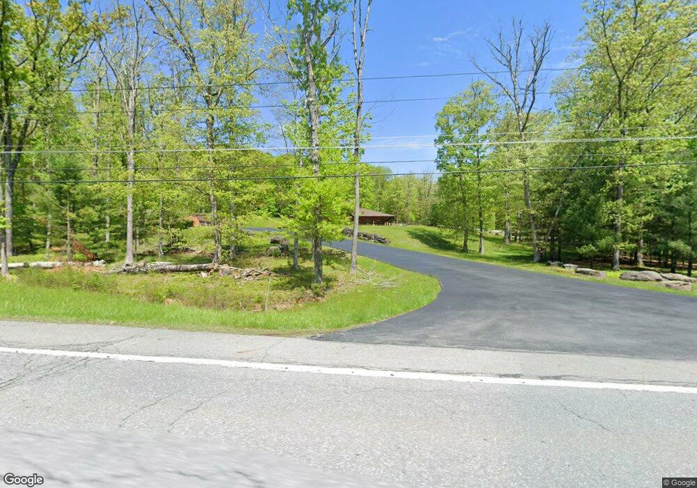
8870 State Route 97 Callicoon, NY 12723
Estimated Value: $190,000
Studio
--
Bath
4,996
Sq Ft
$38/Sq Ft
Est. Value
About This Home
This home is located at 8870 State Route 97, Callicoon, NY 12723 and is currently priced at $190,000, approximately $38 per square foot. 8870 State Route 97 is a home located in Sullivan County with nearby schools including Sullivan West Elementary School, Sullivan West High School at Lake Huntington, and Damascus Christian Academy.
Ownership History
Date
Name
Owned For
Owner Type
Purchase Details
Closed on
May 18, 2022
Sold by
L & B Ice Cream & Caf Llc
Bought by
6193 St Rte 52 Hldgs Llc
Current Estimated Value
Purchase Details
Closed on
Jun 12, 2018
Sold by
Mesler Joel and Aibel Sarah
Bought by
Ridge Properties West Llc
Purchase Details
Closed on
Sep 30, 2009
Sold by
Hollow Properties Llc, Su Ccessor By Merger O
Bought by
Tap Realty Group Llc
Purchase Details
Closed on
Dec 6, 2006
Sold by
Hollow Properties Inc
Bought by
Town Of Delaware
Create a Home Valuation Report for This Property
The Home Valuation Report is an in-depth analysis detailing your home's value as well as a comparison with similar homes in the area
Home Values in the Area
Average Home Value in this Area
Purchase History
| Date | Buyer | Sale Price | Title Company |
|---|---|---|---|
| 6193 St Rte 52 Hldgs Llc | $230,000 | None Available | |
| Ridge Properties West Llc | $300,000 | -- | |
| Tap Realty Group Llc | -- | Victor Emanuelo | |
| Town Of Delaware | -- | Kenneth Klein | |
| Town Of Delaware | -- | Kenneth Klein |
Source: Public Records
Tax History
| Year | Tax Paid | Tax Assessment Tax Assessment Total Assessment is a certain percentage of the fair market value that is determined by local assessors to be the total taxable value of land and additions on the property. | Land | Improvement |
|---|---|---|---|---|
| 2024 | $38,933 | $1,100,400 | $526,000 | $574,400 |
| 2023 | $38,717 | $1,100,400 | $526,000 | $574,400 |
| 2022 | $39,283 | $1,100,400 | $526,000 | $574,400 |
| 2021 | $36,337 | $1,100,400 | $526,000 | $574,400 |
| 2020 | $35,605 | $1,100,400 | $526,000 | $574,400 |
| 2019 | $34,766 | $1,100,400 | $526,000 | $574,400 |
| 2018 | $34,828 | $1,100,400 | $526,000 | $574,400 |
| 2017 | $34,766 | $1,100,400 | $526,000 | $574,400 |
| 2016 | $34,194 | $1,100,400 | $526,000 | $574,400 |
| 2015 | -- | $573,755 | $445,455 | $128,300 |
| 2014 | -- | $573,755 | $445,455 | $128,300 |
Source: Public Records
Map
Nearby Homes
- 18 Naomi Dr
- 839 Conklin Hill Rd
- 4261 State Route 17b
- 2585 River Rd
- 21 Mitchell Ave
- 55 Upper Main St
- 486 County Road 114
- 50 Parsonage Rd
- 221 Gabel Rd
- 632 New Turnpike Rd
- 763 County Road 114
- 9478 State Route 97
- 00 New York 97
- 168 Cr 94
- 356 Gabel Rd
- 1657 River Rd
- 33 Syloro Ln
- 9568 State Route 97
- 897 County Route 164
- 877 County Route 164
- 8869 State Route 97
- 8843 State Route 97
- 24 Country Rd
- 24 Country Rd
- 33 Country Rd
- 82 Serenity Dr
- 46 Old Route 97
- 42 Country Rd
- 26 Mountain Top Ln
- 66 Serenity Dr
- Lot 4 Mountain Top Ln
- 0 Mountain Top Ln Unit H6171507
- 0 Mountain Top Ln Unit H6043632
- 0 Country Ln Unit ONEH6318060
- 0 Country Ln Unit ONEH6304812
- 0 Country Ln Unit ONEH4208105
- 0 Country Ln Unit PWB132657
- 0 Country Ln Unit H4208390
- 0 Country Ln Unit H4207338
- 0 Country Ln Unit H5072504
Your Personal Tour Guide
Ask me questions while you tour the home.
