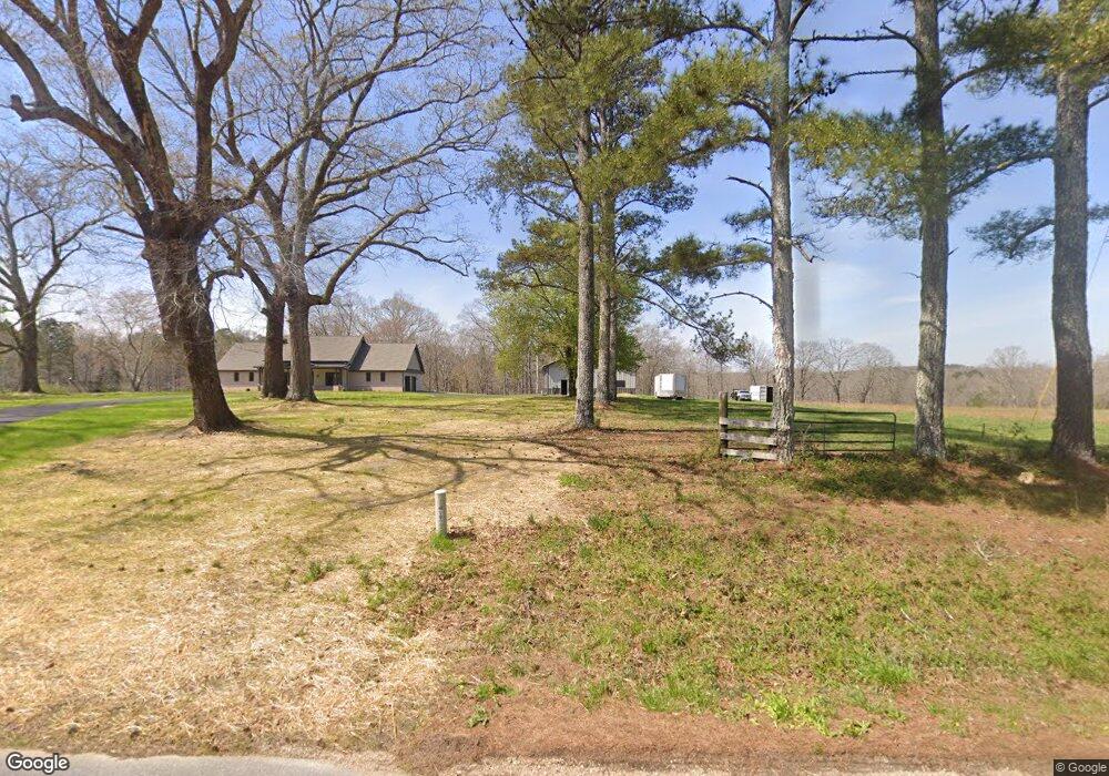
888 Bethlehem Rd Rockmart, GA 30153
Estimated Value: $642,000 - $812,779
3
Beds
2
Baths
2,818
Sq Ft
$258/Sq Ft
Est. Value
About This Home
This home is located at 888 Bethlehem Rd, Rockmart, GA 30153 and is currently estimated at $727,390, approximately $258 per square foot. 888 Bethlehem Rd is a home located in Polk County with nearby schools including Rockmart Middle School.
Ownership History
Date
Name
Owned For
Owner Type
Purchase Details
Closed on
Jul 16, 2021
Sold by
Janis Ralph
Bought by
Rc Sparks Llc
Current Estimated Value
Purchase Details
Closed on
Jun 6, 2016
Sold by
Barber Raymond
Bought by
Janis Ralph and Janis Terrie
Purchase Details
Closed on
Feb 28, 2013
Sold by
Barber Raymond
Bought by
Barber Charles Bradley
Purchase Details
Closed on
Oct 7, 2011
Sold by
Barber Raymond C
Bought by
Zaharogiannis Michael
Purchase Details
Closed on
Oct 5, 2011
Sold by
Barber Raymond C
Bought by
Zaharogiannis Michael
Purchase Details
Closed on
Apr 30, 1984
Bought by
Barber Raymond
Purchase Details
Closed on
Apr 28, 1961
Bought by
Barber Raymond
Create a Home Valuation Report for This Property
The Home Valuation Report is an in-depth analysis detailing your home's value as well as a comparison with similar homes in the area
Purchase History
| Date | Buyer | Sale Price | Title Company |
|---|---|---|---|
| Rc Sparks Llc | $225,000 | -- | |
| Janis Ralph | $100,000 | -- | |
| Barber Charles Bradley | -- | -- | |
| Zaharogiannis Michael | $5,000 | -- | |
| Zaharogiannis Michael | $5,000 | -- | |
| Barber Raymond | -- | -- | |
| Barber Raymond | -- | -- |
Source: Public Records
Tax History
| Year | Tax Paid | Tax Assessment Tax Assessment Total Assessment is a certain percentage of the fair market value that is determined by local assessors to be the total taxable value of land and additions on the property. | Land | Improvement |
|---|---|---|---|---|
| 2025 | $5,613 | $249,468 | $50,614 | $198,854 |
| 2024 | $5,356 | $256,240 | $50,614 | $205,626 |
| 2023 | $1,247 | $52,558 | $50,614 | $1,944 |
| 2022 | $1,092 | $46,025 | $44,081 | $1,944 |
| 2021 | $980 | $54,148 | $44,081 | $10,067 |
| 2020 | $982 | $54,148 | $44,081 | $10,067 |
| 2019 | $1,190 | $57,641 | $44,081 | $13,560 |
| 2018 | $1,210 | $57,241 | $44,081 | $13,160 |
| 2017 | $1,190 | $57,241 | $44,081 | $13,160 |
| 2016 | $628 | $36,569 | $23,410 | $13,160 |
| 2015 | $637 | $36,873 | $23,410 | $13,464 |
| 2014 | $659 | $37,538 | $23,410 | $14,128 |
Source: Public Records
Map
Nearby Homes
- 957 Bethlehem Rd
- 907 Stringer Rd
- 93 Clay Rd
- 0 Bethlehem Rd Unit 7730467
- 0 Bethlehem Rd Unit 10705308
- 3566 Rockmart Hwy
- 600 Grady Rd
- 397 Stringer Rd
- Lot 10 Sunset Loop
- 461 Lakeview Rd
- 0 Everett Mtn Rd
- 341 Sunset Loop
- 65 Wheeler Rd
- 536 Wimberly Hill Rd
- 0 Runyon Loop Unit 10606366
- 0 Runyon Loop Unit 7650113
- 172 Fish Creek Rd
- 2056 Bellview Rd
- 184 Morgan Ln
- 0 Hightower Rd Unit 10584768
- 929 Bethlehem Rd
- 672 Bethlehem Rd
- 11374 Bethlehem Rd
- 980 Bethlehem Rd
- 946 Bethlehem Rd
- 809 Bethlehem Rd
- 714 Bethlehem Rd
- 679 Bethlehem Rd
- 778 Bethlehem Rd
- 431 Knight Rd Unit 5AC
- 431 Knight Rd
- 672 Bethlehem Rd
- 1501 Stringer Rd
- 1491 Stringer Rd
- 1481 Stringer Rd
- 1471 Stringer Rd
- 1461 Stringer Rd
- 1451 Stringer Rd
- 1435 Stringer Rd
- 1046 Bethlehem Rd
Your Personal Tour Guide
Ask me questions while you tour the home.