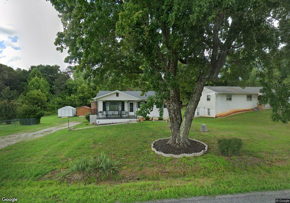
888 Old Mayfield Rd Danville, VA 24541
Estimated Value: $104,000 - $135,644
2
Beds
1
Bath
748
Sq Ft
$155/Sq Ft
Est. Value
About This Home
This home is located at 888 Old Mayfield Rd, Danville, VA 24541 and is currently estimated at $116,161, approximately $155 per square foot. 888 Old Mayfield Rd is a home located in Pittsylvania County with nearby schools including Brosville Elementary School, Tunstall Middle School, and Tunstall High School.
Ownership History
Date
Name
Owned For
Owner Type
Purchase Details
Closed on
Jan 28, 2022
Sold by
Sherman Warner
Bought by
Davis Walter H and Davis Hattie D
Current Estimated Value
Home Financials for this Owner
Home Financials are based on the most recent Mortgage that was taken out on this home.
Original Mortgage
$81,000
Outstanding Balance
$73,171
Interest Rate
3.45%
Mortgage Type
VA
Estimated Equity
$42,990
Purchase Details
Closed on
Apr 22, 2013
Sold by
Lester Caroline M
Bought by
Howard Rosa B
Create a Home Valuation Report for This Property
The Home Valuation Report is an in-depth analysis detailing your home's value as well as a comparison with similar homes in the area
Home Values in the Area
Average Home Value in this Area
Purchase History
| Date | Buyer | Sale Price | Title Company |
|---|---|---|---|
| Davis Walter H | $81,000 | Rosenberg Pllc | |
| Howard Rosa B | $14,000 | -- |
Source: Public Records
Mortgage History
| Date | Status | Borrower | Loan Amount |
|---|---|---|---|
| Open | Davis Walter H | $81,000 |
Source: Public Records
Tax History Compared to Growth
Tax History
| Year | Tax Paid | Tax Assessment Tax Assessment Total Assessment is a certain percentage of the fair market value that is determined by local assessors to be the total taxable value of land and additions on the property. | Land | Improvement |
|---|---|---|---|---|
| 2025 | $449 | $98,200 | $6,500 | $91,700 |
| 2024 | $550 | $98,200 | $6,500 | $91,700 |
| 2023 | $550 | $98,200 | $6,500 | $91,700 |
| 2022 | $455 | $54,000 | $6,500 | $47,500 |
| 2021 | $335 | $54,000 | $6,500 | $47,500 |
| 2020 | $335 | $54,000 | $6,500 | $47,500 |
| 2019 | $335 | $54,000 | $6,500 | $47,500 |
| 2018 | $335 | $54,000 | $6,500 | $47,500 |
| 2017 | $350 | $54,000 | $6,500 | $47,500 |
| 2016 | $350 | $59,300 | $6,500 | $52,800 |
| 2015 | $350 | $59,300 | $6,500 | $52,800 |
| 2011 | -- | $50,200 | $6,500 | $43,700 |
Source: Public Records
Map
Nearby Homes
- 303 Robin Dr
- 00 Winston Rd
- 182 Ireson St
- 24 Holcomb St
- 8 Holcomb St
- 150 Acorn Ln
- 554 Cedarbrook Dr
- 624 Ferry Rd
- 104 Hermitage Dr
- 2797 Old Mayfield Rd
- 2920 Old Mayfield Rd
- 0 Ferry Rd
- 124 Winston Rd
- 0 Winston Rd
- 111 Briarcliff Place
- 00 Wimbish Dr
- 00 Briarcliff Place
- 0 Briarcliff Ln
- 3 Lots Briarcliff Ln
- 356 Hermitage Dr
- 860 Old Mayfield Rd
- 860 Mayfield Rd
- 169 W Prospect St
- 916 Old Mayfield Rd
- 132 W Prospect St
- 928 Old Mayfield Rd
- 891 Old Mayfield Rd
- 152 W Prospect St
- 948 Old Mayfield Rd
- 812 Old Mayfield Rd
- 805 Old Mayfield Rd
- 961 Old Mayfield Rd
- 925 Old Mayfield Rd
- 968 Old Mayfield Rd
- 980 Old Mayfield Rd
- 147 Leslie Ln
- 145 Leslie Ln
- 745 Old Mayfield Rd
- 0 Leslie Ln
- TBD Leslie Ln