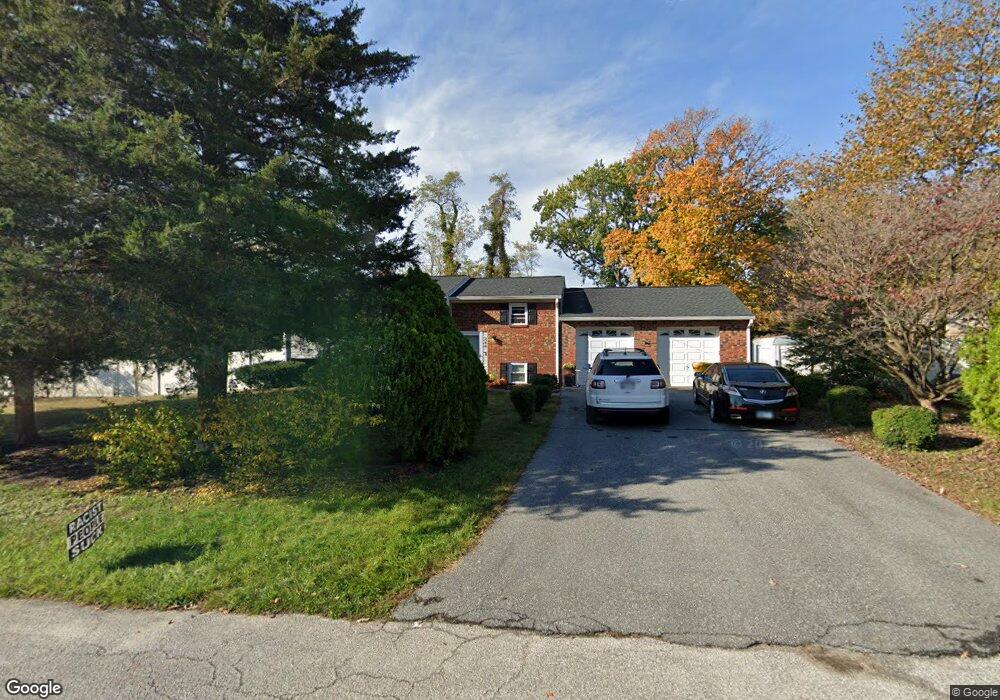
888 Windsong Dr Arnold, MD 21012
Estimated Value: $446,255 - $538,000
Studio
2
Baths
1,008
Sq Ft
$486/Sq Ft
Est. Value
About This Home
This home is located at 888 Windsong Dr, Arnold, MD 21012 and is currently estimated at $490,064, approximately $486 per square foot. 888 Windsong Dr is a home located in Anne Arundel County with nearby schools including Belvedere Elementary School, Severn River Middle School, and Broadneck High School.
Ownership History
Date
Name
Owned For
Owner Type
Purchase Details
Closed on
Jul 19, 2018
Sold by
Lipham Wayne M and Lipham Deborah S
Bought by
Lipham Wayne M and Lipham Deborah S
Current Estimated Value
Purchase Details
Closed on
Nov 9, 2006
Sold by
Lipham William M
Bought by
Lipham Doreen
Purchase Details
Closed on
Aug 30, 2006
Sold by
Lipham William M
Bought by
Lipham Doreen
Purchase Details
Closed on
May 30, 2003
Sold by
Lipham William M
Bought by
Lipham William M and Lipham Doreen
Create a Home Valuation Report for This Property
The Home Valuation Report is an in-depth analysis detailing your home's value as well as a comparison with similar homes in the area
Home Values in the Area
Average Home Value in this Area
Purchase History
| Date | Buyer | Sale Price | Title Company |
|---|---|---|---|
| Lipham Wayne M | -- | None Available | |
| Lipham Wayne M | -- | None Available | |
| Lipham Wayne M | -- | None Available | |
| Lipham Doreen | -- | -- | |
| Lipham Doreen | -- | -- | |
| Lipham William M | -- | -- |
Source: Public Records
Tax History
| Year | Tax Paid | Tax Assessment Tax Assessment Total Assessment is a certain percentage of the fair market value that is determined by local assessors to be the total taxable value of land and additions on the property. | Land | Improvement |
|---|---|---|---|---|
| 2025 | $3,162 | $413,133 | -- | -- |
| 2024 | $3,162 | $395,700 | $248,000 | $147,700 |
| 2023 | $3,063 | $377,300 | $0 | $0 |
| 2022 | $2,855 | $358,900 | $0 | $0 |
| 2020 | $1,882 | $331,600 | $0 | $0 |
| 2019 | $3,158 | $322,700 | $0 | $0 |
| 2018 | $3,182 | $313,800 | $174,700 | $139,100 |
| 2017 | $2,492 | $312,367 | $0 | $0 |
| 2016 | -- | $310,933 | $0 | $0 |
| 2015 | -- | $309,500 | $0 | $0 |
| 2014 | -- | $305,200 | $0 | $0 |
Source: Public Records
Map
Nearby Homes
- 856 Imperial Rd
- 805 Barrett Ave
- 859 Birchwood Ct
- 413 Ridgeview Ct
- 854 Imperial Rd
- 406 Elmwood Ct
- 319 Alameda Pkwy
- 404 Alameda Pkwy
- 114 Howard Ave
- 797 David Dr
- 308 Clifton Ave
- 792 Match Point Dr
- 807 Brechin Garth
- 876 Nancy Lynn Ln
- 243 and 245 Haverton Rd
- 930 Whitstable Blvd
- 889 Lynch Dr
- 1050 Brightleaf Dr
- 836 Mill Creek Rd
- 746 Match Point Dr
- 892 Windsong Dr
- 884 Windsong Dr
- 774 Harmony Ave
- 778 Harmony Ave
- 780 Harmony Ave
- 889 Windsong Dr
- 772 Harmony Ave
- 893 Windsong Dr
- 885 Windsong Dr
- 782 Harmony Ave
- 776 Harmony Ave
- 896 Windsong Dr
- 880 Windsong Dr
- 773 Harmony Ave
- 897 Windsong Dr
- 784 Harmony Ave
- 888 Doris Dr
- 886 Doris Dr
- 890 Doris Dr
- 884 Doris Dr
Your Personal Tour Guide
Ask me questions while you tour the home.