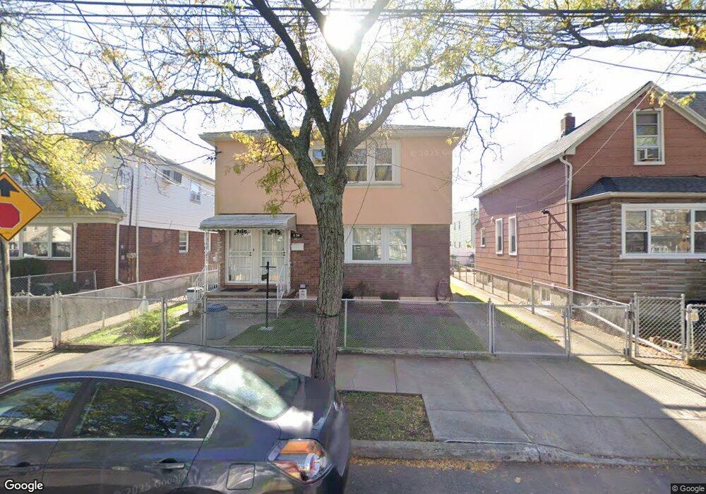
89-34 Desarc Rd Unit 2nd FL Ozone Park, NY 11417
Ozone Park NeighborhoodEstimated Value: $918,000 - $1,097,000
2
Beds
1
Bath
2,132
Sq Ft
$474/Sq Ft
Est. Value
About This Home
This home is located at 89-34 Desarc Rd Unit 2nd FL, Ozone Park, NY 11417 and is currently estimated at $1,010,719, approximately $474 per square foot. 89-34 Desarc Rd Unit 2nd FL is a home located in Queens County with nearby schools including P.S. 63 - Old South, Robert H. Goddard High School, and Divine Mercy Catholic Academy.
Ownership History
Date
Name
Owned For
Owner Type
Purchase Details
Closed on
Jun 19, 1998
Sold by
Mocarski Veronica and Mocarski Chester A
Bought by
Niegowski Stanley
Current Estimated Value
Home Financials for this Owner
Home Financials are based on the most recent Mortgage that was taken out on this home.
Original Mortgage
$150,000
Interest Rate
6.92%
Create a Home Valuation Report for This Property
The Home Valuation Report is an in-depth analysis detailing your home's value as well as a comparison with similar homes in the area
Home Values in the Area
Average Home Value in this Area
Purchase History
| Date | Buyer | Sale Price | Title Company |
|---|---|---|---|
| Niegowski Stanley | $282,000 | First American Title Ins Co |
Source: Public Records
Mortgage History
| Date | Status | Borrower | Loan Amount |
|---|---|---|---|
| Closed | Niegowski Stanley | $150,000 |
Source: Public Records
Tax History
| Year | Tax Paid | Tax Assessment Tax Assessment Total Assessment is a certain percentage of the fair market value that is determined by local assessors to be the total taxable value of land and additions on the property. | Land | Improvement |
|---|---|---|---|---|
| 2025 | $7,337 | $40,205 | $11,487 | $28,718 |
| 2024 | $7,349 | $37,930 | $11,125 | $26,805 |
| 2023 | $7,242 | $37,457 | $11,264 | $26,193 |
| 2022 | $6,880 | $60,240 | $17,880 | $42,360 |
| 2021 | $7,141 | $49,920 | $17,880 | $32,040 |
| 2020 | $6,796 | $52,380 | $17,880 | $34,500 |
| 2019 | $6,319 | $47,400 | $17,880 | $29,520 |
| 2018 | $6,065 | $31,214 | $15,224 | $15,990 |
| 2017 | $5,703 | $29,448 | $12,700 | $16,748 |
| 2016 | $5,577 | $29,448 | $12,700 | $16,748 |
| 2015 | $3,131 | $27,920 | $17,536 | $10,384 |
| 2014 | $3,131 | $26,340 | $19,860 | $6,480 |
Source: Public Records
Map
Nearby Homes
- 8851 Pitkin Ave
- 8839 Pitkin Ave
- 8837 Pitkin Ave
- 136-15 Whitelaw St
- 91-25 Gold Rd
- 8812 Albert Rd
- 13716 88th St
- 13723 Lafayette St
- 13803 Lafayette St
- 84-07 Sutter Ave
- 133-42 86th St
- 133-28 86th St
- 13319 Crossbay Blvd
- 9003 Albert Rd
- 10751 89th St
- 107-62 93rd St
- 107-50 90th St
- 13536 95th St
- 8514 Sutter Ave
- 9439 134th Ave
- 89-34 Desarc Rd Unit 1st FL
- 8934 Desarc Rd
- 8930 Desarc Rd
- 8930 Desarc Rd
- 8938 Desarc Rd
- 8928 Desarc Rd
- 8926 Desarc Rd
- 8926 Desarc Rd
- 8940 Desarc Rd
- 89-40 Desarc Rd
- 8942 Desarc Rd
- 8942 Desarc Rd
- 8944 Desarc Rd
- 8944 Desarc Rd
- 8929 Desarc Rd
- 89-38 Desarc Rd
- 8946 Desarc Rd
- 8922 Desarc Rd
- 8931 Desarc Rd
- 8929 Desarc Rd
Your Personal Tour Guide
Ask me questions while you tour the home.