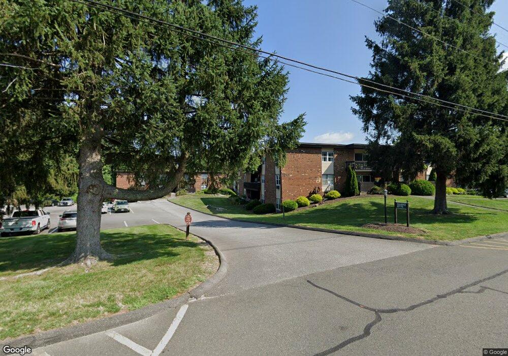
89 Balance Rock Rd Unit 5 Seymour, CT 06483
Estimated Value: $188,765 - $283,000
2
Beds
1
Bath
900
Sq Ft
$242/Sq Ft
Est. Value
About This Home
This home is located at 89 Balance Rock Rd Unit 5, Seymour, CT 06483 and is currently estimated at $217,691, approximately $241 per square foot. 89 Balance Rock Rd Unit 5 is a home located in New Haven County with nearby schools including Bungay Elementary School, Seymour Middle School, and Seymour High School.
Ownership History
Date
Name
Owned For
Owner Type
Purchase Details
Closed on
Jan 15, 2002
Sold by
Plude Ronald H and Plude Michele A
Bought by
Delfino Caroline
Current Estimated Value
Home Financials for this Owner
Home Financials are based on the most recent Mortgage that was taken out on this home.
Original Mortgage
$65,000
Interest Rate
7.04%
Create a Home Valuation Report for This Property
The Home Valuation Report is an in-depth analysis detailing your home's value as well as a comparison with similar homes in the area
Home Values in the Area
Average Home Value in this Area
Purchase History
| Date | Buyer | Sale Price | Title Company |
|---|---|---|---|
| Delfino Caroline | $85,000 | -- |
Source: Public Records
Mortgage History
| Date | Status | Borrower | Loan Amount |
|---|---|---|---|
| Open | Delfino Caroline | $26,600 | |
| Open | Delfino Caroline | $65,000 | |
| Closed | Delfino Caroline | $65,000 |
Source: Public Records
Tax History Compared to Growth
Tax History
| Year | Tax Paid | Tax Assessment Tax Assessment Total Assessment is a certain percentage of the fair market value that is determined by local assessors to be the total taxable value of land and additions on the property. | Land | Improvement |
|---|---|---|---|---|
| 2025 | $3,254 | $117,390 | $0 | $117,390 |
| 2024 | $2,530 | $68,670 | $0 | $68,670 |
| 2023 | $2,471 | $68,670 | $0 | $68,670 |
| 2022 | $2,444 | $68,670 | $0 | $68,670 |
| 2021 | $2,384 | $68,670 | $0 | $68,670 |
| 2020 | $2,195 | $60,970 | $0 | $60,970 |
| 2019 | $2,195 | $60,970 | $0 | $60,970 |
| 2018 | $2,195 | $60,970 | $0 | $60,970 |
| 2017 | $2,195 | $60,970 | $0 | $60,970 |
| 2016 | $2,195 | $60,970 | $0 | $60,970 |
| 2015 | $2,412 | $69,720 | $0 | $69,720 |
| 2014 | -- | $69,720 | $0 | $69,720 |
Source: Public Records
Map
Nearby Homes
- 92 Balance Rock Rd Unit 9
- 26 Balance Rock Rd Unit 16
- 28 Brook St
- 37-14, 49-1, 79-2, 7 Balance Rock Rd
- 4 Brook St
- 202 W Church St
- 36 Bungay Terrace
- 22 Frances Dr
- 11 Oxford Rd
- 4 Nickel Mine Dr
- 4 Mead Farm Rd
- 50 Bissell Place
- 3 Deer Run Dr
- 9 Stanley Dr
- 139 Derby Ave
- 61 Pershing Ave
- 29 George St
- 77 S Main St
- 26-28 S Main St
- 3 Hine St
- 89 Balance Rock Rd Unit 3
- 89 Balance Rock Rd Unit 17
- 89 Balance Rock Rd Unit 6
- 89 Balance Rock Rd Unit 11
- 89 Balance Rock Rd Unit 10
- 89 Balance Rock Rd Unit 9
- 89 Balance Rock Rd Unit 2
- 89 Balance Rock Rd Unit 14
- 89 Balance Rock Rd Unit 15
- 89 Balance Rock Rd Unit 12
- 89 Balance Rock Rd Unit 8
- 89 Balance Rock Rd Unit 7
- 89 Balance Rock Rd Unit 1
- 89 Balance Rock Rd Unit 4
- 89 Balance Rock Rd Unit 16
- 85 Balance Rock Rd Unit 9
- 85 Balance Rock Rd Unit 12
- 85 Balance Rock Rd Unit 5
- 85 Balance Rock Rd Unit 3
- 85 Balance Rock Rd Unit 6