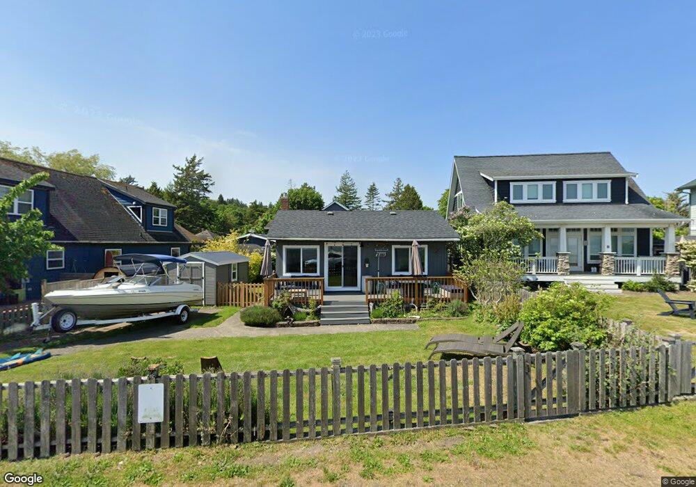
89 Bay View Dr Point Roberts, WA 98281
Estimated Value: $452,000 - $537,000
2
Beds
1
Bath
1,144
Sq Ft
$433/Sq Ft
Est. Value
About This Home
This home is located at 89 Bay View Dr, Point Roberts, WA 98281 and is currently estimated at $494,864, approximately $432 per square foot. 89 Bay View Dr is a home located in Whatcom County with nearby schools including Point Roberts Primary School, Blaine Middle School, and Blaine High School.
Ownership History
Date
Name
Owned For
Owner Type
Purchase Details
Closed on
Jan 21, 2023
Sold by
Eisenhardt John
Bought by
Eisenhardt Merete
Current Estimated Value
Purchase Details
Closed on
Mar 28, 2019
Sold by
Eisenhardt John
Bought by
Eisenhardt John and Eisenhardt Merete
Purchase Details
Closed on
Feb 6, 2001
Sold by
Eisenhardt Margaret Stephanie
Bought by
Eisenhardt John and Eisenhardt Margaret Stephanie
Home Financials for this Owner
Home Financials are based on the most recent Mortgage that was taken out on this home.
Original Mortgage
$45,000
Interest Rate
7.08%
Create a Home Valuation Report for This Property
The Home Valuation Report is an in-depth analysis detailing your home's value as well as a comparison with similar homes in the area
Home Values in the Area
Average Home Value in this Area
Purchase History
| Date | Buyer | Sale Price | Title Company |
|---|---|---|---|
| Eisenhardt Merete | -- | -- | |
| Eisenhardt John | $175,000 | None Available | |
| Eisenhardt John | -- | Whatcom Land Title | |
| Eisenhardt Margaret S | -- | Whatcom Land Title |
Source: Public Records
Mortgage History
| Date | Status | Borrower | Loan Amount |
|---|---|---|---|
| Previous Owner | Eisenhardt John | $45,000 |
Source: Public Records
Tax History Compared to Growth
Tax History
| Year | Tax Paid | Tax Assessment Tax Assessment Total Assessment is a certain percentage of the fair market value that is determined by local assessors to be the total taxable value of land and additions on the property. | Land | Improvement |
|---|---|---|---|---|
| 2024 | $3,902 | $513,713 | $343,283 | $170,430 |
| 2023 | $3,902 | $482,505 | $312,075 | $170,430 |
| 2022 | $3,406 | $440,644 | $285,000 | $155,644 |
| 2021 | $3,392 | $347,412 | $214,016 | $133,396 |
| 2020 | $3,374 | $321,673 | $198,160 | $123,513 |
| 2019 | $3,124 | $308,557 | $190,080 | $118,477 |
| 2018 | $3,046 | $277,390 | $170,880 | $106,510 |
| 2017 | $2,640 | $264,923 | $163,200 | $101,723 |
| 2016 | $2,666 | $259,728 | $160,000 | $99,728 |
| 2015 | $2,836 | $254,956 | $154,576 | $100,380 |
| 2014 | -- | $266,539 | $161,600 | $104,939 |
| 2013 | -- | $255,340 | $155,200 | $100,140 |
Source: Public Records
Map
Nearby Homes
- 2132 Maple St
- 2145 Fir St
- 215 Bay View Dr
- 103 Goodman Rd
- 0 3 73 Acres Derby Ave
- 251 Elizabeth Dr
- 2136 Culp Ct
- 302 Boundary Bay Rd
- Lot 35 Boundary Bay Rd
- 4 Boundary Bay Rd
- 0 X Weasel Run
- 1871 Johnson Rd
- 412 High Bluff Dr
- 1852 Washington Dr
- 0 Lot 7 Weasel Run Rd
- 500 Moose Trail
- Lot 2 Greenwood Dr
- One Acre Uscandia Ln
- 2 Mill Rd
- 308 Mill Rd