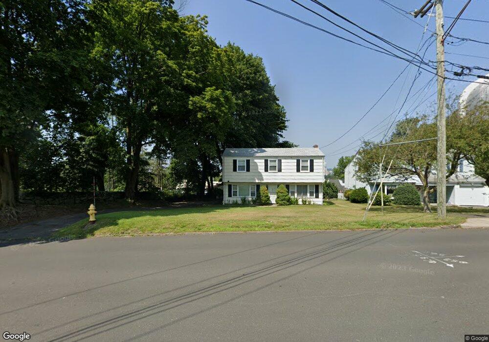
89 Blachley Rd Stamford, CT 06902
East Side Stamford NeighborhoodEstimated Value: $605,000 - $667,000
5
Beds
2
Baths
1,348
Sq Ft
$472/Sq Ft
Est. Value
About This Home
This home is located at 89 Blachley Rd, Stamford, CT 06902 and is currently estimated at $635,836, approximately $471 per square foot. 89 Blachley Rd is a home located in Fairfield County with nearby schools including K. T. Murphy Elementary School, Rippowam Middle School, and Stamford High School.
Ownership History
Date
Name
Owned For
Owner Type
Purchase Details
Closed on
Jun 13, 2014
Sold by
Stamfrod Exit 9 4 Llc
Bought by
Campus Residential 4 L
Current Estimated Value
Purchase Details
Closed on
Sep 17, 1998
Sold by
Jaworski Anthony J and Jaworski Theresa M
Bought by
Clairol Inc
Create a Home Valuation Report for This Property
The Home Valuation Report is an in-depth analysis detailing your home's value as well as a comparison with similar homes in the area
Home Values in the Area
Average Home Value in this Area
Purchase History
| Date | Buyer | Sale Price | Title Company |
|---|---|---|---|
| Campus Residential 4 L | -- | -- | |
| Campus Residential 4 L | -- | -- | |
| Campus Residential 3 L | -- | -- | |
| Campus Residential 2 L | -- | -- | |
| Clairol Inc | $242,000 | -- | |
| Clairol Inc | $242,000 | -- |
Source: Public Records
Tax History Compared to Growth
Tax History
| Year | Tax Paid | Tax Assessment Tax Assessment Total Assessment is a certain percentage of the fair market value that is determined by local assessors to be the total taxable value of land and additions on the property. | Land | Improvement |
|---|---|---|---|---|
| 2025 | $8,068 | $337,290 | $226,510 | $110,780 |
| 2024 | $7,879 | $337,290 | $226,510 | $110,780 |
| 2023 | $8,513 | $337,290 | $226,510 | $110,780 |
| 2022 | $7,206 | $265,230 | $166,920 | $98,310 |
| 2021 | $7,145 | $265,230 | $166,920 | $98,310 |
| 2020 | $6,989 | $265,230 | $166,920 | $98,310 |
| 2019 | $6,989 | $265,230 | $166,920 | $98,310 |
| 2018 | $6,771 | $265,230 | $166,920 | $98,310 |
| 2017 | $5,630 | $209,360 | $102,610 | $106,750 |
| 2016 | $5,468 | $209,360 | $102,610 | $106,750 |
| 2015 | $5,324 | $209,360 | $102,610 | $106,750 |
| 2014 | $5,190 | $209,360 | $102,610 | $106,750 |
Source: Public Records
Map
Nearby Homes
- 375 Sylvan Knoll Rd
- 421 Sylvan Knoll Rd
- 274 Sylvan Knoll Rd
- 162 Sylvan Knoll Rd
- 203 Sylvan Knoll Rd
- 75 Frank St
- 1046 E Main St Unit 4
- 465 Sylvan Knoll Rd
- 175 Seaside Ave Unit 1
- 74 Standish Rd Unit 3
- 26 Courtland Ave Unit 1
- 15 Mathews St
- 77 Palmer Ave
- 30 Revere Dr Unit 3
- 60 Lawn Ave Unit 11
- 60 Lawn Ave Unit 21
- 107 Lockwood Ave Unit 1B
- 80 Lawn Ave Unit 20
- 16 Neponsit St
- 101 Palmer Ave
- 85 Blachley Rd
- 84 Maher Rd
- 80 Maher Rd
- 150 Blachley Rd Unit 150-D
- 150 Blachley Rd Unit 150-C
- 148 Blachley Rd Unit A
- 148 Blachley Rd Unit 148b
- 76 Maher Rd
- 146 Blachley Rd Unit D
- 146 Blachley Rd Unit c
- 144 Blachley Rd Unit A
- 144 Blachley Rd Unit B
- 68 Maher Rd
- 142 Blachley Rd Unit D
- 109 Orange St
- 126 Blachley Rd Unit D
- 126 Blachley Rd Unit c
- 122 Blachley Rd Unit A
- 122 Blachley Rd Unit B
- 140 Blachley Rd Unit D