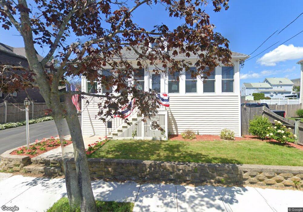
89 Bowdoin St Winthrop, MA 02152
Downtown Winthrop NeighborhoodEstimated Value: $563,000 - $611,000
2
Beds
2
Baths
1,054
Sq Ft
$566/Sq Ft
Est. Value
About This Home
This home is located at 89 Bowdoin St, Winthrop, MA 02152 and is currently estimated at $597,008, approximately $566 per square foot. 89 Bowdoin St is a home located in Suffolk County with nearby schools including William P. Gorman/Fort Banks Elementary School, Arthur T. Cummings Elementary School, and Winthrop Middle School.
Ownership History
Date
Name
Owned For
Owner Type
Purchase Details
Closed on
Jul 15, 1998
Sold by
Smith Hazel M Est
Bought by
Survilas Jason W and Cook Tracy A
Current Estimated Value
Create a Home Valuation Report for This Property
The Home Valuation Report is an in-depth analysis detailing your home's value as well as a comparison with similar homes in the area
Home Values in the Area
Average Home Value in this Area
Purchase History
We collect this data history from publicly available records. To have your information removed, we recommend requesting removal directly through your county’s website.
| Date | Buyer | Sale Price | Title Company |
|---|---|---|---|
| Survilas Jason W | $131,000 | -- |
Source: Public Records
Mortgage History
We collect this data history from publicly available records. To have your information removed, we recommend requesting removal directly through your county’s website.
| Date | Status | Borrower | Loan Amount |
|---|---|---|---|
| Open | Survilas Jason W | $39,000 | |
| Closed | Survilas Jason W | $175,500 |
Source: Public Records
Tax History
| Year | Tax Paid | Tax Assessment Tax Assessment Total Assessment is a certain percentage of the fair market value that is determined by local assessors to be the total taxable value of land and additions on the property. | Land | Improvement |
|---|---|---|---|---|
| 2025 | $5,846 | $566,500 | $350,000 | $216,500 |
| 2024 | $5,714 | $548,400 | $336,300 | $212,100 |
| 2023 | $5,470 | $511,200 | $307,900 | $203,300 |
| 2022 | $5,256 | $446,900 | $274,600 | $172,300 |
| 2021 | $5,333 | $420,600 | $245,200 | $175,400 |
| 2020 | $5,107 | $404,700 | $245,200 | $159,500 |
| 2019 | $5,080 | $385,400 | $225,900 | $159,500 |
| 2018 | $4,987 | $352,200 | $193,900 | $158,300 |
| 2017 | $4,595 | $318,900 | $171,700 | $147,200 |
| 2016 | $4,557 | $296,500 | $149,300 | $147,200 |
| 2015 | $4,139 | $288,600 | $145,000 | $143,600 |
| 2014 | $4,108 | $263,700 | $134,800 | $128,900 |
Source: Public Records
Map
Nearby Homes
- 193 Winthrop St
- 63-69 Putnam St
- 54 Wilshire St
- 26 Shirley St Unit B
- 173 Shirley St Unit 2
- 10 Somerset Ave Unit 304
- 10 Somerset Ave Unit 309
- 10 Somerset Ave Unit 207
- 10 Somerset Ave Unit 406
- 140 Shirley St Unit 230
- 140 Shirley St Unit 210
- 300 Governors Dr Unit 21
- 1000 Governors Dr Unit 4
- 10 Beach Rd Unit 1
- 35 Somerset Ave Unit 3
- 304 Shirley St
- 22 Adams St
- 15 Wave Way
- 142 Pleasant St Unit 12
- 24 Fairview St
- 95 Bowdoin St
- 95 Bowdoin St Unit 3
- 95 Bowdoin St
- 95 Bowdoin St Unit 1
- 85 Bowdoin St
- 19 Oceanview Way
- 101 Bowdoin St
- 101 Bowdoin St Unit 1
- 15 Oceanview Way
- 25 Oceanview Way
- 77 Bowdoin St
- 26 George St
- 82 Bowdoin St Unit 84
- 107 Bowdoin St
- 86 Bowdoin St Unit 88
- 86-88 Bowdoin St
- 71 Bowdoin St
- 88 Bowdoin St Unit 1
- 88 Bowdoin St
- 75 Oceanview St
Your Personal Tour Guide
Ask me questions while you tour the home.