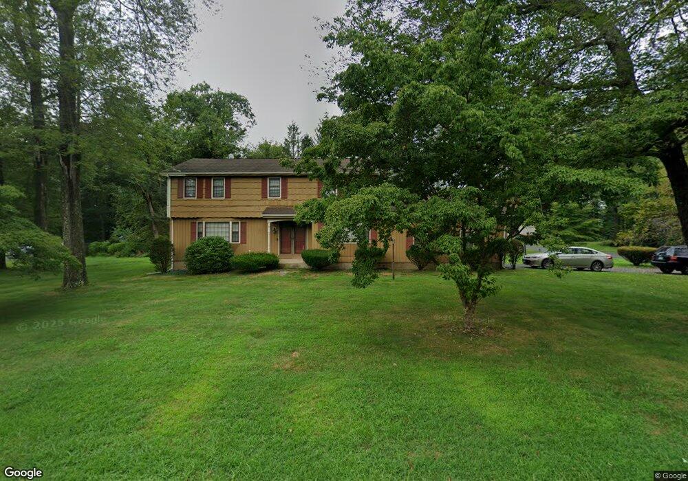
89 Carriage Way Windsor, CT 06095
Hayden NeighborhoodEstimated Value: $469,642 - $511,000
4
Beds
3
Baths
2,152
Sq Ft
$230/Sq Ft
Est. Value
About This Home
This home is located at 89 Carriage Way, Windsor, CT 06095 and is currently estimated at $495,411, approximately $230 per square foot. 89 Carriage Way is a home located in Hartford County with nearby schools including Oliver Ellsworth School, John F. Kennedy School, and Sage Park Middle School.
Ownership History
Date
Name
Owned For
Owner Type
Purchase Details
Closed on
Apr 6, 2004
Sold by
Williams David and Williams Michelle
Bought by
Mcgeorge Grant and Mcgeorge Pamela
Current Estimated Value
Home Financials for this Owner
Home Financials are based on the most recent Mortgage that was taken out on this home.
Original Mortgage
$264,900
Outstanding Balance
$122,848
Interest Rate
5.56%
Mortgage Type
Purchase Money Mortgage
Estimated Equity
$372,563
Purchase Details
Closed on
May 6, 2003
Sold by
Rizzo Michael and Rizzo Dorothy
Bought by
Williams David and Williams Michele
Purchase Details
Closed on
Aug 1, 1997
Sold by
Lareauwe Joseph and Lareau Lucille
Bought by
Rizzo Michael and Rizzo Dorothy
Purchase Details
Closed on
Jul 30, 1987
Sold by
Mahaney Karen
Bought by
Duprey Lucille
Create a Home Valuation Report for This Property
The Home Valuation Report is an in-depth analysis detailing your home's value as well as a comparison with similar homes in the area
Home Values in the Area
Average Home Value in this Area
Purchase History
| Date | Buyer | Sale Price | Title Company |
|---|---|---|---|
| Mcgeorge Grant | $264,900 | -- | |
| Williams David | $260,000 | -- | |
| Rizzo Michael | $165,000 | -- | |
| Duprey Lucille | $218,000 | -- |
Source: Public Records
Mortgage History
| Date | Status | Borrower | Loan Amount |
|---|---|---|---|
| Open | Duprey Lucille | $60,000 | |
| Open | Duprey Lucille | $264,900 |
Source: Public Records
Tax History
| Year | Tax Paid | Tax Assessment Tax Assessment Total Assessment is a certain percentage of the fair market value that is determined by local assessors to be the total taxable value of land and additions on the property. | Land | Improvement |
|---|---|---|---|---|
| 2025 | $7,677 | $269,850 | $72,170 | $197,680 |
| 2024 | $8,182 | $269,850 | $72,170 | $197,680 |
| 2023 | $6,299 | $187,460 | $55,860 | $131,600 |
| 2022 | $6,237 | $187,460 | $55,860 | $131,600 |
| 2021 | $6,237 | $187,460 | $55,860 | $131,600 |
| 2020 | $6,207 | $187,460 | $55,860 | $131,600 |
| 2019 | $6,070 | $187,460 | $55,860 | $131,600 |
| 2018 | $5,893 | $178,780 | $55,860 | $122,920 |
| 2017 | $5,801 | $178,780 | $55,860 | $122,920 |
| 2016 | $5,635 | $178,780 | $55,860 | $122,920 |
| 2015 | $5,528 | $178,780 | $55,860 | $122,920 |
| 2014 | $5,447 | $178,780 | $55,860 | $122,920 |
Source: Public Records
Map
Nearby Homes
- 1333 Palisado Ave
- 24 MacKtown Rd
- 39 Old Kennedy Rd
- 957 Palisado Ave
- 246 Kenswick Ln Unit 246
- 16 Brown Ave
- 9 Brown Ave
- 39 Warham St
- 268 High Path Rd Unit 268
- 294 S Main St Unit LOT 2
- 943 High Path Rd Unit 943
- 44 Maple Ave
- 66 Maple Ave
- 136 High Path Rd
- 98 High Path Rd
- 28 Sycamore St
- 0 Abbe Rd
- 106 Rockybrook
- 30 Parkwood Dr
- 122 S Main St
Your Personal Tour Guide
Ask me questions while you tour the home.