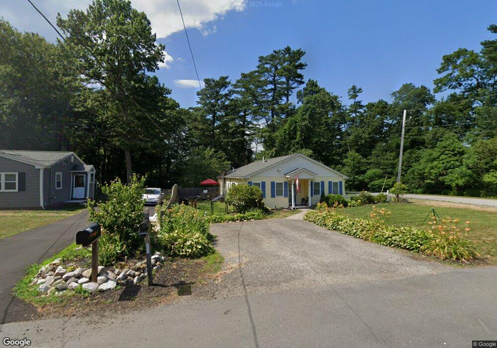
89 Cedar Ln Halifax, MA 02338
Estimated Value: $475,000 - $515,000
2
Beds
1
Bath
835
Sq Ft
$599/Sq Ft
Est. Value
About This Home
This home is located at 89 Cedar Ln, Halifax, MA 02338 and is currently estimated at $499,830, approximately $598 per square foot. 89 Cedar Ln is a home located in Plymouth County with nearby schools including Silver Lake Regional High School, Halifax Elementary School, and Silver Lake Regional Middle School.
Ownership History
Date
Name
Owned For
Owner Type
Purchase Details
Closed on
Nov 20, 2009
Sold by
Kelley Jeffrey R and Kelley Danielle C
Bought by
Coghill Eugene and Coghill Debra
Current Estimated Value
Home Financials for this Owner
Home Financials are based on the most recent Mortgage that was taken out on this home.
Original Mortgage
$208,587
Outstanding Balance
$135,221
Interest Rate
4.86%
Mortgage Type
Purchase Money Mortgage
Estimated Equity
$364,609
Purchase Details
Closed on
Sep 30, 2004
Sold by
Welch Molly S
Bought by
Kelley Jeffrey R and Kelley Danielle C
Purchase Details
Closed on
Jun 24, 2003
Sold by
Naticchioni Daniel L and Naticchioni Tara L
Bought by
Welch Molly S and Lydon Paul P
Purchase Details
Closed on
Oct 27, 2000
Sold by
Manter Judith A
Bought by
Naticchioni Daniel T and Naticchioni Tara L
Create a Home Valuation Report for This Property
The Home Valuation Report is an in-depth analysis detailing your home's value as well as a comparison with similar homes in the area
Home Values in the Area
Average Home Value in this Area
Purchase History
| Date | Buyer | Sale Price | Title Company |
|---|---|---|---|
| Coghill Eugene | $225,000 | -- | |
| Kelley Jeffrey R | $255,000 | -- | |
| Welch Molly S | $226,000 | -- | |
| Naticchioni Daniel T | $110,000 | -- |
Source: Public Records
Mortgage History
| Date | Status | Borrower | Loan Amount |
|---|---|---|---|
| Open | Naticchioni Daniel T | $208,587 | |
| Previous Owner | Naticchioni Daniel T | $52,000 |
Source: Public Records
Tax History
| Year | Tax Paid | Tax Assessment Tax Assessment Total Assessment is a certain percentage of the fair market value that is determined by local assessors to be the total taxable value of land and additions on the property. | Land | Improvement |
|---|---|---|---|---|
| 2025 | $6,196 | $434,200 | $158,500 | $275,700 |
| 2024 | $6,013 | $417,600 | $152,400 | $265,200 |
| 2023 | $5,973 | $401,400 | $147,900 | $253,500 |
| 2022 | $5,746 | $358,900 | $132,100 | $226,800 |
| 2021 | $5,454 | $313,600 | $127,000 | $186,600 |
| 2020 | $5,323 | $305,200 | $139,700 | $165,500 |
| 2019 | $5,206 | $298,000 | $135,700 | $162,300 |
| 2018 | $4,967 | $281,400 | $128,000 | $153,400 |
| 2017 | $4,738 | $255,700 | $128,000 | $127,700 |
| 2016 | $3,694 | $191,900 | $119,700 | $72,200 |
| 2015 | $3,245 | $170,900 | $119,700 | $51,200 |
Source: Public Records
Map
Nearby Homes
- 37 Annawon Dr
- 1 Poplar Rd
- 315 Twin Lakes Dr Unit 315
- 528 Twin Lakes Dr
- 151 Plymouth St Unit 151A
- 343 Monponsett St
- 25 Lawrence Rd
- 4 Upton St
- 3 Natureway Cir
- 265 Monponsett St Unit 2210
- 265 Monponsett St Unit 2203
- 0 Union Park St
- 8 10th Ave
- 20 Forestdale Dr
- 115 Waltham St
- 266 Monponsett St Unit 1103
- 266 Monponsett St Unit 1105
- 266 Monponsett St Unit 1201
- 266 Monponsett St Unit 1208
- 266 Monponsett St Unit 309
Your Personal Tour Guide
Ask me questions while you tour the home.