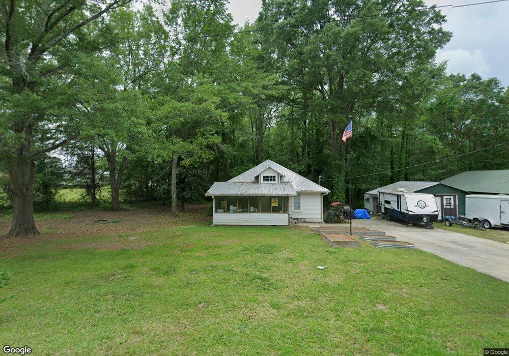
89 Clock Rd Carrollton, GA 30116
Estimated Value: $193,599 - $241,000
2
Beds
1
Bath
1,400
Sq Ft
$159/Sq Ft
Est. Value
About This Home
This home is located at 89 Clock Rd, Carrollton, GA 30116 and is currently estimated at $222,400, approximately $158 per square foot. 89 Clock Rd is a home located in Carroll County with nearby schools including Central Elementary School, Central Middle School, and Central High School.
Ownership History
Date
Name
Owned For
Owner Type
Purchase Details
Closed on
Oct 21, 2013
Sold by
Brumbelow Robin F
Bought by
The Brumbelow Fam Revoc
Current Estimated Value
Purchase Details
Closed on
Oct 16, 2002
Sold by
Brumbelow Robin F
Bought by
Brumbelow Robin F
Purchase Details
Closed on
Jan 9, 2001
Sold by
Fairbanks Capital Co
Bought by
Brumbelow Robin F
Purchase Details
Closed on
Oct 3, 2000
Sold by
Smith Andrew L and Smith Tin
Bought by
Fairbanks Capital Co
Purchase Details
Closed on
Apr 26, 1999
Sold by
Smith Andrew L
Bought by
Smith Andrew L and Smith Tin
Create a Home Valuation Report for This Property
The Home Valuation Report is an in-depth analysis detailing your home's value as well as a comparison with similar homes in the area
Home Values in the Area
Average Home Value in this Area
Purchase History
| Date | Buyer | Sale Price | Title Company |
|---|---|---|---|
| The Brumbelow Fam Revoc | -- | -- | |
| Brumbelow Robin F | -- | -- | |
| Brumbelow Robin F | $42,500 | -- | |
| Fairbanks Capital Co | $34,800 | -- | |
| Smith Andrew L | -- | -- |
Source: Public Records
Tax History Compared to Growth
Tax History
| Year | Tax Paid | Tax Assessment Tax Assessment Total Assessment is a certain percentage of the fair market value that is determined by local assessors to be the total taxable value of land and additions on the property. | Land | Improvement |
|---|---|---|---|---|
| 2024 | $1,180 | $52,157 | $6,391 | $45,766 |
| 2023 | $1,180 | $48,399 | $5,113 | $43,286 |
| 2022 | $958 | $38,204 | $3,409 | $34,795 |
| 2021 | $888 | $34,652 | $2,727 | $31,925 |
| 2020 | $767 | $29,873 | $2,479 | $27,394 |
| 2019 | $745 | $28,795 | $2,479 | $26,316 |
| 2018 | $756 | $28,780 | $2,317 | $26,463 |
| 2017 | $758 | $28,780 | $2,317 | $26,463 |
| 2016 | $645 | $28,780 | $2,317 | $26,463 |
| 2015 | $671 | $24,005 | $2,231 | $21,774 |
| 2014 | $674 | $24,005 | $2,231 | $21,774 |
Source: Public Records
Map
Nearby Homes
- 0 Clem Lowell Rd Unit 10479926
- 0 Clem Lowell Rd Unit 147578
- 0 Clem Lowell Rd Unit 7630669
- 185 White Oak Ct
- 143 Oak Leaf Dr Unit 163
- 143 Oak Leaf Dr
- 2181 2201 Star Point
- 184 Whooping Creek Church Rd
- 2716 Georgia 16
- 2800 Georgia 16
- 2800 Sr 16
- 40 Westbrook Rd
- 197 Westbrook Rd
- 252 Mink Hollow Dr
- 106 Victoria Way
- 106 Victoria Vining
- 391 Foggy Bottom Dr
- 0 Bankhead Hwy and Sassafras Unit 202
- 311 Hidden Lakes Dr
- 158 Foggy Bottom Dr
- 2409 Old Newnan Rd
- 2505 Old Newnan Rd
- 2450 Old Newnan Rd
- 54 Clock Rd
- 2420 Old Newnan Rd
- 14 Gladney Dr
- 20 Gladney Dr
- 2480 Old Newnan Rd
- 40 Gladney Dr
- 2412 S Highway 16
- 60 Gladney Dr
- 113 Stonegate Trail
- 117 Stonegate Trail
- 117 Stonegate Trail Unit TR
- 28 Clock Rd
- 2375 S Highway 16
- 78 Gladney Dr
- 15 Gladney Dr Unit Acres
- 17 Gladney Dr
- 39 Gladney Dr