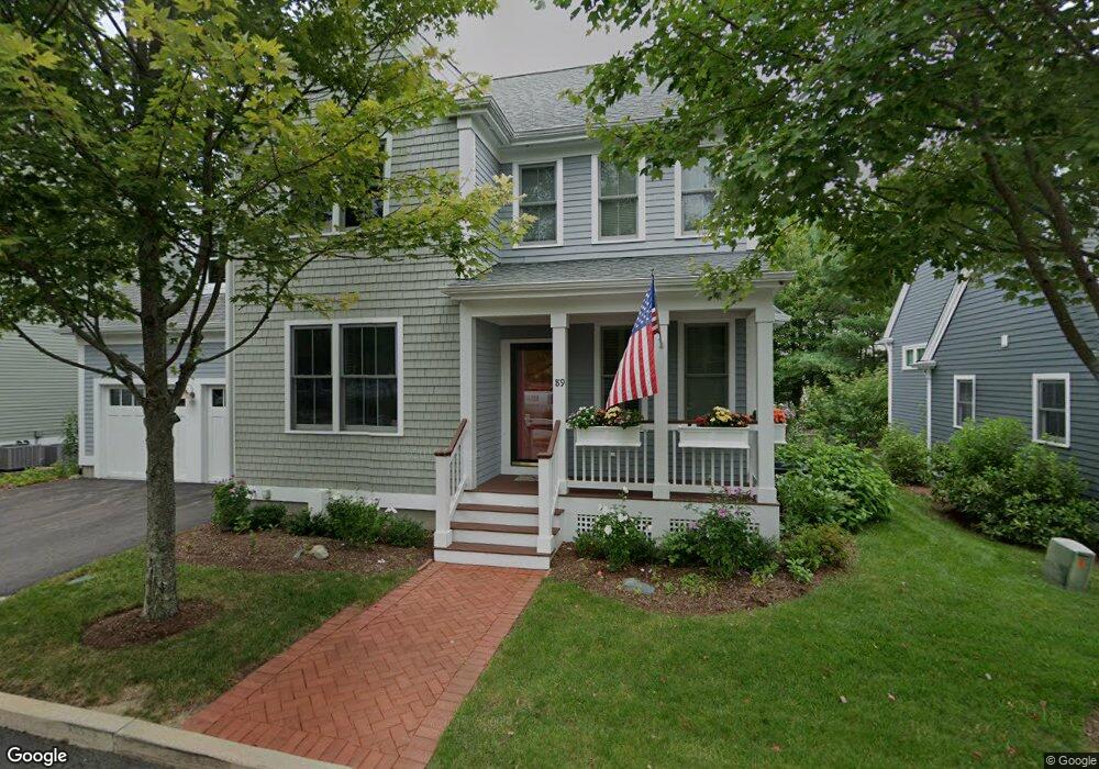
89 Codding Rd Unit 88 Norton, MA 02766
Estimated Value: $847,000 - $995,000
3
Beds
3
Baths
2,556
Sq Ft
$353/Sq Ft
Est. Value
About This Home
This home is located at 89 Codding Rd Unit 88, Norton, MA 02766 and is currently estimated at $902,880, approximately $353 per square foot. 89 Codding Rd Unit 88 is a home located in Bristol County with nearby schools including L.G. Nourse Elementary School, Henri A. Yelle Elementary School, and Norton Middle School.
Ownership History
Date
Name
Owned For
Owner Type
Purchase Details
Closed on
Jul 5, 2011
Sold by
Thorndike Props Of Mas
Bought by
Levitt Mare L and Levitt Judith B
Current Estimated Value
Home Financials for this Owner
Home Financials are based on the most recent Mortgage that was taken out on this home.
Original Mortgage
$440,000
Outstanding Balance
$295,320
Interest Rate
4%
Mortgage Type
Adjustable Rate Mortgage/ARM
Estimated Equity
$607,560
Create a Home Valuation Report for This Property
The Home Valuation Report is an in-depth analysis detailing your home's value as well as a comparison with similar homes in the area
Home Values in the Area
Average Home Value in this Area
Purchase History
| Date | Buyer | Sale Price | Title Company |
|---|---|---|---|
| Levitt Mare L | $611,465 | -- |
Source: Public Records
Mortgage History
| Date | Status | Borrower | Loan Amount |
|---|---|---|---|
| Open | Levitt Mare L | $440,000 |
Source: Public Records
Tax History Compared to Growth
Tax History
| Year | Tax Paid | Tax Assessment Tax Assessment Total Assessment is a certain percentage of the fair market value that is determined by local assessors to be the total taxable value of land and additions on the property. | Land | Improvement |
|---|---|---|---|---|
| 2025 | $94 | $726,200 | $0 | $726,200 |
| 2024 | $9,565 | $738,600 | $0 | $738,600 |
| 2023 | $8,668 | $667,300 | $0 | $667,300 |
| 2022 | $8,787 | $616,200 | $0 | $616,200 |
| 2021 | $8,753 | $586,300 | $0 | $586,300 |
| 2020 | $8,599 | $581,000 | $0 | $581,000 |
| 2019 | $8,639 | $579,800 | $0 | $579,800 |
| 2018 | $8,494 | $560,300 | $0 | $560,300 |
| 2017 | $8,211 | $534,200 | $0 | $534,200 |
| 2016 | $8,181 | $524,100 | $0 | $524,100 |
| 2015 | $8,554 | $555,800 | $0 | $555,800 |
| 2014 | $8,384 | $545,500 | $0 | $545,500 |
Source: Public Records
Map
Nearby Homes
- 48 Codding Rd Unit 48
- 31 Owen Rd
- 6 Horton Dr
- 14 Downing Dr
- 195 E Main St
- 1 Carlton Dr
- O Leonard St
- 0 Knollwood & 0 Rear Kensington
- 12 Kayak Trail
- 0 S Washington St Unit 73437419
- 0 Kensington Rd
- 15 S Washington St
- 8 Johnson Dr
- 38 S Washington St
- 139 Burt St Unit 6
- 145 Burt St Unit 1
- 9 Shagbark Rd
- 23 Indian Rd
- 12 Sylvan Rd
- 10 Ridge Rd