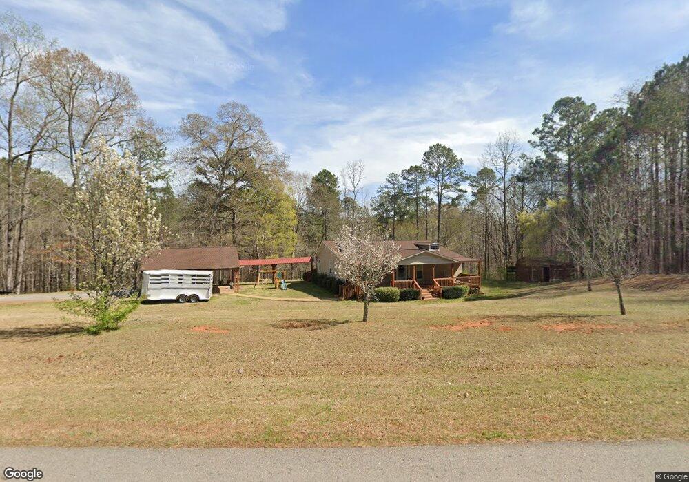
89 Deer Pointe Rd Lagrange, GA 30240
Estimated Value: $273,574 - $304,000
3
Beds
2
Baths
1,880
Sq Ft
$156/Sq Ft
Est. Value
About This Home
This home is located at 89 Deer Pointe Rd, Lagrange, GA 30240 and is currently estimated at $293,394, approximately $156 per square foot. 89 Deer Pointe Rd is a home located in Troup County with nearby schools including Ethel W. Kight Elementary School, Hollis Hand Elementary School, and Franklin Forest Elementary School.
Ownership History
Date
Name
Owned For
Owner Type
Purchase Details
Closed on
Sep 15, 2020
Sold by
Barantine Katie
Bought by
Snyder Caitlyn and Snyder Roger
Current Estimated Value
Home Financials for this Owner
Home Financials are based on the most recent Mortgage that was taken out on this home.
Original Mortgage
$186,951
Outstanding Balance
$164,772
Interest Rate
2.9%
Mortgage Type
FHA
Estimated Equity
$128,622
Purchase Details
Closed on
Mar 21, 2001
Sold by
Caney Creek
Bought by
Shook Cory G
Purchase Details
Closed on
Nov 7, 2000
Bought by
Caney Creek
Create a Home Valuation Report for This Property
The Home Valuation Report is an in-depth analysis detailing your home's value as well as a comparison with similar homes in the area
Purchase History
| Date | Buyer | Sale Price | Title Company |
|---|---|---|---|
| Snyder Caitlyn | $190,400 | -- | |
| Shook Cory G | $39,600 | -- | |
| Caney Creek | -- | -- |
Source: Public Records
Mortgage History
| Date | Status | Borrower | Loan Amount |
|---|---|---|---|
| Open | Snyder Caitlyn | $186,951 |
Source: Public Records
Tax History
| Year | Tax Paid | Tax Assessment Tax Assessment Total Assessment is a certain percentage of the fair market value that is determined by local assessors to be the total taxable value of land and additions on the property. | Land | Improvement |
|---|---|---|---|---|
| 2025 | $2,689 | $98,580 | $20,000 | $78,580 |
| 2024 | $2,223 | $81,500 | $20,000 | $61,500 |
| 2023 | $2,217 | $81,300 | $20,000 | $61,300 |
| 2022 | $2,165 | $77,580 | $20,000 | $57,580 |
| 2021 | $2,069 | $68,600 | $14,000 | $54,600 |
| 2020 | $1,664 | $57,160 | $14,000 | $43,160 |
| 2019 | $1,449 | $50,040 | $9,000 | $41,040 |
| 2018 | $1,337 | $46,320 | $9,000 | $37,320 |
| 2017 | $1,337 | $46,320 | $9,000 | $37,320 |
| 2016 | $1,090 | $38,111 | $9,000 | $29,111 |
| 2015 | $1,092 | $38,111 | $9,000 | $29,111 |
| 2014 | $1,047 | $36,579 | $9,000 | $27,579 |
| 2013 | -- | $38,422 | $9,000 | $29,422 |
Source: Public Records
Map
Nearby Homes
- 42 Deer Pointe Ct
- 153 N Whatley Rd
- 15 Williams Ct
- 163 Terri Rd
- 0 Leisure Cove Dr Unit 10619411
- 511 Williams Rd
- 524 Williams Rd
- 205 Long Cove Dr
- 108 Stonebridge Ln
- 3414 Rock Mills Rd
- 1100 County Road 442
- 780 Sharman Rd
- TRACT 3 AND 4 Sheppard Rd
- 4377 Rock Mills Rd
- 0 County Road 278 Unit 22289211
- 0 County Road 278 Unit 23477602
- 0 County Road 278 Unit 173507
- 0 County Road 278 Unit 174838
- 226 Linda Ln
- 104 Dogwood Point
- 90 Deer Pointe Rd
- 200 Deer Pointe Rd
- 177 Deer Pointe Rd
- 263 Deer Pointe Rd
- 212 Deer Pointe Rd
- 350 Deer Pointe Rd
- 0 Deer Pointe Rd Unit 4&5 7331956
- 0 Deer Pointe Rd Unit 1013000025 8232007
- 0 Deer Pointe Rd Unit 8354874
- 0 Deer Pointe Rd Unit 8427817
- 0 Deer Pointe Rd Unit 8837110
- 496 Deer Pointe Rd
- 518 Deer Pointe Rd
- 450 Deer Pointe Rd
- 0 Deer Pointe Rd Unit 8686892
- 14 Deer Pointe Rd
- 370 Deer Pointe Rd
- 285 Deer Pointe Rd
- 381 Deer Pointe Rd
- 12 Deer Pointe Run
Your Personal Tour Guide
Ask me questions while you tour the home.