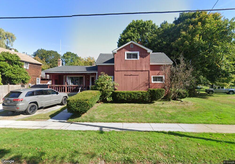
89 Depot St Cheshire, MA 01225
Estimated Value: $232,025 - $291,000
4
Beds
1
Bath
1,496
Sq Ft
$176/Sq Ft
Est. Value
About This Home
This home is located at 89 Depot St, Cheshire, MA 01225 and is currently estimated at $264,006, approximately $176 per square foot. 89 Depot St is a home located in Berkshire County with nearby schools including Hoosac Valley Middle & High School.
Ownership History
Date
Name
Owned For
Owner Type
Purchase Details
Closed on
Jun 28, 1996
Sold by
Gregoire Donald P and Gregoire Loretta A
Bought by
Wojcik James R and Wojcik Tracey A
Current Estimated Value
Home Financials for this Owner
Home Financials are based on the most recent Mortgage that was taken out on this home.
Original Mortgage
$82,618
Outstanding Balance
$5,872
Interest Rate
8.05%
Mortgage Type
Purchase Money Mortgage
Estimated Equity
$258,134
Create a Home Valuation Report for This Property
The Home Valuation Report is an in-depth analysis detailing your home's value as well as a comparison with similar homes in the area
Home Values in the Area
Average Home Value in this Area
Purchase History
| Date | Buyer | Sale Price | Title Company |
|---|---|---|---|
| Wojcik James R | $82,700 | -- | |
| Wojcik James R | $82,700 | -- |
Source: Public Records
Mortgage History
| Date | Status | Borrower | Loan Amount |
|---|---|---|---|
| Open | Wojcik James R | $82,618 | |
| Closed | Wojcik James R | $82,618 | |
| Previous Owner | Wojcik James R | $65,000 | |
| Previous Owner | Wojcik James R | $15,000 |
Source: Public Records
Tax History Compared to Growth
Tax History
| Year | Tax Paid | Tax Assessment Tax Assessment Total Assessment is a certain percentage of the fair market value that is determined by local assessors to be the total taxable value of land and additions on the property. | Land | Improvement |
|---|---|---|---|---|
| 2025 | $2,107 | $189,300 | $56,200 | $133,100 |
| 2024 | $2,079 | $179,700 | $53,700 | $126,000 |
| 2023 | $2,030 | $169,600 | $57,000 | $112,600 |
| 2022 | $1,913 | $149,900 | $59,900 | $90,000 |
| 2021 | $0 | $142,800 | $57,000 | $85,800 |
| 2020 | $1,985 | $147,700 | $57,000 | $90,700 |
| 2019 | $0 | $140,500 | $52,900 | $87,600 |
| 2018 | $1,726 | $136,300 | $52,900 | $83,400 |
| 2017 | $1,689 | $136,300 | $52,900 | $83,400 |
| 2016 | $1,671 | $136,300 | $52,900 | $83,400 |
| 2015 | $1,620 | $135,700 | $47,100 | $88,600 |
Source: Public Records
Map
Nearby Homes
- 136 Church St Unit 142
- 53 Depot St
- 108 Church St
- 57 Church St
- 12 South St
- 18 W Mountain Rd
- 16 2nd Ave
- 29 4th Ave
- 40 Curran Rd
- 83 Devonshire Dr
- 136 Ingalls Rd
- 573 Stafford Hill Rd
- 20 Pleasant View Dr
- 52 Alger St
- 668 N Main St
- 21 Overlook Terrace
- 9 Pinnacle Point
- 558 N Main St
- 14 Glassworks Rd
- 66 Scott Rd