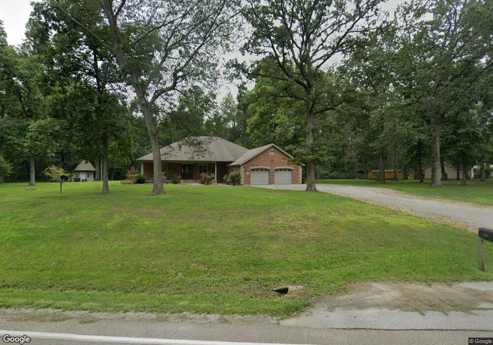
89 Jamestown Rd Pocahontas, IL 62275
Estimated Value: $406,000 - $674,000
4
Beds
3
Baths
2,500
Sq Ft
$202/Sq Ft
Est. Value
About This Home
This home is located at 89 Jamestown Rd, Pocahontas, IL 62275 and is currently estimated at $505,487, approximately $202 per square foot. 89 Jamestown Rd is a home located in Bond County with nearby schools including Breese ESD #12, Beckemeyer Elementary School, and Central Community High School.
Ownership History
Date
Name
Owned For
Owner Type
Purchase Details
Closed on
Jun 9, 2017
Sold by
Busch Michelle D and Busch Todd A
Bought by
Parr Natalie
Current Estimated Value
Purchase Details
Closed on
Oct 23, 2009
Sold by
Schult Jimmy J and Schult Cynthia L
Bought by
Busch Todd A and Busch Michelle D
Home Financials for this Owner
Home Financials are based on the most recent Mortgage that was taken out on this home.
Original Mortgage
$135,000
Interest Rate
5.11%
Mortgage Type
Unknown
Create a Home Valuation Report for This Property
The Home Valuation Report is an in-depth analysis detailing your home's value as well as a comparison with similar homes in the area
Home Values in the Area
Average Home Value in this Area
Purchase History
| Date | Buyer | Sale Price | Title Company |
|---|---|---|---|
| Parr Natalie | $287,500 | None Available | |
| Busch Todd A | $197,500 | -- |
Source: Public Records
Mortgage History
| Date | Status | Borrower | Loan Amount |
|---|---|---|---|
| Previous Owner | Busch Todd A | $135,000 |
Source: Public Records
Tax History Compared to Growth
Tax History
| Year | Tax Paid | Tax Assessment Tax Assessment Total Assessment is a certain percentage of the fair market value that is determined by local assessors to be the total taxable value of land and additions on the property. | Land | Improvement |
|---|---|---|---|---|
| 2023 | $6,348 | $100,606 | $7,405 | $93,201 |
| 2022 | $6,095 | $95,100 | $7,000 | $88,100 |
| 2021 | $4,904 | $65,326 | $5,250 | $60,076 |
| 2020 | $5,032 | $65,326 | $5,250 | $60,076 |
| 2019 | $5,059 | $65,326 | $5,250 | $60,076 |
| 2018 | $5,094 | $65,326 | $5,250 | $60,076 |
| 2016 | $5,014 | $65,788 | $5,250 | $60,538 |
| 2015 | $384 | $68,183 | $5,250 | $62,933 |
| 2013 | $374 | $55,898 | $2,891 | $53,007 |
| 2011 | $3,468 | $55,898 | $2,891 | $53,007 |
Source: Public Records
Map
Nearby Homes
- 000 Hug Cemetery Rd
- 4 Hill Valley Dr
- 22809 Saint Rose Rd
- 112 Blaine St
- 204 E Kavanaugh St
- 371 Frey Meadows Rd
- 0 W State St
- 0 W State Street Lot 3 Unit MAR24014942
- 0 W State Street Lot 2 Unit MAR24014905
- 0 W State Street Lot 1 Unit MAR24014842
- 39 W State St
- 38 W State St
- 35 W State St
- 34 W State St
- 33 W State St
- 32 W State St
- 29 W State St
- 37 W State St
- 36 W State St
- 26 W State St
- 93 Jamestown Rd
- 97 Jamestown Rd
- 98 Jamestown Rd
- 102 Jamestown Rd
- 104 Jamestown Rd
- 110 Jamestown Rd
- 103 Jamestown Rd
- 84 Cherry Lane Rd
- 116 Jamestown Rd
- 88 Cherry Lane Rd
- 29 Jamestown Rd
- 30 Zorn Rd
- 21 Jamestown Rd
- 97 Cherry Lane Rd
- 119 Jamestown Rd
- 19 Jamestown Rd
- 52 Jamestown Rd
- 13 Jamestown Rd
- 3 Westfall Rd
- 46 Zorn Rd