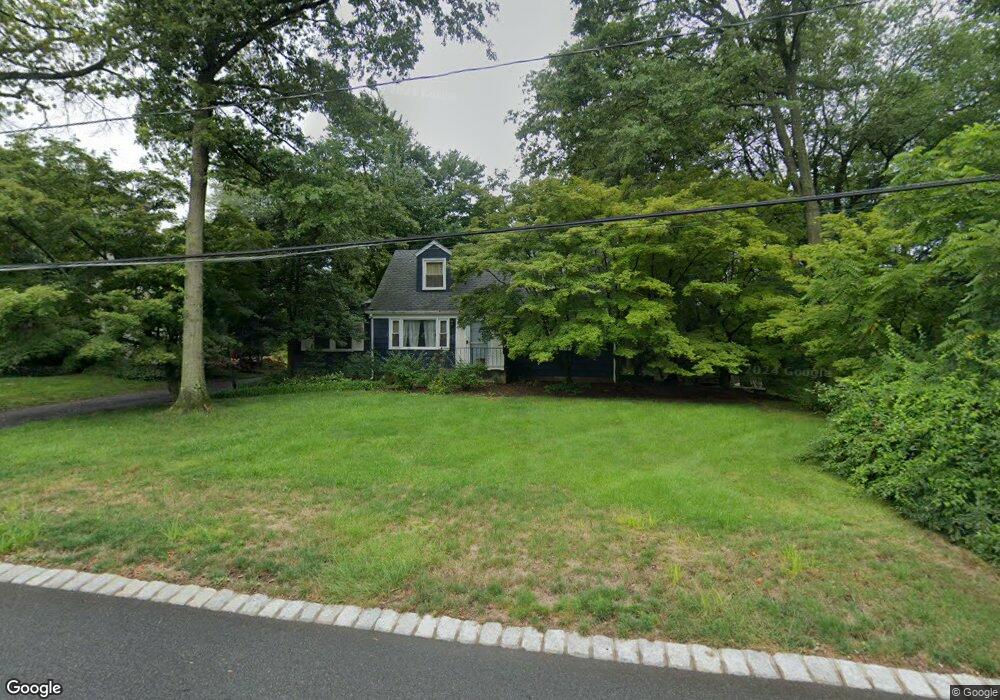
89 Liberty Rd Bernardsville, NJ 07924
Estimated Value: $497,000 - $818,000
--
Bed
--
Bath
1,369
Sq Ft
$454/Sq Ft
Est. Value
About This Home
This home is located at 89 Liberty Rd, Bernardsville, NJ 07924 and is currently estimated at $622,172, approximately $454 per square foot. 89 Liberty Rd is a home located in Somerset County with nearby schools including Bernardsville Middle School, Bernards High School, and Saint James School.
Ownership History
Date
Name
Owned For
Owner Type
Purchase Details
Closed on
Oct 23, 2015
Sold by
Grassi Robert and Grassi Ann
Bought by
Bernando Nan
Current Estimated Value
Purchase Details
Closed on
Oct 31, 2007
Sold by
Cangiano Salvatore J
Bought by
Township Of Bernards
Purchase Details
Closed on
Dec 29, 1998
Sold by
Loft Andrew
Bought by
Congiano Salvatore
Purchase Details
Closed on
Jun 6, 1989
Sold by
Floystad Edwin A
Bought by
Grassi Robert and Grassi Ann
Purchase Details
Closed on
Dec 24, 1988
Sold by
Floystad Edwin A and Floystad Edna V
Bought by
Floystad Edwin A and Floystad Edna
Create a Home Valuation Report for This Property
The Home Valuation Report is an in-depth analysis detailing your home's value as well as a comparison with similar homes in the area
Home Values in the Area
Average Home Value in this Area
Purchase History
| Date | Buyer | Sale Price | Title Company |
|---|---|---|---|
| Bernando Nan | $187,500 | Attorney | |
| Township Of Bernards | $7,116,000 | New Jersey Title Ins Co | |
| Congiano Salvatore | $1,225,000 | -- | |
| Grassi Robert | $100 | -- | |
| Floystad Edwin A | $100 | -- |
Source: Public Records
Tax History Compared to Growth
Tax History
| Year | Tax Paid | Tax Assessment Tax Assessment Total Assessment is a certain percentage of the fair market value that is determined by local assessors to be the total taxable value of land and additions on the property. | Land | Improvement |
|---|---|---|---|---|
| 2025 | $8,389 | $464,300 | $245,600 | $218,700 |
| 2024 | $8,389 | $429,100 | $225,400 | $203,700 |
| 2023 | $8,195 | $407,900 | $214,700 | $193,200 |
| 2022 | $8,094 | $393,700 | $206,400 | $187,300 |
| 2021 | $7,981 | $380,400 | $202,300 | $178,100 |
| 2020 | $7,840 | $372,600 | $202,300 | $170,300 |
| 2019 | $7,473 | $366,700 | $192,300 | $174,400 |
| 2018 | $7,082 | $355,700 | $181,800 | $173,900 |
| 2017 | $6,787 | $352,200 | $171,800 | $180,400 |
| 2016 | $6,596 | $351,600 | $171,800 | $179,800 |
| 2015 | $6,233 | $339,300 | $161,800 | $177,500 |
| 2014 | $6,102 | $333,600 | $161,800 | $171,800 |
Source: Public Records
Map
Nearby Homes
- 16 Dayton Crescent
- 117 W Oak St
- 20 Anderson Hill Rd
- 26 Anderson Hill Rd
- 80 Claremont Rd Unit 802
- 80 Claremont Rd Unit 206
- 22 Dayton St
- 15 Highview Ave
- 41 Anderson Hill Rd
- 209 Lake Rd
- 10 Tysley St
- 101 Rippling Brook Way
- 22 Orchard Hill Rd
- 58 Seney Dr
- 71 Mount Harmony Rd
- 92 Whitenack Rd
- 135 Woods End Dr
- 453 Mine Brook Rd
- 23 Charlotte Hill Dr
- 19 Juniper Way