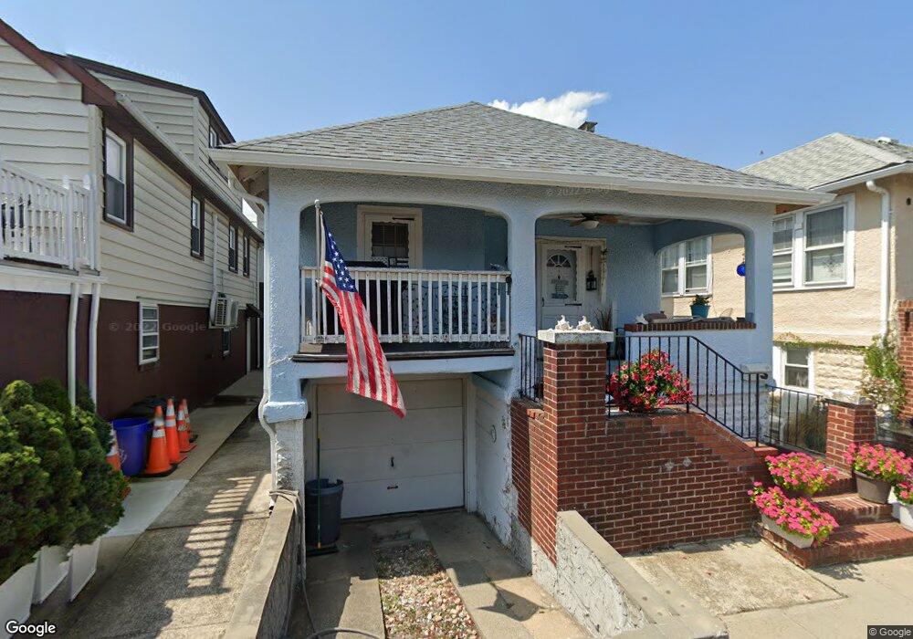
89 Louisiana St Long Beach, NY 11561
Estimated Value: $673,000 - $774,440
3
Beds
1
Bath
900
Sq Ft
$804/Sq Ft
Est. Value
About This Home
This home is located at 89 Louisiana St, Long Beach, NY 11561 and is currently estimated at $723,720, approximately $804 per square foot. 89 Louisiana St is a home located in Nassau County with nearby schools including Lido Elementary School, West Elementary School, and Lindell Elementary School.
Ownership History
Date
Name
Owned For
Owner Type
Purchase Details
Closed on
Oct 30, 2013
Sold by
Marino Dean
Bought by
Cerese Michael
Current Estimated Value
Home Financials for this Owner
Home Financials are based on the most recent Mortgage that was taken out on this home.
Original Mortgage
$269,600
Outstanding Balance
$201,134
Interest Rate
4.24%
Estimated Equity
$522,586
Purchase Details
Closed on
Sep 11, 2000
Sold by
Mager Harry J and Mager Loretta
Bought by
Marino Dean
Create a Home Valuation Report for This Property
The Home Valuation Report is an in-depth analysis detailing your home's value as well as a comparison with similar homes in the area
Home Values in the Area
Average Home Value in this Area
Purchase History
| Date | Buyer | Sale Price | Title Company |
|---|---|---|---|
| Cerese Michael | -- | -- | |
| Marino Dean | $185,000 | Marc Golden |
Source: Public Records
Mortgage History
| Date | Status | Borrower | Loan Amount |
|---|---|---|---|
| Open | Cerese Michael | $269,600 |
Source: Public Records
Tax History Compared to Growth
Tax History
| Year | Tax Paid | Tax Assessment Tax Assessment Total Assessment is a certain percentage of the fair market value that is determined by local assessors to be the total taxable value of land and additions on the property. | Land | Improvement |
|---|---|---|---|---|
| 2025 | $7,113 | $494 | $224 | $270 |
| 2024 | $912 | $494 | $224 | $270 |
| 2023 | $7,166 | $494 | $224 | $270 |
| 2022 | $7,166 | $494 | $224 | $270 |
| 2021 | $13,179 | $474 | $215 | $259 |
| 2020 | $9,755 | $793 | $489 | $304 |
| 2019 | $7,443 | $793 | $489 | $304 |
| 2018 | $7,048 | $793 | $0 | $0 |
| 2017 | $5,277 | $793 | $489 | $304 |
| 2016 | $979 | $760 | $489 | $271 |
| 2015 | $933 | $760 | $489 | $271 |
| 2014 | $933 | $760 | $489 | $271 |
| 2013 | $847 | $722 | $464 | $258 |
Source: Public Records
Map
Nearby Homes
- 84 Georgia Ave
- 1007 W Park Ave
- 71 Michigan St
- 67 Michigan St
- 991 W Park Ave
- 77 Florida St
- 68 Michigan St
- 64 Michigan St
- 103 Connecticut Ave
- 77 New Hampshire St
- 80 Illinois Ave
- 82 Tennessee Ave
- 105 Vermont St
- 64 Tennessee Ave
- 29 Indiana Ave
- 91 Virginia Ave
- 68 Brookline Ave
- 66 Virginia Ave
- 74 Wisconsin St
- 62 Wisconsin St
- 91 Louisiana St
- 87 Louisiana St
- 90 Indiana Ave
- 93 Louisiana St Unit Main
- 88 Indiana Ave
- 92 Indiana Ave
- 83 Louisiana St
- 86 Indiana Ave
- 86 Indiana Ave Unit House
- 94 Indiana Ave
- 95 Louisiana St
- 96 Indiana Ave
- 84 Indiana Ave
- 81 Louisiana St
- 97 Louisiana St
- 97 Louisiana St Unit Lower
- 97 Louisiana St Unit Upper
- 98 Indiana Ave Unit Main
- 98 Indiana Ave Unit Upper
- 82 Indiana Ave