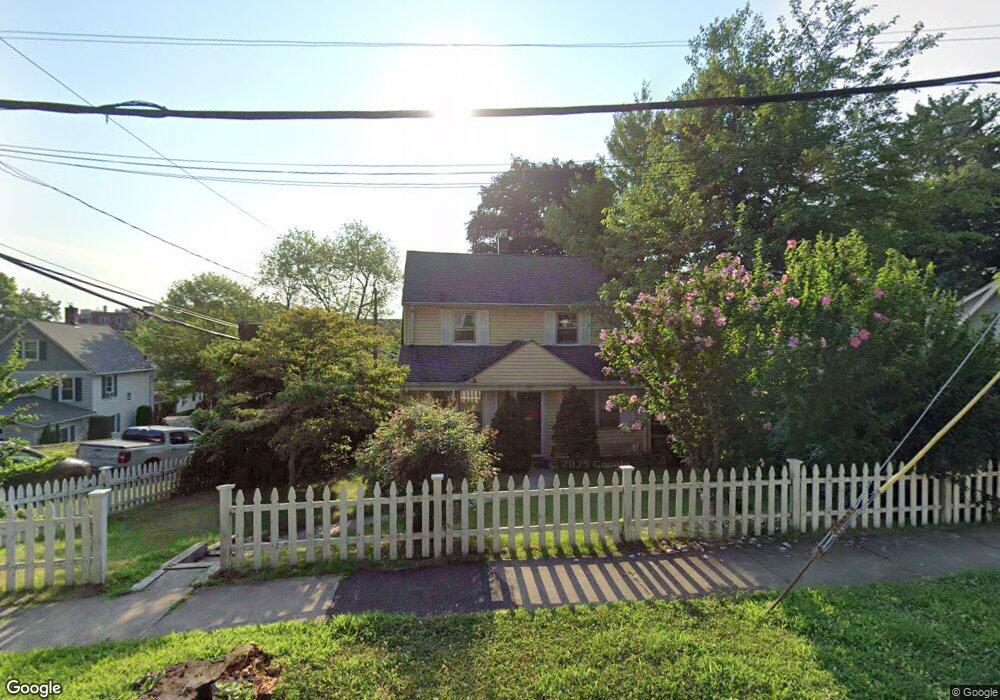
89 Palmer St Stamford, CT 06907
Springdale NeighborhoodEstimated Value: $665,000 - $764,000
3
Beds
2
Baths
1,584
Sq Ft
$453/Sq Ft
Est. Value
About This Home
This home is located at 89 Palmer St, Stamford, CT 06907 and is currently estimated at $718,049, approximately $453 per square foot. 89 Palmer St is a home located in Fairfield County with nearby schools including Springdale Elementary School, Dolan School, and Stamford High School.
Ownership History
Date
Name
Owned For
Owner Type
Purchase Details
Closed on
Jun 28, 2002
Sold by
Carter Ronald C and Carter Karen H
Bought by
Nobay Rommel
Current Estimated Value
Purchase Details
Closed on
Aug 5, 1998
Sold by
Sanislow James R and Sanislow Laura M
Bought by
Carter Ronald C and Carter Karen A
Purchase Details
Closed on
Mar 30, 1995
Sold by
Macgregor Keith D and Macgregor Lynne L
Bought by
Sanislow James R and Sanislow Laura M
Purchase Details
Closed on
Dec 1, 1989
Sold by
Frey William
Bought by
Macgregor Keith
Create a Home Valuation Report for This Property
The Home Valuation Report is an in-depth analysis detailing your home's value as well as a comparison with similar homes in the area
Home Values in the Area
Average Home Value in this Area
Purchase History
| Date | Buyer | Sale Price | Title Company |
|---|---|---|---|
| Nobay Rommel | $401,457 | -- | |
| Nobay Rommel | $401,457 | -- | |
| Carter Ronald C | $265,000 | -- | |
| Carter Ronald C | $265,000 | -- | |
| Sanislow James R | $228,000 | -- | |
| Sanislow James R | $228,000 | -- | |
| Macgregor Keith | $187,500 | -- |
Source: Public Records
Mortgage History
| Date | Status | Borrower | Loan Amount |
|---|---|---|---|
| Open | Macgregor Keith | $274,250 | |
| Closed | Macgregor Keith | $358,200 |
Source: Public Records
Tax History Compared to Growth
Tax History
| Year | Tax Paid | Tax Assessment Tax Assessment Total Assessment is a certain percentage of the fair market value that is determined by local assessors to be the total taxable value of land and additions on the property. | Land | Improvement |
|---|---|---|---|---|
| 2025 | $8,414 | $355,640 | $220,670 | $134,970 |
| 2024 | $8,230 | $355,640 | $220,670 | $134,970 |
| 2023 | $8,841 | $355,640 | $220,670 | $134,970 |
| 2022 | $7,473 | $279,470 | $166,020 | $113,450 |
| 2021 | $7,392 | $279,470 | $166,020 | $113,450 |
| 2020 | $7,202 | $279,470 | $166,020 | $113,450 |
| 2019 | $7,202 | $279,470 | $166,020 | $113,450 |
| 2018 | $6,936 | $279,470 | $166,020 | $113,450 |
| 2017 | $6,794 | $261,310 | $153,750 | $107,560 |
| 2016 | $6,603 | $261,310 | $153,750 | $107,560 |
| 2015 | $6,431 | $261,310 | $153,750 | $107,560 |
| 2014 | $6,217 | $261,310 | $153,750 | $107,560 |
Source: Public Records
Map
Nearby Homes
- 970 Hope St Unit 4J
- 44 Brundage St
- 83 Mulberry St
- 910 Hope St Unit 5B
- 900 Hope St Unit 8C
- 1148 Hope St
- 1157 Hope St
- 16 Columbus Place
- 23 Oenoke Place
- 17 Oenoke Place
- 825 Hope St Unit 4
- 393 Upper Haig Ave
- 95 Columbus Place Unit 6
- 31 Chatfield St
- 31 Gray Farms Rd
- 78 Elizabeth Ave
- 11 Old Oak Rd
- 19 Woodway Rd Unit 14
- 32 Kensett Ln Unit 32
- 72 Kensett Ln