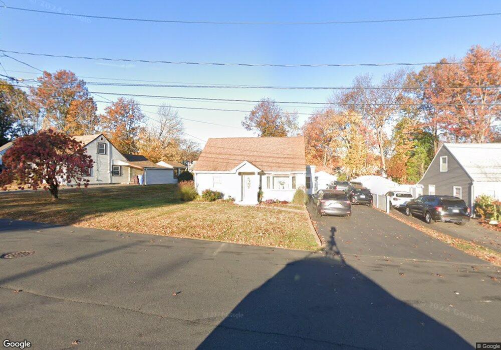
89 Ruth Rd New Britain, CT 06053
Estimated Value: $192,000 - $314,000
4
Beds
1
Bath
1,500
Sq Ft
$186/Sq Ft
Est. Value
About This Home
This home is located at 89 Ruth Rd, New Britain, CT 06053 and is currently estimated at $279,108, approximately $186 per square foot. 89 Ruth Rd is a home located in Hartford County with nearby schools including Jefferson School, Pulaski Middle School, and St. Francis of Assisi Middle School.
Ownership History
Date
Name
Owned For
Owner Type
Purchase Details
Closed on
Jun 7, 2002
Sold by
Soto Lydia and Ramos Nilda
Bought by
Baylor Yvonne M
Current Estimated Value
Purchase Details
Closed on
Jun 1, 1998
Sold by
Kart Janet and Routhier Ronald
Bought by
Soto Lydia and Ramos Nilda
Purchase Details
Closed on
Feb 14, 1994
Sold by
Johnson Bernadette Est
Bought by
Gallupe David
Create a Home Valuation Report for This Property
The Home Valuation Report is an in-depth analysis detailing your home's value as well as a comparison with similar homes in the area
Home Values in the Area
Average Home Value in this Area
Purchase History
| Date | Buyer | Sale Price | Title Company |
|---|---|---|---|
| Baylor Yvonne M | $94,750 | -- | |
| Soto Lydia | $66,900 | -- | |
| Gallupe David | $77,500 | -- |
Source: Public Records
Mortgage History
| Date | Status | Borrower | Loan Amount |
|---|---|---|---|
| Open | Gallupe David | $94,000 | |
| Closed | Gallupe David | $15,000 | |
| Closed | Gallupe David | $82,800 |
Source: Public Records
Tax History
| Year | Tax Paid | Tax Assessment Tax Assessment Total Assessment is a certain percentage of the fair market value that is determined by local assessors to be the total taxable value of land and additions on the property. | Land | Improvement |
|---|---|---|---|---|
| 2025 | $5,828 | $148,750 | $42,910 | $105,840 |
| 2024 | $5,889 | $148,750 | $42,910 | $105,840 |
| 2023 | $5,694 | $148,750 | $42,910 | $105,840 |
| 2022 | $4,969 | $100,380 | $18,060 | $82,320 |
| 2021 | $4,969 | $100,380 | $18,060 | $82,320 |
| 2020 | $5,069 | $100,380 | $18,060 | $82,320 |
| 2019 | $5,069 | $100,380 | $18,060 | $82,320 |
| 2018 | $5,069 | $100,380 | $18,060 | $82,320 |
| 2017 | $4,751 | $94,080 | $18,060 | $76,020 |
| 2016 | $4,751 | $94,080 | $18,060 | $76,020 |
| 2015 | $4,610 | $94,080 | $18,060 | $76,020 |
| 2014 | $4,610 | $94,080 | $18,060 | $76,020 |
Source: Public Records
Map
Nearby Homes
- 2453 Corbin Ave
- 678 Farmington Ave
- 24 Pentlow Ave
- 153 Horseplain Rd
- 432 Mcclintock St
- 234 Pierremount Ave
- 57 Merigold Dr
- 45 Tunxis St
- 822 Slater Rd
- 51 Kenyon Cir
- 172 Batterson Dr
- 55 Allen St
- 154 Allen St
- 1114 Fienemann Rd
- 182 Francis St
- 527 Burritt St
- 45 Atlantic St Unit C
- 1634 Stanley St
- 497 Commonwealth Ave
- 50 Curtin Ave
Your Personal Tour Guide
Ask me questions while you tour the home.