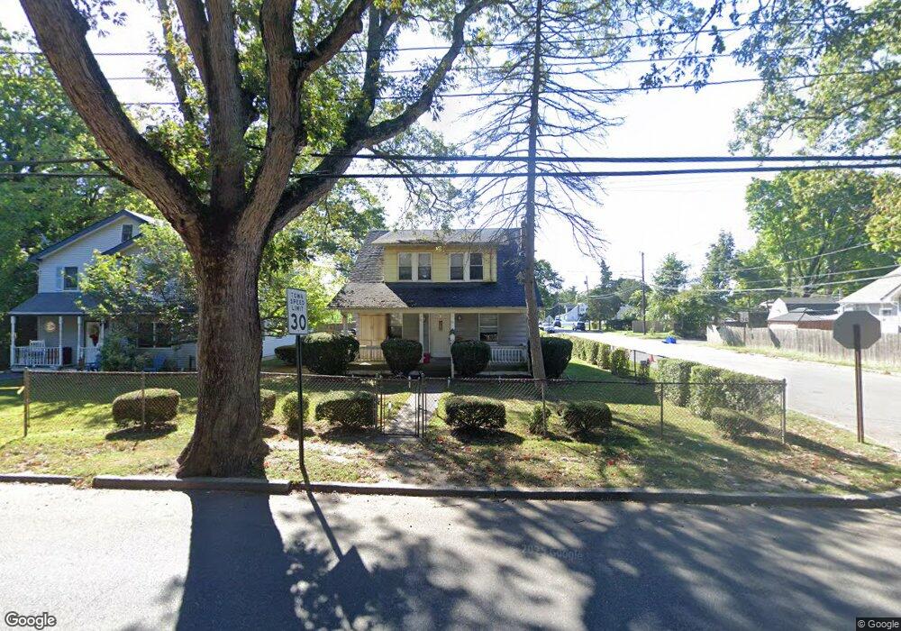
89 W 11th St Huntington Station, NY 11746
Estimated Value: $474,000 - $655,000
--
Bed
--
Bath
--
Sq Ft
5,227
Sq Ft Lot
About This Home
This home is located at 89 W 11th St, Huntington Station, NY 11746 and is currently estimated at $589,907. 89 W 11th St is a home located in Suffolk County with nearby schools including Silas Wood Sixth Grade Center, Henry L Stimson Middle School, and Walt Whitman High School.
Ownership History
Date
Name
Owned For
Owner Type
Purchase Details
Closed on
Apr 22, 2004
Sold by
Aguido Lise Jennings and Jennings Lise
Bought by
Jennings Lise
Current Estimated Value
Home Financials for this Owner
Home Financials are based on the most recent Mortgage that was taken out on this home.
Original Mortgage
$190,000
Interest Rate
6.37%
Mortgage Type
New Conventional
Purchase Details
Closed on
Jan 26, 2001
Sold by
Agudio Lise Jennings and Jennings Eugene
Bought by
Agudio Lise Jennings
Create a Home Valuation Report for This Property
The Home Valuation Report is an in-depth analysis detailing your home's value as well as a comparison with similar homes in the area
Home Values in the Area
Average Home Value in this Area
Purchase History
| Date | Buyer | Sale Price | Title Company |
|---|---|---|---|
| Jennings Lise | -- | First American Title Ins Co | |
| Agudio Lise Jennings | -- | Fidelity National Title Ins |
Source: Public Records
Mortgage History
| Date | Status | Borrower | Loan Amount |
|---|---|---|---|
| Closed | Jennings Lise | $190,000 |
Source: Public Records
Tax History Compared to Growth
Tax History
| Year | Tax Paid | Tax Assessment Tax Assessment Total Assessment is a certain percentage of the fair market value that is determined by local assessors to be the total taxable value of land and additions on the property. | Land | Improvement |
|---|---|---|---|---|
| 2024 | $7,564 | $1,975 | $225 | $1,750 |
| 2023 | $3,782 | $1,975 | $225 | $1,750 |
| 2022 | $7,335 | $1,975 | $225 | $1,750 |
| 2021 | $7,183 | $1,975 | $225 | $1,750 |
| 2020 | $6,984 | $1,975 | $225 | $1,750 |
| 2019 | $13,967 | $0 | $0 | $0 |
| 2018 | $6,490 | $1,975 | $225 | $1,750 |
| 2017 | $6,490 | $1,975 | $225 | $1,750 |
| 2016 | $6,377 | $1,975 | $225 | $1,750 |
| 2015 | -- | $1,975 | $225 | $1,750 |
| 2014 | -- | $1,975 | $225 | $1,750 |
Source: Public Records
Map
Nearby Homes