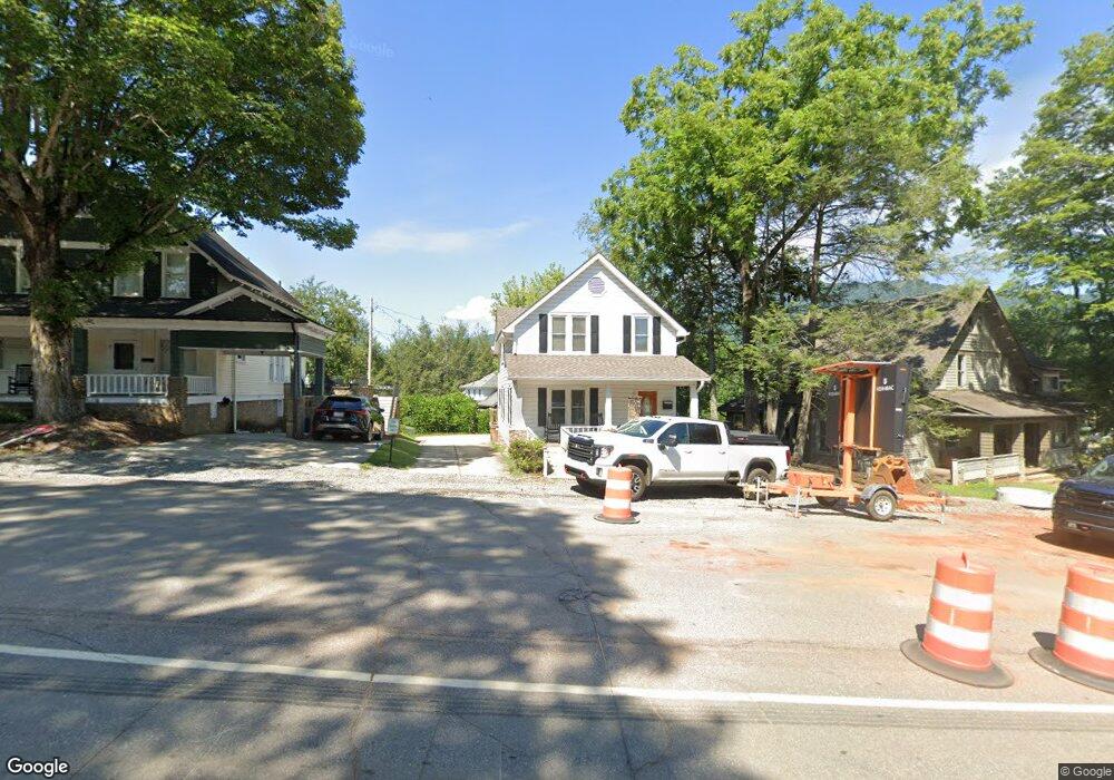
89 Walnut St Waynesville, NC 28786
Estimated Value: $430,736 - $727,000
--
Bed
--
Bath
1,184
Sq Ft
$467/Sq Ft
Est. Value
About This Home
This home is located at 89 Walnut St, Waynesville, NC 28786 and is currently estimated at $552,434, approximately $466 per square foot. 89 Walnut St is a home located in Haywood County with nearby schools including Hazelwood Elementary, Waynesville Middle, and Tuscola High.
Ownership History
Date
Name
Owned For
Owner Type
Purchase Details
Closed on
Mar 28, 2014
Sold by
Roknich Nick and Roknich Julie B
Bought by
48 Properties Llc
Current Estimated Value
Home Financials for this Owner
Home Financials are based on the most recent Mortgage that was taken out on this home.
Original Mortgage
$100,000
Interest Rate
4.3%
Mortgage Type
Purchase Money Mortgage
Purchase Details
Closed on
Feb 7, 2014
Sold by
Duke Terrell W and Duke Michelle J
Bought by
71 Woodhaven Ridge Llc
Home Financials for this Owner
Home Financials are based on the most recent Mortgage that was taken out on this home.
Original Mortgage
$100,000
Interest Rate
4.3%
Mortgage Type
Purchase Money Mortgage
Purchase Details
Closed on
Jun 20, 2007
Sold by
Fraser Judith C
Bought by
Roknich Nick and Rknich Julie B
Home Financials for this Owner
Home Financials are based on the most recent Mortgage that was taken out on this home.
Original Mortgage
$312,000
Interest Rate
6.1%
Mortgage Type
Purchase Money Mortgage
Create a Home Valuation Report for This Property
The Home Valuation Report is an in-depth analysis detailing your home's value as well as a comparison with similar homes in the area
Home Values in the Area
Average Home Value in this Area
Purchase History
| Date | Buyer | Sale Price | Title Company |
|---|---|---|---|
| 48 Properties Llc | $295,000 | None Available | |
| 71 Woodhaven Ridge Llc | $1,300 | None Available | |
| Roknich Nick | $390,000 | None Available |
Source: Public Records
Mortgage History
| Date | Status | Borrower | Loan Amount |
|---|---|---|---|
| Closed | 48 Properties Llc | $100,000 | |
| Previous Owner | Roknich Nick | $312,000 |
Source: Public Records
Tax History Compared to Growth
Tax History
| Year | Tax Paid | Tax Assessment Tax Assessment Total Assessment is a certain percentage of the fair market value that is determined by local assessors to be the total taxable value of land and additions on the property. | Land | Improvement |
|---|---|---|---|---|
| 2025 | -- | $299,300 | $64,800 | $234,500 |
| 2024 | $1,646 | $299,300 | $64,800 | $234,500 |
| 2023 | $1,646 | $299,300 | $64,800 | $234,500 |
| 2022 | $1,601 | $299,300 | $64,800 | $234,500 |
| 2021 | $1,601 | $299,300 | $64,800 | $234,500 |
| 2020 | $1,743 | $298,000 | $36,000 | $262,000 |
| 2019 | $1,743 | $298,000 | $36,000 | $262,000 |
| 2018 | $1,743 | $298,000 | $36,000 | $262,000 |
| 2017 | $1,728 | $295,300 | $0 | $0 |
| 2016 | $1,699 | $300,200 | $0 | $0 |
| 2015 | $1,699 | $300,200 | $0 | $0 |
| 2014 | $1,625 | $300,200 | $0 | $0 |
Source: Public Records
Map
Nearby Homes
- 145 Shackford St
- 9999 Hazel St
- 118 Maple St
- 352 Welch St
- 34 Leap Frog Park
- 35 Leap Frog Park
- 11 Leap Frog Park
- 21 Leap Frog Park
- 45 Leap Frog Park
- 20 Leap Frog Park
- 25 Leap Frog Park
- 115 Woolsey Heights
- 252 Rogers St
- 123 W Marshall St
- 129 Woolsey Heights
- 169 East St
- 85 E Marshall St
- 220 Love Ln
- 31 Paralee Ln
- 15 Belleview Rd
- 99 Walnut St
- 73 Walnut St
- 37 Branner Ave
- 53 Walnut St
- 90 Walnut St
- 0000 Hwy 276n (Dellwood Rd)
- 000 Hwy 276 (Dellwood Rd)
- 66 Walnut St
- 321 Boundary St
- 327 Boundary St
- 52 Walnut St
- 344 Boundary St
- 68 Branner Ave
- 305 N Main St
- 28 Walnut St
- 337 Boundary St
- 134 Walnut St
- 82 & 84 Branner Ave
- 82 Branner Ave
- LOT 16 Walnut Ridge Unit 16
