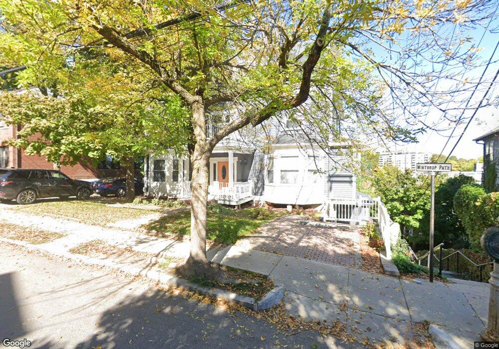
89 Winthrop Rd Unit 2 Brookline, MA 02445
Washington Square NeighborhoodEstimated Value: $1,623,000 - $1,918,866
4
Beds
4
Baths
2,613
Sq Ft
$681/Sq Ft
Est. Value
About This Home
This home is located at 89 Winthrop Rd Unit 2, Brookline, MA 02445 and is currently estimated at $1,778,967, approximately $680 per square foot. 89 Winthrop Rd Unit 2 is a home located in Norfolk County with nearby schools including Pierce School, Brookline High School, and Torah Academy.
Ownership History
Date
Name
Owned For
Owner Type
Purchase Details
Closed on
Mar 7, 2002
Sold by
Greenberg Linda S
Bought by
Siciliano Donna A
Current Estimated Value
Home Financials for this Owner
Home Financials are based on the most recent Mortgage that was taken out on this home.
Original Mortgage
$639,200
Outstanding Balance
$266,071
Interest Rate
7.01%
Mortgage Type
Purchase Money Mortgage
Estimated Equity
$1,512,896
Create a Home Valuation Report for This Property
The Home Valuation Report is an in-depth analysis detailing your home's value as well as a comparison with similar homes in the area
Home Values in the Area
Average Home Value in this Area
Purchase History
| Date | Buyer | Sale Price | Title Company |
|---|---|---|---|
| Siciliano Donna A | $799,000 | -- |
Source: Public Records
Mortgage History
| Date | Status | Borrower | Loan Amount |
|---|---|---|---|
| Open | Siciliano Donna A | $639,200 |
Source: Public Records
Tax History
| Year | Tax Paid | Tax Assessment Tax Assessment Total Assessment is a certain percentage of the fair market value that is determined by local assessors to be the total taxable value of land and additions on the property. | Land | Improvement |
|---|---|---|---|---|
| 2025 | $16,896 | $1,711,900 | $0 | $1,711,900 |
| 2024 | $16,397 | $1,678,300 | $0 | $1,678,300 |
| 2023 | $15,990 | $1,603,800 | $0 | $1,603,800 |
| 2022 | $15,867 | $1,557,100 | $0 | $1,557,100 |
| 2021 | $15,110 | $1,541,800 | $0 | $1,541,800 |
| 2020 | $14,425 | $1,526,500 | $0 | $1,526,500 |
| 2019 | $13,622 | $1,453,800 | $0 | $1,453,800 |
| 2018 | $13,098 | $1,384,600 | $0 | $1,384,600 |
| 2017 | $12,666 | $1,282,000 | $0 | $1,282,000 |
| 2016 | $12,145 | $1,165,500 | $0 | $1,165,500 |
| 2015 | $11,315 | $1,059,500 | $0 | $1,059,500 |
| 2014 | $11,254 | $988,100 | $0 | $988,100 |
Source: Public Records
Map
Nearby Homes
- 84 Winthrop Rd Unit 1
- 84 Winthrop Rd
- 15 Colbourne Crescent Unit 2
- 89 University Rd
- 90 Addington Rd Unit 1
- 90 Addington Rd Unit 2
- 57 University Rd Unit 3
- 4 Fairbanks St Unit 2
- 20 Claflin Rd Unit A
- 195 Winthrop Rd Unit 1
- 1618 Beacon St Unit 1
- 1620 Beacon St
- 315 Tappan St Unit 4
- 19 Westbourne Terrace Unit 2
- 33 Westbourne Terrace Unit 4
- 1490 Beacon St Unit 4
- 30 York Terrace
- 24 Blake Rd
- 71 Greenough St Unit 71-1
- 140 Sumner Rd Unit 1
- 89 Winthrop Rd Unit 3
- 89 Winthrop Rd Unit 1
- 89 Winthrop Rd
- 79 Winthrop Rd
- 79 Winthrop Rd
- 79 Winthrop Rd Unit 3
- 79 Winthrop Rd Unit 1
- 79 Winthrop Rd Unit 2
- 103 University Rd
- 103 University Rd Unit 1
- 101-103 University Rd Unit 2 (or both)
- 101-103 University Rd
- 91 Winthrop Rd
- 91 Winthrop Rd Unit 1
- 97 University Rd
- 107 University Rd Unit 3
- 107 University Rd Unit 2
- 107 University Rd Unit 1
- 101 University Rd
- 92 Winthrop Rd Unit 1
Your Personal Tour Guide
Ask me questions while you tour the home.