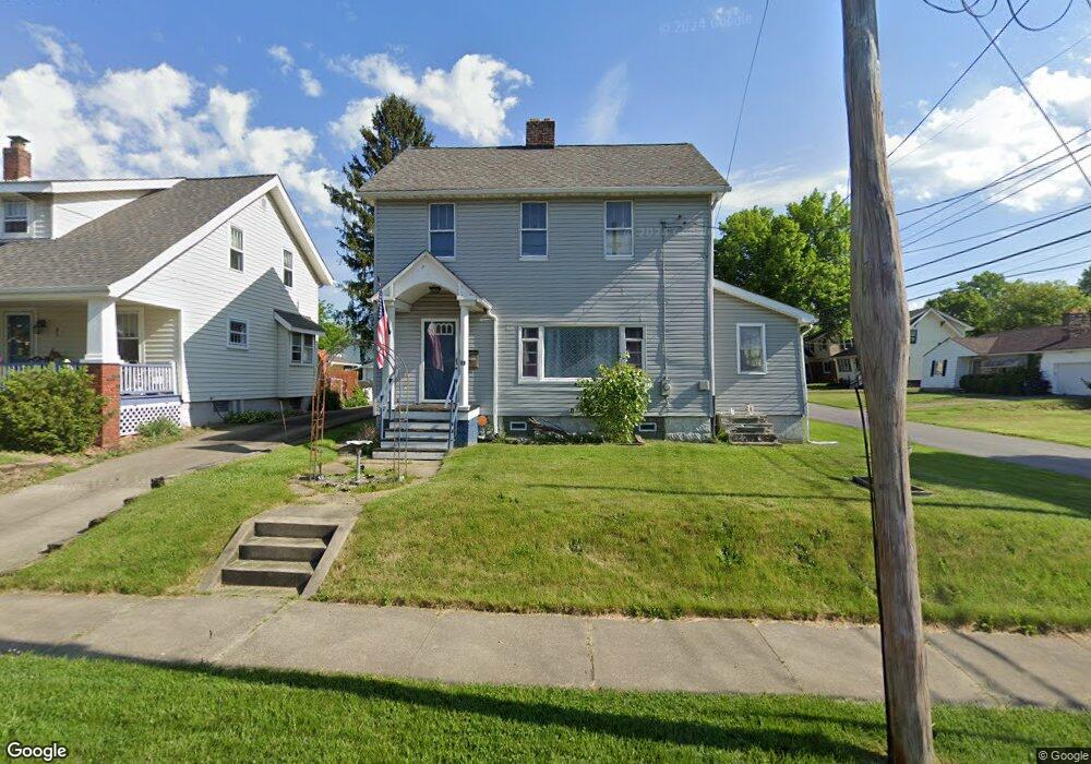
89 Youtz Ave Akron, OH 44301
Firestone Park NeighborhoodEstimated Value: $125,000 - $149,264
3
Beds
1
Bath
1,248
Sq Ft
$114/Sq Ft
Est. Value
About This Home
This home is located at 89 Youtz Ave, Akron, OH 44301 and is currently estimated at $141,816, approximately $113 per square foot. 89 Youtz Ave is a home located in Summit County with nearby schools including Kenmore Garfield Community Learning Center, Main Preparatory Academy, and Eagle Elementary.
Ownership History
Date
Name
Owned For
Owner Type
Purchase Details
Closed on
Jun 11, 2020
Sold by
Hanlon Theodore J and Hanlon Jenene N
Bought by
Johnson Timothy and Johnson Tammy
Current Estimated Value
Home Financials for this Owner
Home Financials are based on the most recent Mortgage that was taken out on this home.
Original Mortgage
$0
Interest Rate
3.2%
Mortgage Type
New Conventional
Purchase Details
Closed on
May 27, 2020
Sold by
Hanlon Theodore J and Hanlon Jenene N
Bought by
Johnson Timothy and Johnson Tammy
Home Financials for this Owner
Home Financials are based on the most recent Mortgage that was taken out on this home.
Original Mortgage
$0
Interest Rate
3.2%
Mortgage Type
New Conventional
Purchase Details
Closed on
Jun 23, 1995
Sold by
King Charleen E
Bought by
Hanlon Theodore J and Hanlon Jenene N
Create a Home Valuation Report for This Property
The Home Valuation Report is an in-depth analysis detailing your home's value as well as a comparison with similar homes in the area
Home Values in the Area
Average Home Value in this Area
Purchase History
| Date | Buyer | Sale Price | Title Company |
|---|---|---|---|
| Johnson Timothy | $80,000 | Minnesota Title Agency | |
| Johnson Timothy | $80,000 | Minnesota Title Agency | |
| Hanlon Theodore J | $65,000 | -- |
Source: Public Records
Mortgage History
| Date | Status | Borrower | Loan Amount |
|---|---|---|---|
| Closed | Johnson Timothy | $0 |
Source: Public Records
Tax History Compared to Growth
Tax History
| Year | Tax Paid | Tax Assessment Tax Assessment Total Assessment is a certain percentage of the fair market value that is determined by local assessors to be the total taxable value of land and additions on the property. | Land | Improvement |
|---|---|---|---|---|
| 2025 | $2,311 | $41,413 | $9,167 | $32,246 |
| 2024 | $2,311 | $41,413 | $9,167 | $32,246 |
| 2023 | $2,311 | $41,413 | $9,167 | $32,246 |
| 2022 | $2,177 | $30,489 | $6,643 | $23,846 |
| 2021 | $2,179 | $30,489 | $6,643 | $23,846 |
| 2020 | $2,148 | $30,490 | $6,640 | $23,850 |
| 2019 | $2,047 | $26,270 | $6,640 | $19,630 |
| 2018 | $2,021 | $26,270 | $6,640 | $19,630 |
| 2017 | $2,437 | $26,270 | $6,640 | $19,630 |
| 2016 | $2,438 | $26,270 | $6,640 | $19,630 |
| 2015 | $2,437 | $26,270 | $6,640 | $19,630 |
| 2014 | $2,421 | $26,270 | $6,640 | $19,630 |
| 2013 | $2,168 | $23,150 | $6,640 | $16,510 |
Source: Public Records
Map
Nearby Homes
- 41 E Rosewood Ave
- 74 E Catawba Ave
- 1861 S Main St
- 1595 Evergreen Ave
- 1637 Rockford St
- 37 Selden Ave
- 23 Selden Ave
- 197 E Wilbeth Rd
- 75 W Dartmore Ave
- 132 Crescent Dr
- 40 E Dresden Ave
- 1614 Glenmount Ave
- 291 Selden Ave
- 315 Clinton Ave
- 17 W Woodsdale Ave
- 41 W Woodsdale Ave
- 361 Mission Dr
- 369 Mission Dr
- 55 W Ralston Ave
- 1500 Beardsley St
- 85 Youtz Ave
- 81 Youtz Ave
- 1843 Dallas Ave
- 77 Youtz Ave
- 90 E Rosewood Ave
- 1835 Dallas Ave
- 86 E Rosewood Ave
- 1847 Dallas Ave
- 82 E Rosewood Ave
- 73 Youtz Ave
- 1829 Dallas Ave
- 88 Youtz Ave
- 1855 Dallas Ave
- 78 E Rosewood Ave
- 82 Youtz Ave
- 1825 Dallas Ave
- 78 Youtz Ave
- 74 E Rosewood Ave
- 1861 Dallas Ave
- 74 Youtz Ave