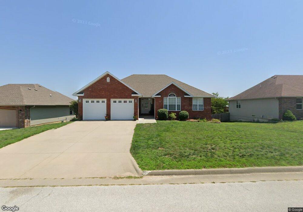
890 Fox Hill Rd Marshfield, MO 65706
Estimated Value: $308,272 - $410,000
Studio
--
Bath
1,859
Sq Ft
$183/Sq Ft
Est. Value
About This Home
This home is located at 890 Fox Hill Rd, Marshfield, MO 65706 and is currently estimated at $341,068, approximately $183 per square foot. 890 Fox Hill Rd is a home with nearby schools including Edwin P. Hubble Elementary School, Daniel Webster Elementary School, and Shook Elementary School.
Ownership History
Date
Name
Owned For
Owner Type
Purchase Details
Closed on
Sep 6, 2024
Sold by
Luebbert Randall E
Bought by
Luebbert Joanna M
Current Estimated Value
Home Financials for this Owner
Home Financials are based on the most recent Mortgage that was taken out on this home.
Original Mortgage
$232,300
Interest Rate
6.2%
Mortgage Type
New Conventional
Purchase Details
Closed on
Jul 6, 2020
Sold by
Sexton Karen
Bought by
Luebbert Randall E and Luebbert Joanna M
Purchase Details
Closed on
Apr 23, 2013
Sold by
Marshfield Reorganized R-1 School Distri
Bought by
Sexton Karen
Create a Home Valuation Report for This Property
The Home Valuation Report is an in-depth analysis detailing your home's value as well as a comparison with similar homes in the area
Home Values in the Area
Average Home Value in this Area
Purchase History
| Date | Buyer | Sale Price | Title Company |
|---|---|---|---|
| Luebbert Joanna M | -- | None Listed On Document | |
| Luebbert Randall E | -- | -- | |
| Sexton Karen | -- | -- |
Source: Public Records
Mortgage History
| Date | Status | Borrower | Loan Amount |
|---|---|---|---|
| Previous Owner | Luebbert Joanna M | $232,300 |
Source: Public Records
Tax History
| Year | Tax Paid | Tax Assessment Tax Assessment Total Assessment is a certain percentage of the fair market value that is determined by local assessors to be the total taxable value of land and additions on the property. | Land | Improvement |
|---|---|---|---|---|
| 2024 | $2,366 | $40,830 | $0 | $0 |
| 2023 | $2,299 | $40,830 | $0 | $0 |
| 2022 | $2,300 | $40,830 | $0 | $0 |
| 2021 | $2,299 | $40,830 | $0 | $0 |
| 2020 | $2,065 | $37,430 | $0 | $0 |
| 2019 | $1,957 | $37,430 | $0 | $0 |
| 2018 | $1,959 | $37,430 | $0 | $0 |
| 2017 | $1,755 | $37,430 | $0 | $0 |
| 2016 | $1,894 | $40,090 | $0 | $0 |
| 2015 | -- | $40,090 | $0 | $0 |
| 2012 | -- | $4,730 | $0 | $0 |
Source: Public Records
Map
Nearby Homes
- 931 Bradford Ct
- 1020 Berkley Dr
- 444 Sweetbriar Dr
- TBD E Hubble Dr
- 60 Community Dr
- 841 E Hubble Dr
- 831 E Burford St
- 000 E Hubble
- 721 E Bedford St
- 720 E Burford St
- Tbd E Hubble Dr
- 542 N Locust St
- 782 N Olive St
- 112 N Vine St
- 705 E Washington St
- 1541 Briarwood Dr
- 1660 Briarwood Dr
- 504 E Burford St
- Lot 3 N Pine St
- Lot 1 N Pine St
- 0 Fox Hill Unit 11116647
- 0 Fox Hill Unit 11116653
- 0 Fox Hill Unit 11116652
- 0 Fox Hill Unit 11116651
- 0 Fox Hill Unit 11116649
- 0 Fox Hill Unit 11116646
- 0 Fox Hill Unit 11400327
- 0 Fox Hill Unit 11400330
- 0 Fox Hill Unit 11400331
- 0 Fox Hill Unit 11400328
- 848 Fox Hill Rd
- Lot 53 Fox Hill Rd
- Lot 54 Fox Hill Rd
- 876 Fox Hill Rd
- 862 Fox Hill Rd
- 920 Fox Hill Rd
- 1484 Glenwood Rd
- 461 Stonebrooke Dr
- 617 Stonebrooke Dr
- 424 Stonebrooke Dr
Your Personal Tour Guide
Ask me questions while you tour the home.