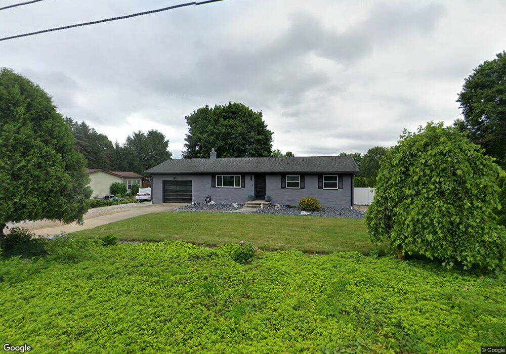
890 Harring Rd Uniontown, OH 44685
Estimated Value: $185,000 - $253,000
3
Beds
1
Bath
1,050
Sq Ft
$210/Sq Ft
Est. Value
About This Home
This home is located at 890 Harring Rd, Uniontown, OH 44685 and is currently estimated at $220,355, approximately $209 per square foot. 890 Harring Rd is a home located in Summit County with nearby schools including Greenwood Elementary School, Green Intermediate Elementary School, and Green Primary School.
Ownership History
Date
Name
Owned For
Owner Type
Purchase Details
Closed on
Mar 31, 2025
Sold by
Curtis Teresa L
Bought by
Michael And Teresa L Curtis Family Trust and Curtis
Current Estimated Value
Purchase Details
Closed on
Sep 3, 2024
Sold by
Curtis Seth M
Bought by
Curtis Teresa L
Purchase Details
Closed on
Jun 3, 2022
Sold by
Rebekah N Harvey Revocable Trust
Bought by
Curtis Seth M
Purchase Details
Closed on
Jun 2, 2022
Sold by
Rebekah N Harvey Revocable Trust
Bought by
Curtis Seth M
Purchase Details
Closed on
Mar 5, 1999
Sold by
Harvey Rebekah N
Bought by
Harvey Rebekah N and Rebekah N Harvey Revocable Trust
Create a Home Valuation Report for This Property
The Home Valuation Report is an in-depth analysis detailing your home's value as well as a comparison with similar homes in the area
Home Values in the Area
Average Home Value in this Area
Purchase History
| Date | Buyer | Sale Price | Title Company |
|---|---|---|---|
| Michael And Teresa L Curtis Family Trust | -- | None Listed On Document | |
| Curtis Teresa L | -- | First Security Title | |
| Curtis Seth M | -- | Weimer Law Firm Llc | |
| Curtis Seth M | -- | Weimer Law Firm Llc | |
| Harvey Rebekah N | -- | -- |
Source: Public Records
Tax History Compared to Growth
Tax History
| Year | Tax Paid | Tax Assessment Tax Assessment Total Assessment is a certain percentage of the fair market value that is determined by local assessors to be the total taxable value of land and additions on the property. | Land | Improvement |
|---|---|---|---|---|
| 2025 | $2,935 | $62,654 | $16,331 | $46,323 |
| 2024 | $2,935 | $62,654 | $16,331 | $46,323 |
| 2023 | $2,935 | $62,654 | $16,331 | $46,323 |
| 2022 | $2,446 | $45,788 | $11,834 | $33,954 |
| 2021 | $1,812 | $45,788 | $11,834 | $33,954 |
| 2020 | $1,777 | $45,780 | $11,830 | $33,950 |
| 2019 | $1,606 | $40,100 | $13,970 | $26,130 |
| 2018 | $1,642 | $40,100 | $13,970 | $26,130 |
| 2017 | $1,561 | $40,100 | $13,970 | $26,130 |
| 2016 | $1,554 | $36,740 | $13,970 | $22,770 |
| 2015 | $1,561 | $36,740 | $13,970 | $22,770 |
| 2014 | $1,551 | $36,740 | $13,970 | $22,770 |
| 2013 | $1,574 | $36,920 | $13,970 | $22,950 |
Source: Public Records
Map
Nearby Homes
- 4441 Merlin Dr
- 1008 Dalby Cir
- 0 Kenway Blvd Unit 5162986
- 683 Chilham Cir
- 3943 Crest View Dr
- Mystique Plan at Brier Creek
- Countryview Plan at Brier Creek
- Prosperity Plan at Brier Creek
- 3704 Kenway Blvd
- 3680 Kenway Blvd
- 3672 Kenway Blvd
- 757 Southwood Dr
- 3683 Kenway Blvd
- 3630 Great Windsor Ln
- 3675 Kenway Blvd
- 3667 Kenway Blvd
- 3621 Great Windsor Ln
- 3832 Jacobs Ln
- 583 Knollwood Dr
- 3829 Jacobs Ln
- 900 Harring Rd
- 878 Harring Rd
- 912 Harring Rd
- 866 Harring Rd
- 925 Harring Rd
- 905 Harring Rd
- 863 Harring Rd
- 940 Harring Rd
- 4355 King Arthur Dr
- 4168 Arlington Rd
- 4166 Arlington Rd
- 4142 Arlington Rd
- 4178 Arlington Rd
- 4118 Arlington Rd
- 4200 Arlington Rd
- 4090 Arlington Rd
- 4407 King Arthur Dr
- 4417 King Arthur Dr
- 4080 Arlington Rd
- 4226 Arlington Rd