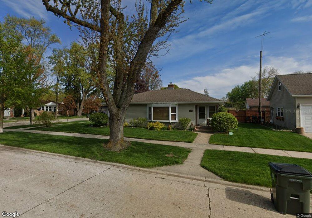
8901 Mansfield Ave Morton Grove, IL 60053
Estimated Value: $294,000 - $439,393
3
Beds
2
Baths
1,306
Sq Ft
$307/Sq Ft
Est. Value
About This Home
This home is located at 8901 Mansfield Ave, Morton Grove, IL 60053 and is currently estimated at $400,848, approximately $306 per square foot. 8901 Mansfield Ave is a home located in Cook County with nearby schools including Park View Elementary School and Niles West High School.
Ownership History
Date
Name
Owned For
Owner Type
Purchase Details
Closed on
Nov 29, 2001
Sold by
Hoffman Mildred and Warner James R
Bought by
Swets Christopher M
Current Estimated Value
Home Financials for this Owner
Home Financials are based on the most recent Mortgage that was taken out on this home.
Original Mortgage
$157,500
Interest Rate
6.9%
Mortgage Type
Credit Line Revolving
Purchase Details
Closed on
Mar 24, 1998
Sold by
Hoffman Susan L
Bought by
Hoffman Mildred
Create a Home Valuation Report for This Property
The Home Valuation Report is an in-depth analysis detailing your home's value as well as a comparison with similar homes in the area
Home Values in the Area
Average Home Value in this Area
Purchase History
| Date | Buyer | Sale Price | Title Company |
|---|---|---|---|
| Swets Christopher M | $150,000 | -- | |
| Hoffman Mildred | -- | -- |
Source: Public Records
Mortgage History
| Date | Status | Borrower | Loan Amount |
|---|---|---|---|
| Closed | Swets Christopher M | $157,500 |
Source: Public Records
Tax History Compared to Growth
Tax History
| Year | Tax Paid | Tax Assessment Tax Assessment Total Assessment is a certain percentage of the fair market value that is determined by local assessors to be the total taxable value of land and additions on the property. | Land | Improvement |
|---|---|---|---|---|
| 2024 | $8,505 | $30,762 | $8,415 | $22,347 |
| 2023 | $8,757 | $32,760 | $8,415 | $24,345 |
| 2022 | $8,757 | $35,240 | $8,415 | $26,825 |
| 2021 | $6,863 | $24,728 | $5,178 | $19,550 |
| 2020 | $6,752 | $24,728 | $5,178 | $19,550 |
| 2019 | $6,819 | $27,785 | $5,178 | $22,607 |
| 2018 | $6,372 | $23,629 | $4,692 | $18,937 |
| 2017 | $6,439 | $23,629 | $4,692 | $18,937 |
| 2016 | $6,493 | $24,164 | $4,692 | $19,472 |
| 2015 | $6,784 | $23,674 | $4,045 | $19,629 |
| 2014 | $8,032 | $27,518 | $4,045 | $23,473 |
| 2013 | $7,829 | $27,518 | $4,045 | $23,473 |
Source: Public Records
Map
Nearby Homes
- 8841 Menard Ave
- 8836 Mansfield Ave
- 8918 Parkside Ave
- 8849 Mcvicker Ave
- 5536 Greenwood St
- 8708 Central Ave
- 5459 Suffield Ct
- 9224 Menard Ave
- 5449 Arcadia St
- 9234 Central Ave
- 9314 Menard Ave
- 9320 Menard Ave
- 5352 Greenwood St
- 8655 Harms Rd
- 5644 Lyons St
- 5346 Suffield Terrace
- 6020 Lincoln Ave Unit 407
- 8541 Lotus Ave Unit 914
- 5510 Lincoln Ave Unit B301
- 5510 Lincoln Ave Unit B101
- 8907 Mansfield Ave
- 8907 Mansfield Ave
- 8913 Mansfield Ave
- 8913 Mansfield Ave
- 8845 Mansfield Ave
- 8900 Menard Ave
- 8906 Menard Ave
- 8839 Mansfield Ave
- 8844 Menard Ave
- 8844 Menard Ave
- 8910 Menard Ave
- 8917 Mansfield Ave
- 8902 Mansfield Ave
- 8906 Mansfield Ave
- 8916 Menard Ave
- 8916 Menard Ave
- 8910 Mansfield Ave
- 8840 Menard Ave
- 8840 Menard Ave
- 8835 Mansfield Ave