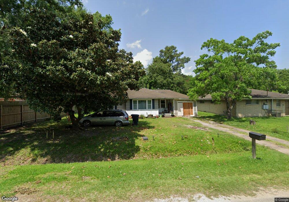
8903 Camay Dr Houston, TX 77016
Trinity-Houston Gardens NeighborhoodEstimated Value: $137,095 - $165,000
2
Beds
1
Bath
999
Sq Ft
$148/Sq Ft
Est. Value
About This Home
This home is located at 8903 Camay Dr, Houston, TX 77016 and is currently estimated at $147,524, approximately $147 per square foot. 8903 Camay Dr is a home located in Harris County with nearby schools including Felix Cook Jr. Elementary School, Key Middle, and Kashmere High School.
Ownership History
Date
Name
Owned For
Owner Type
Purchase Details
Closed on
Aug 15, 2025
Sold by
Auramark Investments Llc and Cain Melina B
Bought by
Auramark Investments Llc
Current Estimated Value
Purchase Details
Closed on
Feb 12, 2021
Sold by
Auramark Investments Llc
Bought by
Diaz Jose Luis Velazqu and Cruz Lidia Leticia
Purchase Details
Closed on
Aug 19, 2020
Sold by
Bmi Investments Incorporated
Bought by
Auramark Investments Llc
Purchase Details
Closed on
Apr 3, 2020
Sold by
Wells Cathy and Estates Of King Limbrick
Bought by
Markman Martinez Investments Inc
Create a Home Valuation Report for This Property
The Home Valuation Report is an in-depth analysis detailing your home's value as well as a comparison with similar homes in the area
Home Values in the Area
Average Home Value in this Area
Purchase History
| Date | Buyer | Sale Price | Title Company |
|---|---|---|---|
| Auramark Investments Llc | $174,540 | None Listed On Document | |
| Diaz Jose Luis Velazqu | -- | None Listed On Document | |
| Auramark Investments Llc | -- | None Available | |
| Markman Martinez Investments Inc | -- | None Available |
Source: Public Records
Mortgage History
| Date | Status | Borrower | Loan Amount |
|---|---|---|---|
| Closed | Auramark Investments Llc | $0 |
Source: Public Records
Tax History Compared to Growth
Tax History
| Year | Tax Paid | Tax Assessment Tax Assessment Total Assessment is a certain percentage of the fair market value that is determined by local assessors to be the total taxable value of land and additions on the property. | Land | Improvement |
|---|---|---|---|---|
| 2025 | $2,099 | $102,395 | $75,188 | $27,207 |
| 2024 | $2,099 | $102,395 | $75,188 | $27,207 |
| 2023 | $2,099 | $83,598 | $56,391 | $27,207 |
| 2022 | $1,339 | $60,833 | $37,594 | $23,239 |
| 2021 | $671 | $28,797 | $18,797 | $10,000 |
| 2020 | $697 | $28,797 | $18,797 | $10,000 |
| 2019 | $996 | $39,359 | $18,797 | $20,562 |
| 2018 | $558 | $22,100 | $13,534 | $8,566 |
| 2017 | $559 | $22,100 | $13,534 | $8,566 |
| 2016 | $559 | $22,100 | $13,534 | $8,566 |
| 2015 | -- | $22,100 | $13,534 | $8,566 |
| 2014 | -- | $22,100 | $13,534 | $8,566 |
Source: Public Records
Map
Nearby Homes
- 6320 Laura Koppe Rd
- 9009 Compton St
- 6415 Laura Koppe Rd
- 6012 Laura Koppe Rd
- 6005 Laura Koppe Rd
- 8716 Allwood St
- 8914 Lanewood Dr
- 8504 Shady Dr
- 8636 Allwood St
- 6513 Laura Koppe Rd
- 8700 Lanewood Dr
- 8634 Allwood St
- 8502 Shady Dr
- 9205 & 9207 Spaulding St
- 8420 Lanewood Dr
- 8598 Hoffman St
- 8602 Hoffman St
- 8928 Homestead Rd
- 8312 Lanewood Dr
- 9118 Sandra St Unit A and B
- 8911 Camay Dr Unit 2
- 8815 Camay Dr
- 8902 Shady Dr
- 8929 Camay Dr
- 6207 Laura Koppe Rd
- 8222 Shady Dr
- 8916 Camay Dr
- 8818 Shady Dr
- 8807 Camay Dr
- 8920 Camay Dr
- 8924 Camay Dr
- 8815 Shady Dr
- 8907 Compton St
- 9006 Camay Dr
- 8815 Compton St
- 8927 Shady Dr
- 8909 Compton St
- 8811 Compton St
- 89095 Compton St
- 9010 Shady Dr