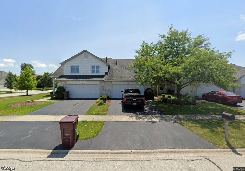
8903 Mallard Rd Tinley Park, IL 60487
Central Tinley Park NeighborhoodEstimated Value: $320,000 - $347,000
2
Beds
2
Baths
1,632
Sq Ft
$205/Sq Ft
Est. Value
About This Home
This home is located at 8903 Mallard Rd, Tinley Park, IL 60487 and is currently estimated at $334,493, approximately $204 per square foot. 8903 Mallard Rd is a home located in Cook County with nearby schools including Millennium Elementary School, Prairie View Middle School, and Victor J Andrew High School.
Ownership History
Date
Name
Owned For
Owner Type
Purchase Details
Closed on
Sep 12, 1996
Sold by
First United Bank
Bought by
Graff Stephen R
Current Estimated Value
Home Financials for this Owner
Home Financials are based on the most recent Mortgage that was taken out on this home.
Original Mortgage
$100,000
Outstanding Balance
$8,655
Interest Rate
8.29%
Estimated Equity
$325,838
Create a Home Valuation Report for This Property
The Home Valuation Report is an in-depth analysis detailing your home's value as well as a comparison with similar homes in the area
Home Values in the Area
Average Home Value in this Area
Purchase History
| Date | Buyer | Sale Price | Title Company |
|---|---|---|---|
| Graff Stephen R | $167,500 | -- |
Source: Public Records
Mortgage History
| Date | Status | Borrower | Loan Amount |
|---|---|---|---|
| Open | Graff Stephen R | $100,000 |
Source: Public Records
Tax History Compared to Growth
Tax History
| Year | Tax Paid | Tax Assessment Tax Assessment Total Assessment is a certain percentage of the fair market value that is determined by local assessors to be the total taxable value of land and additions on the property. | Land | Improvement |
|---|---|---|---|---|
| 2024 | $6,117 | $27,999 | $3,219 | $24,780 |
| 2023 | $5,163 | $29,000 | $3,219 | $25,781 |
| 2022 | $5,163 | $20,640 | $2,778 | $17,862 |
| 2021 | $5,053 | $20,638 | $2,777 | $17,861 |
| 2020 | $5,331 | $21,448 | $2,777 | $18,671 |
| 2019 | $5,198 | $22,200 | $2,525 | $19,675 |
| 2018 | $5,083 | $22,200 | $2,525 | $19,675 |
| 2017 | $5,815 | $22,200 | $2,525 | $19,675 |
| 2016 | $4,874 | $17,172 | $2,272 | $14,900 |
| 2015 | $4,780 | $17,172 | $2,272 | $14,900 |
| 2014 | $4,757 | $17,172 | $2,272 | $14,900 |
| 2013 | $5,843 | $21,976 | $2,272 | $19,704 |
Source: Public Records
Map
Nearby Homes
- 9038 Mansfield Dr Unit 8
- 9051 Mansfield Dr Unit 1
- 18055 Upland Dr
- 18248 Murphy Cir Unit 182
- 18261 Kirby Dr Unit 2918261
- 8423 Stratford Dr Unit 8423
- 8416 Stratford Dr Unit 8416
- 17964 Upland Dr
- 17631 Dover Ct
- Fremont Plan at Radcliffe Place
- Calysta Plan at Radcliffe Place
- Danbury Plan at Radcliffe Place
- Briarcliffe Plan at Radcliffe Place
- Eden Plan at Radcliffe Place
- Amberwood Plan at Radcliffe Place
- 17533 Pecan Ln
- 9280 Windsor Pkwy Unit 92
- 9260 Windsor Pkwy Unit 80
- 9201 175th St
- 17500 Lagrange Rd
- 8905 Mallard Rd
- 8901 Mallard Rd Unit 3
- 8907 Mallard Rd
- 18128 Mockingbird Ln
- 18130 Mockingbird Ln
- 8911 Mallard Rd
- 18132 Mockingbird Ln
- 18134 Mockingbird Ln
- 8900 Mallard Rd
- 8913 Mallard Rd
- 8915 Mallard Rd
- 8906 Mallard Rd
- 18125 Mockingbird Ln
- 8830 Mallard Rd
- 18131 Mockingbird Ln
- 8917 Mallard Rd
- 18138 Mockingbird Ln
- 8912 Mallard Rd
- 8824 Mallard Rd
- 18137 Mockingbird Ln