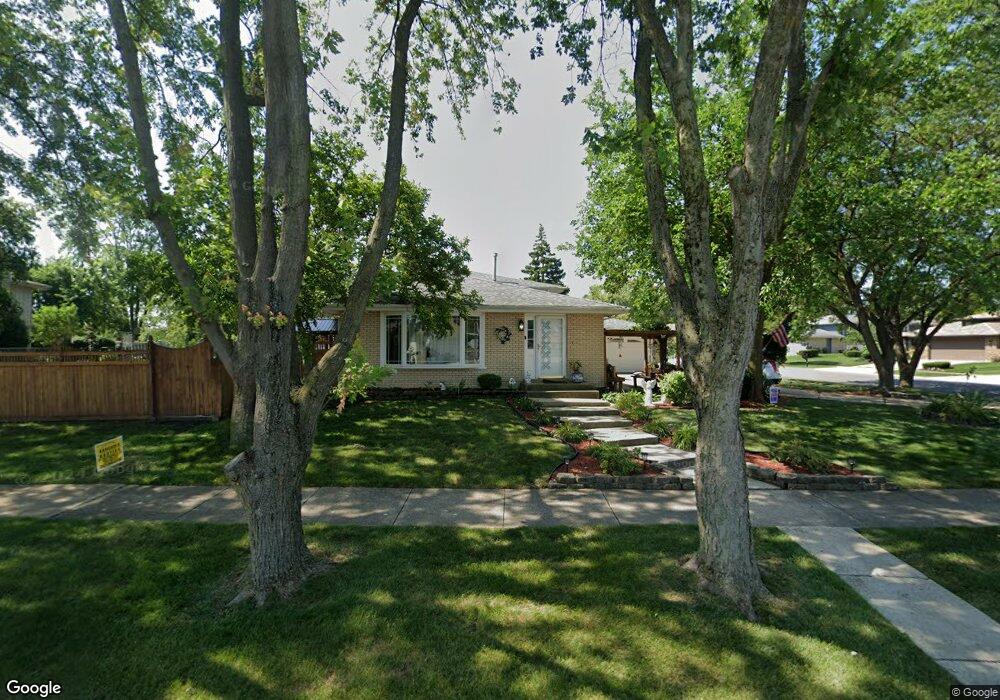
8905 Lori Ln Orland Park, IL 60462
Silver Lake North NeighborhoodEstimated Value: $387,000 - $457,000
4
Beds
2
Baths
1,624
Sq Ft
$256/Sq Ft
Est. Value
About This Home
This home is located at 8905 Lori Ln, Orland Park, IL 60462 and is currently estimated at $414,998, approximately $255 per square foot. 8905 Lori Ln is a home located in Cook County with nearby schools including Orland Park Elementary School, High Point Elementary School, and Orland Jr High School.
Ownership History
Date
Name
Owned For
Owner Type
Purchase Details
Closed on
Sep 18, 2001
Sold by
Henson Paul W and Henson Joan C
Bought by
Flores Hector M and Flores Nancy
Current Estimated Value
Home Financials for this Owner
Home Financials are based on the most recent Mortgage that was taken out on this home.
Original Mortgage
$208,000
Outstanding Balance
$80,990
Interest Rate
6.97%
Estimated Equity
$334,008
Purchase Details
Closed on
Jan 1, 2000
Sold by
Lasalle Bank National Assn
Bought by
Henson Paul W and Henson Joan C
Home Financials for this Owner
Home Financials are based on the most recent Mortgage that was taken out on this home.
Original Mortgage
$110,000
Interest Rate
12.61%
Create a Home Valuation Report for This Property
The Home Valuation Report is an in-depth analysis detailing your home's value as well as a comparison with similar homes in the area
Home Values in the Area
Average Home Value in this Area
Purchase History
| Date | Buyer | Sale Price | Title Company |
|---|---|---|---|
| Flores Hector M | $219,000 | -- | |
| Henson Paul W | -- | -- |
Source: Public Records
Mortgage History
| Date | Status | Borrower | Loan Amount |
|---|---|---|---|
| Open | Flores Hector M | $208,000 | |
| Previous Owner | Henson Paul W | $110,000 |
Source: Public Records
Tax History Compared to Growth
Tax History
| Year | Tax Paid | Tax Assessment Tax Assessment Total Assessment is a certain percentage of the fair market value that is determined by local assessors to be the total taxable value of land and additions on the property. | Land | Improvement |
|---|---|---|---|---|
| 2024 | $8,180 | $36,001 | $6,897 | $29,104 |
| 2023 | $6,476 | $36,001 | $6,897 | $29,104 |
| 2022 | $6,476 | $25,039 | $5,956 | $19,083 |
| 2021 | $6,280 | $25,038 | $5,956 | $19,082 |
| 2020 | $6,108 | $25,038 | $5,956 | $19,082 |
| 2019 | $6,334 | $26,504 | $5,329 | $21,175 |
| 2018 | $6,158 | $26,504 | $5,329 | $21,175 |
| 2017 | $6,035 | $26,504 | $5,329 | $21,175 |
| 2016 | $5,981 | $23,932 | $4,702 | $19,230 |
| 2015 | $5,889 | $23,932 | $4,702 | $19,230 |
| 2014 | $5,816 | $23,932 | $4,702 | $19,230 |
| 2013 | $5,787 | $25,208 | $4,702 | $20,506 |
Source: Public Records
Map
Nearby Homes
- 14216 Clearview Dr
- 14111 Tod William Dr
- 14304 Clearview Ct Unit 8904
- 14325 Clearview Dr Unit 14325
- 8820 W 140th St Unit 2A
- 14040 Boxwood Ln
- 8700 Berkley Ct
- 8810 Clearview Dr Unit 8810
- 14340 Mason Ln
- 9114 W 140th St Unit 204
- 14350 Mason Ln
- 14402 S 90th Ct Unit 1A
- 8932 Pebble Beach Ln
- 14345 S 87th Ave
- 14453 S 88th Ave
- 9146 W 140th St Unit 3NE
- 14508 Maycliff Dr
- 14440 Brentwood St
- 13904 Virginia Ct
- 14602 Beech St
- 14137 Clearview Dr
- 8901 Lori Ln
- 14147 Clearview Dr
- 8904 Lori Ln
- 8900 Lori Ln
- 14130 Clearview Dr
- 8847 Lori Ln
- 14136 Clearview Dr
- 14201 Clearview Dr
- 14142 Clearview Dr
- 8926 Lori Ln
- 8848 Lori Ln
- 8845 Lori Ln
- 14113 Clearview Dr
- 8939 Lori Ln
- 14148 Clearview Dr
- 8844 Lori Ln
- 14212 Terry Dr
- 14114 Clearview Dr
- 8843 Lori Ln