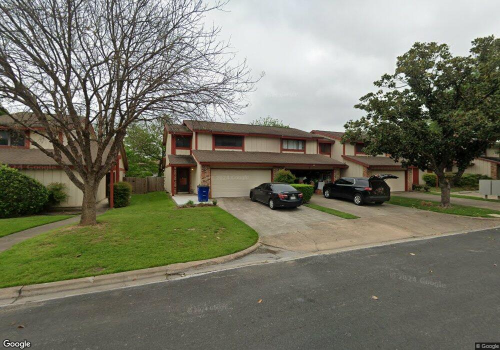
8905 Trone Cir Unit A Austin, TX 78758
North Austin NeighborhoodEstimated Value: $257,000 - $301,000
3
Beds
2
Baths
1,430
Sq Ft
$191/Sq Ft
Est. Value
About This Home
This home is located at 8905 Trone Cir Unit A, Austin, TX 78758 and is currently estimated at $272,607, approximately $190 per square foot. 8905 Trone Cir Unit A is a home located in Travis County with nearby schools including Wooldridge Elementary School, Burnet Middle School, and Navarro Early College High School.
Ownership History
Date
Name
Owned For
Owner Type
Purchase Details
Closed on
Aug 30, 2010
Sold by
Seaborn Terry and Seaborn Dorthea
Bought by
Seaborn Elizabeth
Current Estimated Value
Purchase Details
Closed on
Nov 18, 2009
Sold by
Morrow Valeria and Noris Federico
Bought by
Seaborn Elizabeth and Seaborn Terry
Home Financials for this Owner
Home Financials are based on the most recent Mortgage that was taken out on this home.
Original Mortgage
$112,917
Outstanding Balance
$73,087
Interest Rate
4.83%
Mortgage Type
Purchase Money Mortgage
Estimated Equity
$199,520
Create a Home Valuation Report for This Property
The Home Valuation Report is an in-depth analysis detailing your home's value as well as a comparison with similar homes in the area
Home Values in the Area
Average Home Value in this Area
Purchase History
| Date | Buyer | Sale Price | Title Company |
|---|---|---|---|
| Seaborn Elizabeth | -- | None Available | |
| Seaborn Elizabeth | -- | None Available |
Source: Public Records
Mortgage History
| Date | Status | Borrower | Loan Amount |
|---|---|---|---|
| Open | Seaborn Elizabeth | $112,917 |
Source: Public Records
Tax History
| Year | Tax Paid | Tax Assessment Tax Assessment Total Assessment is a certain percentage of the fair market value that is determined by local assessors to be the total taxable value of land and additions on the property. | Land | Improvement |
|---|---|---|---|---|
| 2025 | $3,199 | $244,152 | $4,102 | $240,050 |
| 2023 | $3,201 | $248,029 | $0 | $0 |
| 2022 | $4,453 | $225,481 | $0 | $0 |
| 2021 | $4,462 | $204,983 | $41 | $230,237 |
| 2020 | $3,997 | $186,348 | $41 | $199,119 |
| 2018 | $3,410 | $154,006 | $41 | $195,543 |
| 2017 | $3,122 | $140,005 | $21,500 | $118,505 |
| 2016 | $2,896 | $129,847 | $21,500 | $112,677 |
| 2015 | $2,241 | $118,043 | $21,500 | $97,882 |
| 2014 | $2,241 | $107,312 | $0 | $0 |
Source: Public Records
Map
Nearby Homes
- 8906 Trone Cir Unit A
- 8708 Brookfield Dr
- 9007 Quail Valley Dr
- 1315 Quail Park Dr
- 8602 Colonial Dr
- 9215 Hunters Trace E
- 8512 Remington Ln
- 1606 Colony Creek Dr
- 9013 Collinfield Dr
- 1011 Chesapeake Dr
- 9009 Blue Quail Dr
- 8400 Jamestown Dr Unit 212
- 8400 Jamestown Dr Unit 226
- 1315 Clearfield Dr Unit 2
- 9010 Quail Creek Dr
- 9300 Meadow Vale
- 8401 Staunton Dr
- 8911 Little Walnut Pkwy
- 809 Maryland Dr
- 8702 Bridgeport Dr
- 8905 Trone Cir
- 8905 Trone Cir Unit C
- 8905 Trone Cir Unit B
- 8903 Trone Cir Unit C
- 8903 Trone Cir Unit B
- 8903 Trone Cir Unit A
- 8903 Trone Cir
- 8907 Trone Cir Unit D
- 8907 Trone Cir Unit C
- 8907 Trone Cir Unit B
- 8907 Trone Cir Unit A
- 8903A Trone Cir
- 8902 Parkfield Dr
- 8902 Parkfield Dr
- 8902 Parkfield Dr
- 8902 Parkfield Dr
- 8902 Parkfield Dr Unit A
- 8902 Parkfield Dr Unit D
- 8906 Parkfield Dr
Your Personal Tour Guide
Ask me questions while you tour the home.