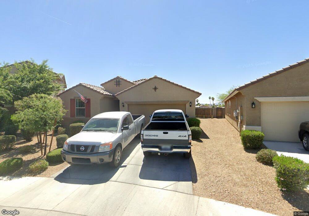
8906 N 102nd Ln Peoria, AZ 85345
Estimated Value: $450,700 - $512,000
--
Bed
--
Bath
1,895
Sq Ft
$258/Sq Ft
Est. Value
About This Home
This home is located at 8906 N 102nd Ln, Peoria, AZ 85345 and is currently estimated at $489,175, approximately $258 per square foot. 8906 N 102nd Ln is a home with nearby schools including Country Meadows Elementary School, Raymond S. Kellis, and Ombudsman - Northwest Charter.
Ownership History
Date
Name
Owned For
Owner Type
Purchase Details
Closed on
Sep 28, 2017
Sold by
Green Linda
Bought by
Green Paul S
Current Estimated Value
Home Financials for this Owner
Home Financials are based on the most recent Mortgage that was taken out on this home.
Original Mortgage
$216,460
Outstanding Balance
$181,143
Interest Rate
3.89%
Mortgage Type
New Conventional
Estimated Equity
$308,032
Purchase Details
Closed on
Sep 25, 2017
Sold by
Garrett Walker Homes Llc
Bought by
Green Paul S
Home Financials for this Owner
Home Financials are based on the most recent Mortgage that was taken out on this home.
Original Mortgage
$216,460
Outstanding Balance
$181,143
Interest Rate
3.89%
Mortgage Type
New Conventional
Estimated Equity
$308,032
Create a Home Valuation Report for This Property
The Home Valuation Report is an in-depth analysis detailing your home's value as well as a comparison with similar homes in the area
Home Values in the Area
Average Home Value in this Area
Purchase History
| Date | Buyer | Sale Price | Title Company |
|---|---|---|---|
| Green Paul S | -- | Dhi Title Agency | |
| Green Paul S | $270,575 | Dhi Title Agency |
Source: Public Records
Mortgage History
| Date | Status | Borrower | Loan Amount |
|---|---|---|---|
| Open | Green Paul S | $216,460 |
Source: Public Records
Tax History Compared to Growth
Tax History
| Year | Tax Paid | Tax Assessment Tax Assessment Total Assessment is a certain percentage of the fair market value that is determined by local assessors to be the total taxable value of land and additions on the property. | Land | Improvement |
|---|---|---|---|---|
| 2025 | $1,849 | $23,224 | -- | -- |
| 2024 | $1,817 | $22,118 | -- | -- |
| 2023 | $1,817 | $38,680 | $7,730 | $30,950 |
| 2022 | $1,779 | $29,900 | $5,980 | $23,920 |
| 2021 | $1,901 | $29,210 | $5,840 | $23,370 |
| 2020 | $1,919 | $27,530 | $5,500 | $22,030 |
| 2019 | $1,859 | $24,070 | $4,810 | $19,260 |
Source: Public Records
Map
Nearby Homes
- 8828 N 102nd Ln
- 10221 W Puget Ave
- 10201 W Caron Dr
- 10326 W Caron Dr
- 10001 W Deanita Ln
- 8601 N 103rd Ave Unit 72
- 8601 N 103rd Ave Unit 313
- 8601 N 103rd Ave Unit 166
- 10001 W Caron Dr Unit 8
- 10448 W Caron Dr
- 8803 N 105th Dr
- 10512 W Ruth Ave
- 10014 W Mission Ln
- 10222 W Mountain View Rd Unit 2
- 10030 W Denham Dr
- 10109 W Mountain View Rd
- 10603 W Ruth Ave
- 10022 W Mountain View Rd
- 10621 W Lawrence Ln
- 10301 W Salem Dr Unit 6D
- 8912 N 102nd Ln
- 8902 N 102nd Ln
- 8918 N 102nd Ln
- 10259 W Townley Ave
- 8924 N 102nd Ln
- 10254 W Townley Ave
- 8930 N 102nd Ln
- 10251 W Townley Ave
- 10278 W Golden Ln
- 10270 W Golden Ln
- 10250 W Townley Ave
- 10262 W Golden Ln
- 8936 N 102nd Ln
- 10247 W Townley Ave
- 10256 W Golden Ln
- 10246 W Townley Ave
- 10251 W Puget Ave
- 8942 N 102nd Ln
- 10245 W Puget Ave
- 10250 W Golden Ln
