891 Sistrunk Rd Lake Charles, LA 70611
Moss Bluff NeighborhoodEstimated Value: $206,629 - $687,000
3
Beds
8
Baths
4,520
Sq Ft
$109/Sq Ft
Est. Value
Highlights
- Traditional Architecture
- Central Heating and Cooling System
- Rectangular Lot
- Graham & Parks Alternative Public School Rated A
About This Home
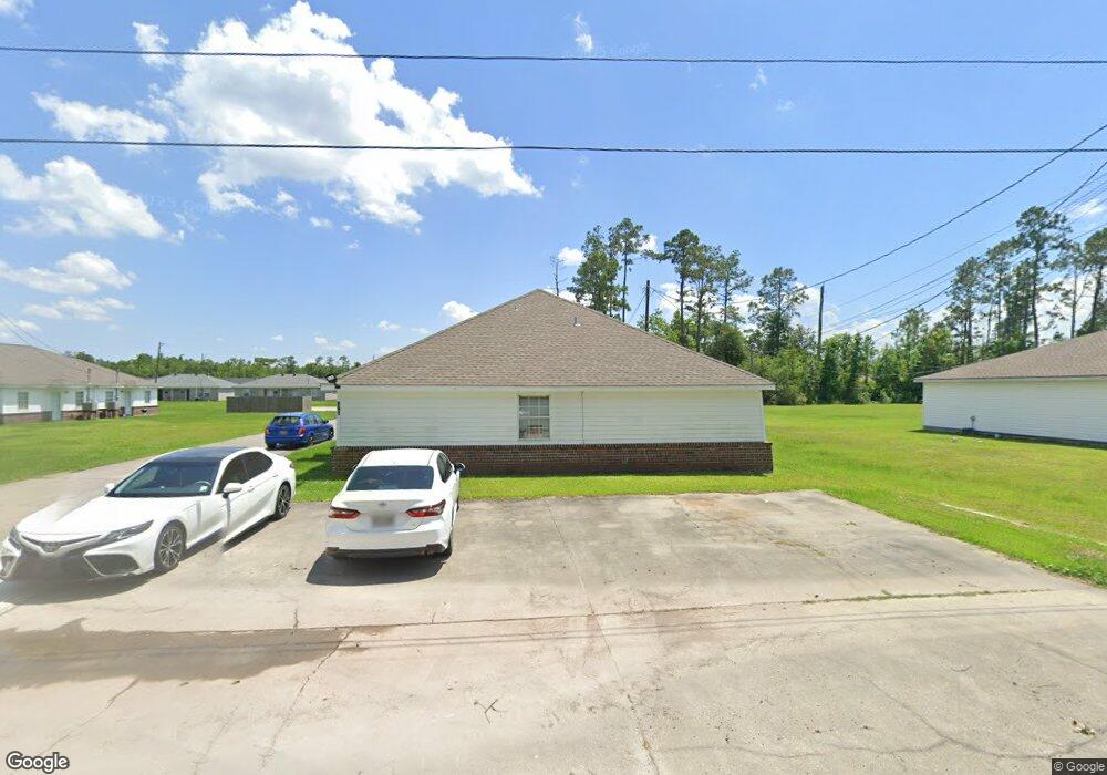
As of August 2020Great Investment Opportunity!! Two great duplexes available for sale in central area of Moss Bluff. Near schools and the new Rouses. Units have upgraded granite counter tops and all appliances stay with the unit. Also, all 4 units have washer & dryer connections. Two units have long term tenants (over 5 years), two units vacant and ready to rent. Flood zone X so no flood insurance required. Parcel also has enough space to build two more duplexes and the community sewer plant was designed for 4 duplexes so you have the option to build on the property.
Property Details
Home Type
- Multi-Family
Year Built
- 2006
Lot Details
- 0.45 Acre Lot
- Rectangular Lot
Parking
- Driveway
Home Design
- Duplex
- Traditional Architecture
- Brick Exterior Construction
- Slab Foundation
- Frame Construction
- Shingle Roof
- Asphalt Roof
- Vinyl Siding
Additional Features
- Outside City Limits
- Central Heating and Cooling System
Community Details
- 4 Units
- Jevonwood Subdivision
Ownership History
Date
Name
Owned For
Owner Type
Purchase Details
Closed on
Apr 30, 2024
Sold by
Ford Benjamin J and Moses Kenyonna
Bought by
C & C R Inc
Current Estimated Value
Purchase Details
Listed on
Feb 10, 2020
Closed on
Aug 1, 2020
Sold by
Rivet Family Trust
Bought by
Ford Benjamin J
List Price
$390,000
Home Financials for this Owner
Home Financials are based on the most recent Mortgage that was taken out on this home.
Avg. Annual Appreciation
5.37%
Original Mortgage
$366,244
Interest Rate
3.1%
Mortgage Type
New Conventional
Create a Home Valuation Report for This Property
The Home Valuation Report is an in-depth analysis detailing your home's value as well as a comparison with similar homes in the area
Home Values in the Area
Average Home Value in this Area
Purchase History
| Date | Buyer | Sale Price | Title Company |
|---|---|---|---|
| C & C R Inc | $400,000 | Reliant Title | |
| Ford Benjamin J | $373,000 | Standard Title |
Source: Public Records
Mortgage History
| Date | Status | Borrower | Loan Amount |
|---|---|---|---|
| Previous Owner | Ford Benjamin J | $366,244 |
Source: Public Records
Property History
| Date | Event | Price | List to Sale | Price per Sq Ft |
|---|---|---|---|---|
| 08/04/2020 08/04/20 | Sold | -- | -- | -- |
| 05/28/2020 05/28/20 | Pending | -- | -- | -- |
| 02/10/2020 02/10/20 | For Sale | $390,000 | -- | $86 / Sq Ft |
Source: Southwest Louisiana Association of REALTORS®
Tax History Compared to Growth
Tax History
| Year | Tax Paid | Tax Assessment Tax Assessment Total Assessment is a certain percentage of the fair market value that is determined by local assessors to be the total taxable value of land and additions on the property. | Land | Improvement |
|---|---|---|---|---|
| 2024 | $1,641 | $15,030 | $2,170 | $12,860 |
| 2023 | $1,616 | $15,030 | $2,170 | $12,860 |
| 2022 | $1,588 | $15,030 | $2,170 | $12,860 |
| 2021 | $1,667 | $15,030 | $2,170 | $12,860 |
| 2020 | $1,486 | $13,650 | $2,080 | $11,570 |
| 2019 | $521 | $4,770 | $480 | $4,290 |
| 2018 | $522 | $4,770 | $480 | $4,290 |
| 2017 | $529 | $4,770 | $480 | $4,290 |
| 2016 | $522 | $4,770 | $480 | $4,290 |
| 2015 | $533 | $4,770 | $480 | $4,290 |
Source: Public Records
Map
Source: Southwest Louisiana Association of REALTORS®
MLS Number: 186465
APN: 01336659
Nearby Homes
- 0 Park Rd
- 0 Park Rd Unit SWL25002774
- TBD Tan Tara Cir
- 1032 Tan Tara Cir
- 959 Southern Meadows Dr
- 863 Cooley Rd
- 1003 New Castle Dr
- 1492 Becky St
- 833 N Huval Dr
- 986 Hollyvale Dr
- 647 Morrow Rd
- 1208 Sam Houston Joness Pkwy
- 0 Sam Houston Jones Pkwy Unit 145953
- 125 Thelma Ln
- 1107 Idlebrook Dr
- 1152 Park Rd
- 751 N Perkins Ferry Rd
- 1630 Hollow Cove Ln
- 290 Morrow Rd
- 1647 Hollow Cove
- 891 Sistrunk Rd
- 891 Sistrunk Rd Unit 891 & 893
- 883 Sistrunk Rd
- 885 Sistrunk Rd
- 879 Sistrunk Rd
- 879 Sistrunk Rd Unit 881,883,885
- 879 Sistrunk Rd Unit 879,881,883,885
- 915 Sistrunk Rd
- 881 Sistrunk Rd
- 1102 Shellie Ln
- 1102 Shellie Ln Unit B
- 1092 Shellie Ln
- 1092 A & B Shellie Ln
- 1082 Shellie Ln
- 1112 Shellie Ln
- 1112 Shellie Ln Unit B
- 1072 Shellie Ln
- 1122 Shellie Ln
- 1062 Shellie Ln
- 927 Sistrunk Rd